
Clapham in Lambeth in Greater London, England, United Kingdom — Northwestern Europe (the British Isles)
Clapham Common Deep Shelter
Photographed by Andrew Ruppenstein, March 28, 2026
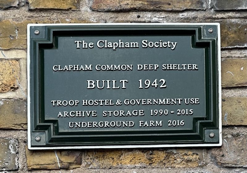
1. Clapham Common Deep Shelter Marker
Clapham Common Deep Shelter
Built 1942
Troop hostel & government use
Archive storage 1990-2015
Underground farm 2016
Erected 2018 by The Clapham Society.
Topics. This historical marker is listed in these topic lists: Agriculture • Forts and Castles • War, World II. A significant historical year for this entry is 1942.
Location. 51° 27.72′ N, 0° 8.243′ W. Marker is in Lambeth, England, in Greater London. It is in Clapham. It is at the intersection of Clapham Park Road and Clapham High Street on Clapham Park Road. Touch for map. Marker is at or near this postal address: 1 Clapham Park Rd, Lambeth, England SW4 7SS, United Kingdom. Touch for directions.

Regionally, this marker is in the Greater South East. Globally, it is on the Atlantic Ocean, in the North Atlantic Region, in Europe, in Atlantic Europe, on one of the British Isles, in the Western World, and in the Anglosphere. Historically, it finds itself in what was once the Roman Empire.
Other nearby markers. At least 8 other markers are within walking distance of this marker: Venn Street (SW4) (within shouting distance of this marker);
this page online
Also see . . . London deep-level shelters (Wikipedia). Excerpt:
The London deep-level shelters are eight deep-level air-raid shelters that were built under London Underground stations during World War II.(Submitted on March 28, 2026.)
Each shelter consists of a pair of parallel tunnels 16 feet 6 inches (5.03 m) in diameter and 1,200 feet (370 m) long. Each tunnel is subdivided into two decks, and each shelter was designed to hold up to 8,000 people.…
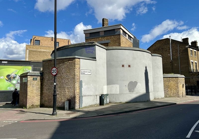
The shelters were started in 1940 during the Blitz in response to public demand to shelter in the London Underground stations. However, they were not completed until 1942 after the Blitz was over, so they were initially all used by the government, but as bombing intensified five of them wereopened to the public in 1944: Stockwell, Clapham North, Camden Town, Belsize Park and Clapham South.…Photographed by Andrew Ruppenstein, March 28, 20262. Clapham Common Deep Shelter and Marker
Credits. This page was last revised on March 28, 2026. It was originally submitted on March 28, 2026, by Andrew Ruppenstein of Lamorinda, California. This page has been viewed 6 times since then. Photos: 1, 2. submitted on March 28, 2026, by Andrew Ruppenstein of Lamorinda, California.
