Seminary Hill in Alexandria, Virginia — The American South (Mid-Atlantic)
Profile of Fort
Photographed by Craig Swain, March 1, 2008
1. Profile of Fort Marker
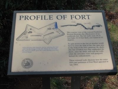
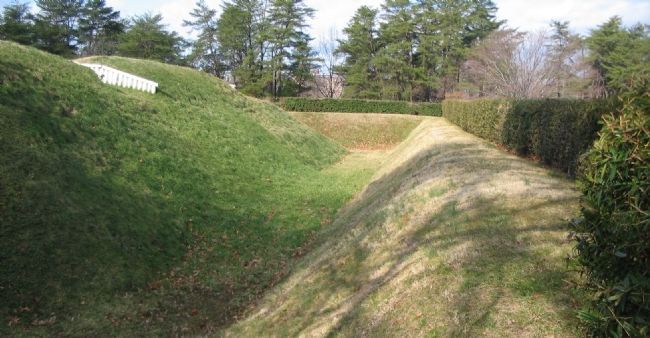
This exterior view of the restored Northwest Bastion illustrates the effectiveness of an earthwork fort. The fort walls were 18-22 feet high, 12-14 feet thick, and slanted at 45 degrees.
To gain access to the fort an attacker would have to cross the field of fire (the open area to the front of the fort), penetrate the abatis (the line of felled trees that surrounded the ditch), enter the ditch, and scale the walls while the defenders were well protected behind the embankments.
These restored walls illustrate how the entire 818-yard perimeter of Fort Ward appeared in late 1864.
Erected by City of Alexandria, Virginia.
Topics and series. This historical marker is listed in these topic lists: Forts and Castles • War, US Civil. In addition, it is included in the Virginia, The City of Alexandria series list. A significant historical year for this entry is 1864.
Location. Marker has been permanently removed. It was located near 38° 49.865′ N, 77° 6.138′ W. Marker was in Alexandria, Virginia. It was in Seminary Hill. It could be reached from West Braddock Road 0.2 miles north of North Howard Street, on the right
this page online
We have been informed that this marker is no longer there and will not be replaced. This page is an archival view of what was.
Regionally, this marker was in the Washington Metropolitan Area and in Northern Virginia. It was also in the American South, specifically in the Upper South, in the Mid-Atlantic, and on the Eastern Seaboard. Globally, it was in the North Atlantic Region, North America, the Western Hemisphere, the Western World, and the Anglosphere. Historically, it found itself in what was once the territory of the Mississippian Culture, one of the original Thirteen Colonies, one of the Confederate States of America, and the Antebellum South.

Other nearby markers. At least 8 other markers are within walking distance of this location: Profile of the Fort (here, next to this marker); a different marker also named Northwest Bastion (within shouting distance of this marker); a different marker also named Powder Magazine and Filling Room
Photographed by Craig Swain, March 1, 2008
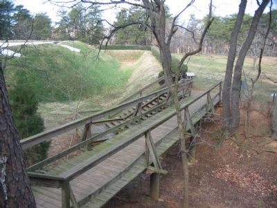
2. Bridge Walkway to the Marker
Other markers no longer nearby. Northwest Bastion (was within shouting distance of this marker but has been replaced with another marker now near it); Powder Magazine and Filling Room (was within shouting distance of this marker but has been replaced with another marker now near it); a different marker also named Rifle Trench (was within shouting distance of this marker but has been replaced with another marker now near it); a different marker also named Fort Ward (was about 400 feet away but has been replaced with another marker now near it); Bombproof (was about 400 feet away but has been replaced with another marker now near it).
More about this marker. Above the text is a profile of the fort indicating the parapet, scarp (wall), ditch, and abatis.
Photographed by Craig Swain, March 1, 2008
3. Profile of the Fort Defenses
Related marker. Click here for another marker that is related to this marker. This marker has been replaced with the linked marker.
Also see . . . Fort Ward Historic Site. (Submitted on May 15, 2008, by Craig Swain of Leesburg, Virginia.)
Photographed by Craig Swain, March 1, 2008
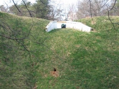
4. Attacker's Perspective of the Fort's Defenses
Looking down the bore of a reproduction 6-pdr James rifle.
Photographed by Craig Swain, March 1, 2008
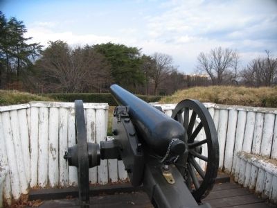
5. Defender's Point of View
From one of the reproduction 4.5in Rifles. At the time of the war, the ground in front of the fort was much more open, without the modern buildings and trees. The surrounding area was mostly pasture, orchards, and farms in 1861-1865.
Credits. This page was last revised on March 31, 2026. It was originally submitted on May 15, 2008, by Craig Swain of Leesburg, Virginia. This page has been viewed 2,126 times since then and 30 times this year. Last updated on March 30, 2026, by Evan Dwyer of Richmond, Virginia. Photos: 1, 2, 3, 4, 5. submitted on May 15, 2008, by Craig Swain of Leesburg, Virginia. • Devry Becker Jones was the editor who published this page.
