
Whakarewarewa in Rotorua in Rotorua District, Bay of Plenty Region, New Zealand — Southwestern Pacific Ocean
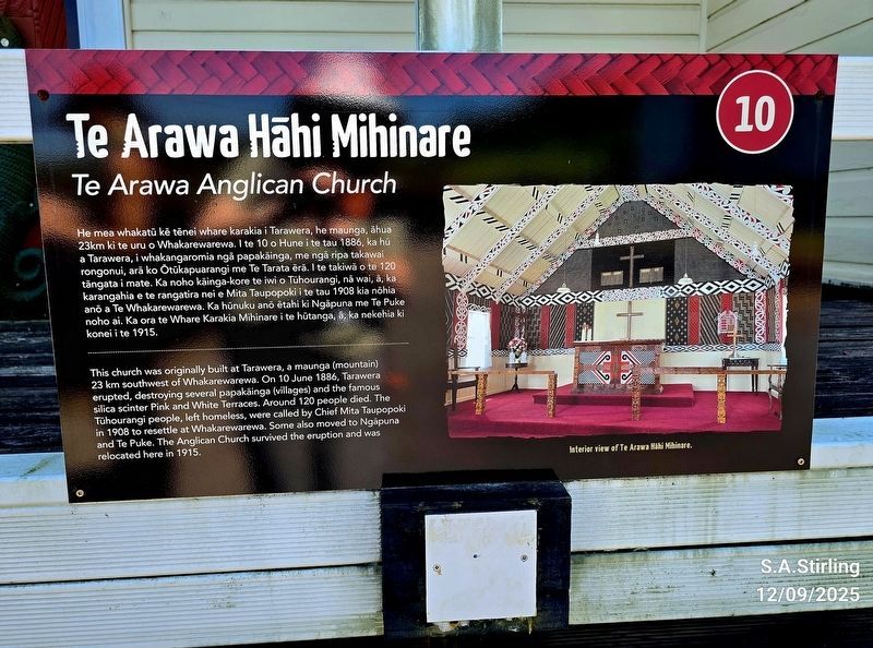
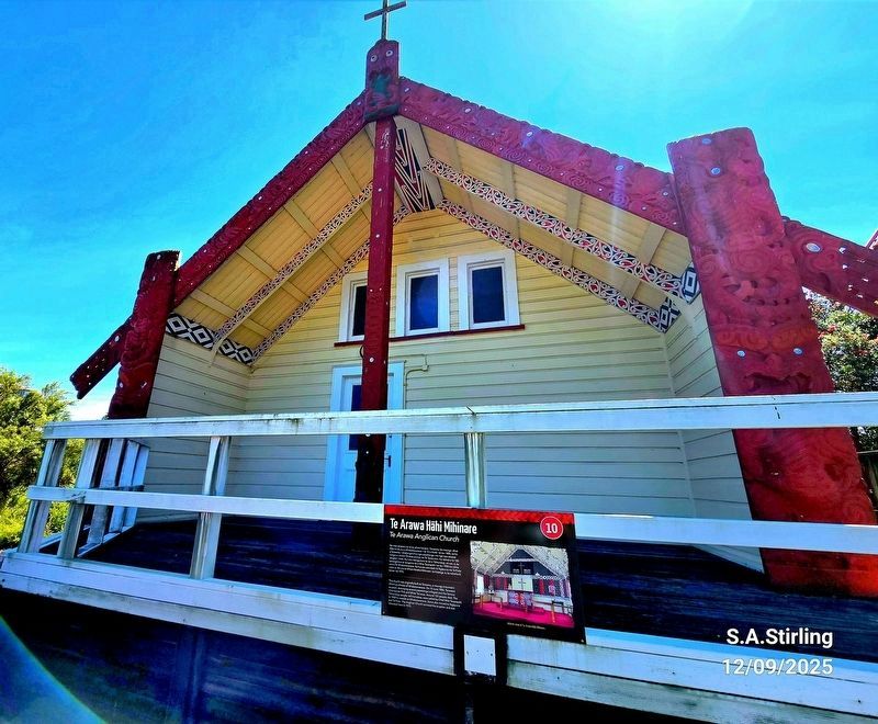
Te Arawa Hāhi Mihinare
⎯⎯⎯
Te Arawa Anglican Church
Photographed by Shirley A Stirling, December 9, 2025
1. Te Arawa Hahi Mihinare / Te Arawa Anglican Church Marker

He mea whakatu kê tenei whare karakia i Tarawera, he maunga, ahua 23km ki te uru o Whakarewarewa. I te 10 o Hune i te tau 1886, ka hú a Tarawera, i whakangaromia nga papakainga, me nga ripa takawai rongonui, ara ko Otükapuarangi me Te Tarata era. I te takiwa o to 120 tangata i mate. Ka noho kainga-kore te iwi o Tühourangi, na wai, ā, ka karangahia e te rangatira nei e Mita Taupopoki i te tau 1908 kia nôhia and a Te Whakarewarewa. Ka hünuku ano etahi ki Ngapuna me Te Puke noho ai. Ka ora te Whare Karakia Mihinare i te hütanga, &, ka nekehia ki konei i te 1915.
Topics. This historical marker is listed in these
this page online
Location. 38° 9.702′ S, 176° 15.475′ E. Marker is in Rotorua, Bay of Plenty Region, in Rotorua District. It is in Whakarewarewa. It is on Huarere Street east of Hinganoa Drive, on the left. This is part of the historic Living Maori Village. Touch for map. Marker is at or near this postal address: 16B Huarere St, Rotorua, Bay of Plenty Region 3010, New Zealand. Touch for directions.

Regionally, it is in Oceania, in Australasia, in Polynesia, in the Pacific Ocean, on the Ring of Fire, on the Pacific Rim, in the Western World, and in the Anglosphere. Historically, it finds itself in what was once a British colony.
Other nearby markers. At least 8 other markers are within 3 kilometers of this marker, measured as the crow flies: New Zealand Centennial (about 120 meters away, measured in a direct line); Roto Kanapanapa (approx. 0.4 kilometers away); Priest & Radium Hot Springs (approx. 2.6 kilometers away); Boer War 1899-1902 (approx. 2.9 kilometers away); Wylie Memorial (approx.
Photographed by Shirley A Stirling, December 9, 2025
2. Te Arawa Anglican Church
Credits. This page was last revised on March 31, 2026. It was originally submitted on March 30, 2026, by Shirley A Stirling of Lacey, Washington. This page has been viewed 26 times since then. Photos: 1, 2. submitted on March 30, 2026, by Shirley A Stirling of Lacey, Washington. • Devry Becker Jones was the editor who published this page.
Editor’s want-list for this marker. Transcription of the Maori text. • Can you help?
