Pullman in Chicago in Cook County, Illinois — The American Midwest (Great Lakes)
The Walk In, The Walk Out
Photographed by Daniel Barriball, March 21, 2026
1. The Walk In, The Walk Out Marker
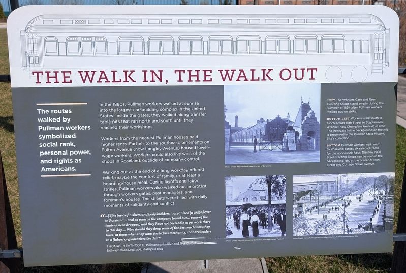
The routes walked by Pullman workers symbolized social rank, personal power, and rights as Americans.
In the 1880s, Pullman workers walked at sunrise into the largest car-building complex in the United States. Inside the gates, they walked along transfer table pits that ran north and south until they reached their workshops.
Workers from the nearest Pullman houses paid higher rents. Farther to the southeast, tenements on Fulton Avenue (now Langley Avenue) housed lower-wage workers. Workers could also live west of the shops in Roseland, outside of company control.
Walking out at the end of a long workday offered relief, maybe the comfort of family, or at least a boarding-house meal. During layoffs and labor strikes, Pullman workers also walked out in protest through workers gates, past managers' and foremen's houses. The streets were filled with daily moments of solidarity and conflict.
"...[T]he inside finishers and body builders... organized [a union] over in Roseland... and as soon as the company found out... some of the leaders were dropped, and they have not been able to get work there to this day... Why should they drop some of the best mechanics they have, at times when they want first-class mechanics, that are leaders in a [labor] organization like that?"
Thomas
this page online
[Captions:]
Left The Workers Gate and Rear Erecting Shops stand empty during the summer of 1894 after Pullman workers walked out on strike.
Bottom Left Workers walk south to lunch across 111th Street to Stephenson Avenue (now Champlain Avenue) in 1910. The iron gate in the background on the left is preserved in the Pullman State Historic Site's collection.
Bottom Pullman workers walk west to Roseland across six railroad tracks for the noon lunch hour. The new 1908 Steel Erecting Shops can be seen in the background left, at the corner of 111th Street and Cottage Grove Avenue.
Topics. This historical marker is listed in these topic lists: Industry & Commerce • Labor Unions • Railroads & Streetcars. A significant historical date for this entry is August 16, 1894.
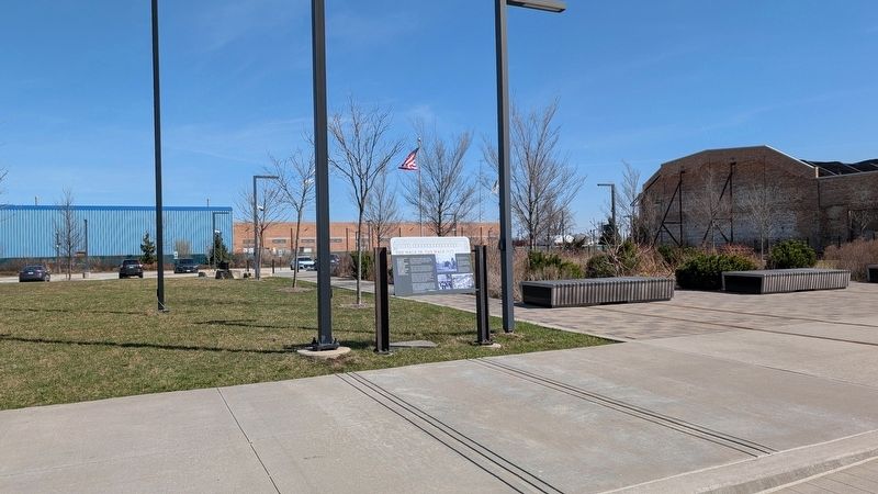
Location. 41° 41.664′ N, 87° 36.495′ W. Marker is in Chicago, Illinois, in Cook County. It is in Pullman. It can be reached from the intersection of East 111th Street and South St. Lawrence Avenue, on the right when traveling west. This marker stands to the east of the Administration
Photographed by Daniel Barriball, March 21, 2026
2. The Walk In, The Walk Out Marker in context

Regionally, this marker is on Chicago’s South Side. It is also in the American Midwest. Globally, it is in North America, on the Great Lakes, in the Western Hemisphere, in the Western World, and in the Anglosphere. Historically, it finds itself in what was once the Viceroyalty of New France, the territory of the Mississippian Culture, and the Northwest Territory.
Other nearby markers. At least 8 other markers are within walking distance of this marker: Welcome to Pullman (within shouting distance of this marker); Machines and Workers (about 300 feet away, measured in a direct line); Invention and Innovation (about 300 feet away); a different marker also named Welcome to Pullman (about 300 feet away); People-Powered (about 400 feet away); From Wood to Steel (about 400 feet away); The Town of Pullman (about 500 feet away); Image and Reality (about 500 feet away). Touch for a list and map of all markers in Chicago.
Credits. This page was last revised on March 31, 2026. It was originally submitted on March 29, 2026, by Daniel Barriball of Chesterton, Indiana. This page has been viewed 23 times since then. Last updated on March 31, 2026, by Daniel Barriball of Chesterton, Indiana. Photos: 1, 2. submitted on March 29, 2026, by Daniel Barriball of Chesterton, Indiana. • Devry Becker Jones was the editor who published this page.
