Point Loma in San Diego in San Diego County, California — The American West (Pacific Coastal)
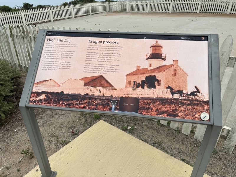
High and Dry
Photographed by Connor Olson, March 31, 2026
1. High and Dry Marker
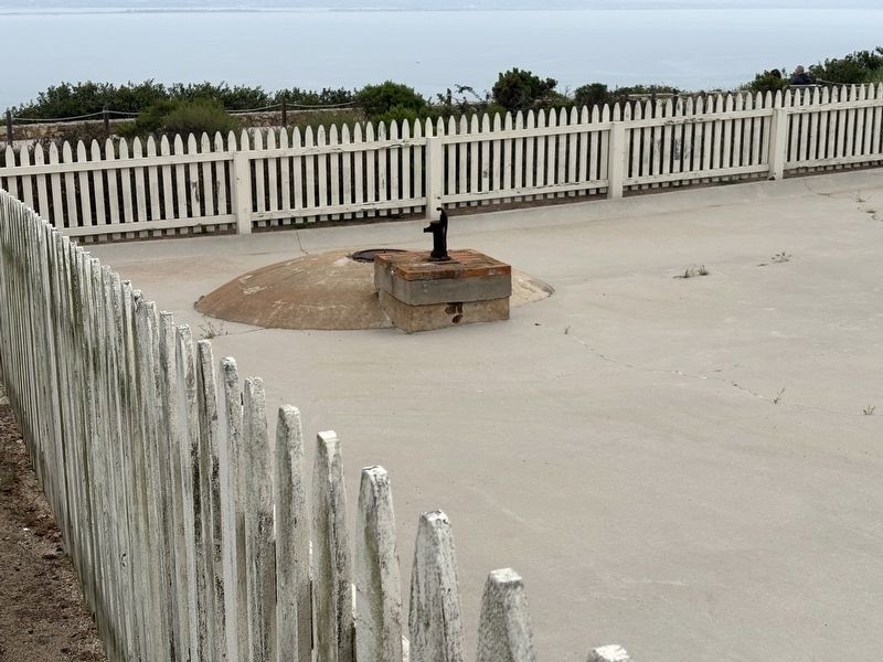
These giant concrete funnels diverted rainwater into underground cisterns, where it was stored for later use by the lighthouse keepers. Unfortunately, Point Loma's sparse rainfall-about 10 inches per year-didn't yield a high enough "catch."
To survive, lighthouse keepers labored for hours hauling extra water by horse and wagon. They also limited cach person's average water use to a meager one gallon per day. Can you imagine life with just one gallon of water per day?
Erected by National Park Service, U.S. Department of Interior.
Topics and series. This historical marker is listed in this topic list: Man-Made Features. In addition, it is included in the Lighthouses series list.
Location. 32° 40.326′ N, 117° 14.452′ W. Marker is in San Diego, California, in San Diego County. It is in Point Loma. It can be reached from Cabrillo Memorial Drive, on the right when traveling south. Touch for map. Marker is at or near this
this page online

Regionally, this marker is in the Peninsular Ranges. It is also in the American Borderlands and on the Pacific Coast. Globally, it is in North America, on the Ring of Fire, on the Pacific Rim, in the Western Hemisphere, in the Western World, and in the Anglosphere. Historically, it finds itself in what was once New Spain and also Mexico’s Alta California.
Other nearby markers. At least 8 other markers are within walking distance of this marker: The Heart and Soul of Lighthouses (within shouting distance of this marker); Old Point Loma Lighthouse (within shouting distance of this marker); Point Loma - The Early Years (within shouting distance of this marker); The Civilian Conservation Corps (within shouting distance of this marker); Point Loma Lighthouse (within shouting distance of this marker); Ears to the Sea, Eyes on the Weather (about 400 feet away, measured in a direct line); They also serve who only stand and wait (about 600 feet away); Harbor Lights (about 700 feet away). Touch for a list and map of all
Photographed by Connor Olson, March 31, 2026
2. Cistern Pump
Other markers no longer nearby. The Bayside Trail (was within shouting distance of this marker); Army Radio Station (was about 400 feet away but has been reported to have been replaced with another marker now near it); a different marker also named Army Radio Station (was about 600 feet away but has been permanently removed).

Photographed by Tom Bosse, September 6, 2026
3. High and Dry Marker
Credits. This page was last revised on September 16, 2026. It was originally submitted on April 1, 2026, by Connor Olson of Menomonee Falls, Wisconsin. This page has been viewed 17 times since then. Photos: 1, 2. submitted on April 1, 2026, by Connor Olson of Menomonee Falls, Wisconsin. 3. submitted on September 14, 2026, by Tom Bosse of Jefferson City, Tennessee. • Andrew Ruppenstein was the editor who published this page.
