
Morgantown in Monongalia County, West Virginia — The American South (Appalachia)
Sandstone Cliffs
Photographed by Bradley Owen, March 30, 2026
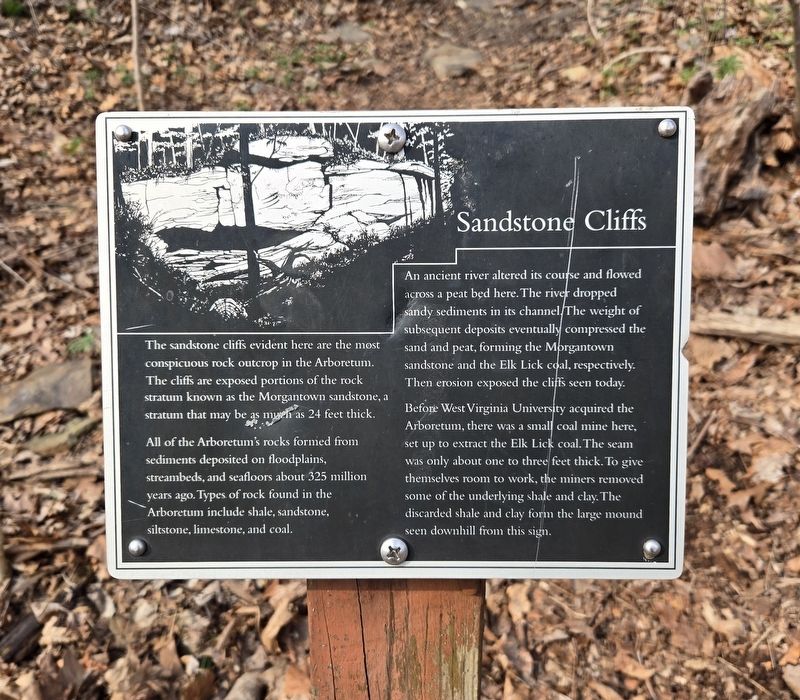
1. Sandstone Cliffs Marker
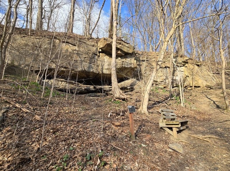
The sandstone cliffs evident here are the most conspicuous rock outcrop in the Arboretum.
The cliffs are exposed portions of the rock stratum known as the Morgantown sandstone, a stratum that may be as much as 24 feet thick.
All of the Arboretum's rocks formed from sediments deposited on floodplains, streambeds, and seafloors about 325 million years ago. Types of rock found in the Arboretum include shale, sandstone, siltstone, limestone, and coal.
An ancient river altered its course and flowed across a peat bed here. The river dropped sandy sediments in its channel. The weight of subsequent deposits eventually compressed the sand and peat, forming the Morgantown sandstone and the Elk Lick coal, respectively. Then erosion exposed the cliffs seen today.
Before West Virginia University acquired the Arboretum, there was a small coal mine here, set up to extract the Elk Lick coal. The seam was only about one to three feet thick. To give themselves room to work, the miners removed some of the underlying shale and clay. The discarded shale and clay form the large mound seen downhill from this sign.
Erected by West
this page online
Topics. This historical marker is listed in these topic lists: Industry & Commerce • Natural Features.
Location. 39° 38.897′ N, 79° 59.032′ W. Marker is in Morgantown, West Virginia, in Monongalia County. It can be reached from the intersection of Monongahela Boulevard (U.S. 19) and Evansdale Drive, on the right when traveling south. The marker is at the small visitor's parking lot at the entrance to the Core Arboretum that can only be reached from the southbound lane. The marker is on the Cliff Trail. Touch for map. Marker is in this post office area: Morgantown WV 26505, United States of America. Touch for directions.

Regionally, this marker is in North Central West Virginia. It is also in the American South, specifically in the Upper South, in Appalachia, and specifically in Northern Appalachia. Globally, it is in North America, the Western Hemisphere, the Western World, and the Anglosphere. Historically, it finds itself in what was once the territory of the Mississippian Culture.
Other nearby markers. At least 8 other markers
Photographed by Bradley Owen, March 30, 2026
2. Sandstone Cliffs and Marker
Credits. This page was last revised on April 3, 2026. It was originally submitted on April 3, 2026, by Bradley Owen of Morgantown, West Virginia. This page has been viewed 15 times since then. Photos: 1, 2. submitted on April 3, 2026, by Bradley Owen of Morgantown, West Virginia.
