Bamberg, Bavaria, Germany — Central Europe
Untere Mühlen
⎯⎯⎯
Lower Mills
Photographed by James Hulse, July 8, 2025
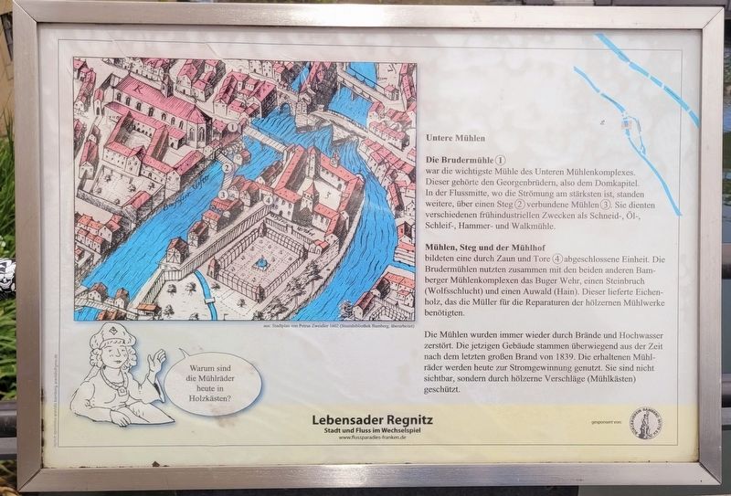
1. Untere Mühlen / Lower Mills Marker

Die Brudermühle (1)
war die wichtigste Mühle des Unteren Mühlenkomplexes. Dieser gehörte den Georgenbrüdern, also dem Domkapitel. In der Flussmitte, wo die Strömung am stärksten ist, standen weitere, über einen Steg (2) verbundene Mühlen (3). Sie dienten verschiedenen frühindustriellen Zwecken als Schneid-, Öl-, Schleif-, Hammer- und Walkmühle.
Mühlen, Steg und der Mühlhof
bildeten eine durch Zaun und Tore (4) abgeschlossene Einheit. Die Brudermühlen nutzten zusammen mit den beiden anderen Bamberger Mühlenkomplexen das Buger Wehr, einen Steinbruch (Wolfsschlucht) und einen Auwald (Hain). Dieser lieferte Eichenholz, das die Müller für die Reparaturen der hölzernen Mühlwerke benötigten.
Die Mühlen wurden immer wieder durch Brände und Hochwasser zerstört. Die jetzigen Gebäude stammen überwiegend aus der Zeit nach dem letzten großen Brand von 1839. Die erhaltenen Mühlräder werden heute zur Stromgewinnung genutzt. Sie sind nicht sichtbar, sondern durch hölzerne Verschläge (Mühlkästen) geschützt.
aus: Stadtplan von Petrus Zweidler 1602 (Staatsbibliothek Bamberg, überarbeitet)
The Brothers’ Mill (1)
was
this page online
The mills, the bridge, and the mill yard
formed a unit enclosed by fences and gates (4). Together with the other two Bamberg mill complexes, the Brothers’ Mill used the Buger weir, a quarry (Wolfsschlucht), and a riverside forest (Hain). This provided oak wood, which the millers needed for repairs to the wooden mill machinery.
The mills were repeatedly destroyed by fires and floods. The present buildings largely date from the period after the last major fire of 1839. The preserved mill wheels are now used to generate electricity. They are not visible but are protected by wooden enclosures (mill housings).
from: city map by Petrus Zweidler, 1602 (Bamberg State Library, revised)
Erected by Bürgerverein Bamberg-Mitte e. V.
Topics. This historical marker is listed
Photographed by James Hulse, July 8, 2025
2. Untere Mühlen / Lower Mills Marker
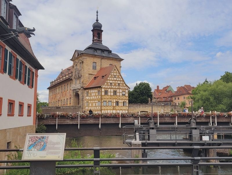
The view of the marker with the Altes Rathaus (Old Town Hall) and mill water works in the background.
Location. 49° 53.449′ N, 10° 53.214′ E. Marker is in Bamberg, Bayern (Bavaria). It is on Untere Mühlbrücke 0 kilometers east of Schranne, on the left when traveling east. Touch for map. Marker is at or near this postal address: Schranne 2, Bamberg BY 96047, Germany. Touch for directions.

Regionally, it is in Europe, the European Union, Atlantic Europe, Central Europe, the Schengen Area, Western Europe, and the Western World. Historically, it finds itself in what was once the Holy Roman Empire.
Other nearby markers. At least 8 other markers are within walking distance of this marker: Mühlen im 20. Jahrhundert / Mills in the 20th Century (here, next to this marker); Franziskanerkirch / Franciscan Church (within shouting distance of this marker); Upper Bridge and City Hall on the Bridge (within shouting distance of this marker); Schranne 2/3 (within shouting distance of this marker); Claus Graf Stauffenberg (within shouting distance of this marker); Altes Rathaus / Old City Hall (within shouting distance of this
Photographed by James Hulse, July 8, 2025
3. Untere Mühlen / Lower Mills Marker
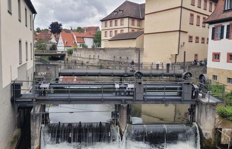
A closeup view of the water works for the mills from the foot bridge.
Photographed by James Hulse, July 8, 2025
4. Untere Mühlen / Lower Mills Marker
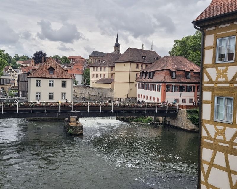
The view of the mill buildings and water works from the Obere Brücke near the Altes Rathaus.
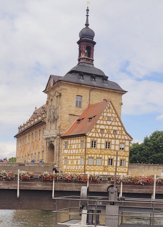
Photographed by James Hulse, July 8, 2025
5. Altes Rathaus (Old Town Hall)
Credits. This page was last revised on April 3, 2026. It was originally submitted on April 3, 2026, by James Hulse of Medina, Texas. This page has been viewed 15 times since then. Photos: 1, 2, 3, 4, 5. submitted on April 3, 2026, by James Hulse of Medina, Texas.
