South Lebanon in Warren County, Ohio — The American Midwest (Great Lakes)
South Lebanon
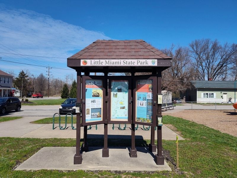
Little Miami Railroad History On The Trail
| — | Little Miami State Park | — |
Photographed by Craig Doda, March 21, 2026
1. South Lebanon Marker
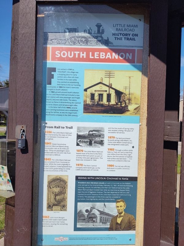
First settled in 1797 as “Deerfield”, the village was a stopping place for early settlers who often left their families in the town while they worked on establishing their farms in the surrounding countryside. In 1854 the town’s name was changed to South Lebanon.
In 1862, growth around South Lebanon on the Little Miami Railroad included a new train station with new passenger and freight depots, and new side tracks. The eatery known as Hainer & Brandenburg also opened to serve citizens and rail passengers alike.
In the latter half of the 1800s, several corn-canning businesses were established along the rail line, as was the large Fred’s Mushrooms company in the 20th century.
From Rail to Trail
1836 The Little Miami Railroad was chartered by the state of Ohio to run between Cincinnati and Springfield.
1841 Steam locomotive Governor Morrow blazed along the wooden rails at six miles per hour. Thirty-six passengers were thrilled with the 50-cent ride from Cincinnati to Milford.
1845 The Little Miami Railroad was completed from Cincinnati to Xenia. While the route originally included Lebanon, it was bypassed due
this page online
1863 John Hunt Morgan and his 2300 raiders barricaded the railroad track near Camp Dennison, causing the onrushing train to derail.
1870 The Little Miami Railroad leased most of its line to the Pennsylvania Railroad system as part of a ninety-nine-year agreement. This lease was renewed in 1968.
1970 The Penn Central company went bankrupt, so the LMRR became part of Conrail, and the line south of Spring Valley was vacated, ending 140 years of successful rail service.
1979 The land purchased by quick-acting Little Miami, Inc. (now Little Miami Conservancy) was designated a state park.
1983 Through a million dollar Rails to Trails Act and a matching one million from the Ohio Legislature, the first section of asphalt trail surface was laid down — 13.5 miles from Loveland to Morrow.
1984 The trail was officially dedicated in a public ceremony in Loveland.
Riding With Lincoln: Cincinnati to Xenia
President-elect Abraham Lincoln arrived in Cincinnati on the Wabash Line railroad on his 52nd birthday, February 12, 1861. At 8:30 the following morning, Lincoln,
Photographed by Craig Doda, March 21, 2026
2. South Lebanon Marker
Topics. This historical marker is listed in these topic lists: Industry & Commerce • Parks & Recreational Areas • Railroads & Streetcars • Settlements & Settlers. A significant historical date for this entry is February 12, 1861.
Location. 39° 21.976′ N, 84° 13.079′ W. Marker is in South Lebanon, Ohio, in Warren County. It is at the intersection of Zoar Road and South Main Street, on the right when traveling west on Zoar Road. Touch for map. Marker is at or near this postal address: 2301 Zoar Rd, South Lebanon OH 45065, United States of America. Touch for directions.

Regionally, this marker is in Greater Cincinnati and in the Miami Valley. It is also in the American Midwest and in the Corn Belt. Globally, it is in North America, the Western Hemisphere,
Photographed by Craig Doda, March 21, 2026
3. South Lebanon Marker
Other nearby markers. At least 8 other markers are within 2 miles of this marker, measured as the crow flies: Deerfield- South Lebanon (a few steps from this marker); Deerfield Heritage Park (approx. 0.3 miles away); South Lebanon Veterans Memorial (approx. 0.4 miles away); Union Township Town Hall (approx. 0.4 miles away); In Honor of Those Who Served (approx. 0.4 miles away); Kash D. Amburgy Park (approx. half a mile away); The King Mansion / Ahimaaz King (1839-1909) (approx. 1.6 miles away); Gershom Moore Peters, LLD / Peters Cartridge Company (approx. 1.7 miles away). Touch for a list and map of all markers in South Lebanon.
Photographed by Craig Doda, March 21, 2026
4. South Lebanon Marker
Credits. This page was last revised on April 6, 2026. It was originally submitted on April 5, 2026, by Craig Doda of Napoleon, Ohio. This page has been viewed 19 times since then. Photos: 1, 2, 3, 4. submitted on April 5, 2026, by Craig Doda of Napoleon, Ohio. • Devry Becker Jones was the editor who published this page.
