High View Park in Arlington in Arlington County, Virginia — The American South (Mid-Atlantic)
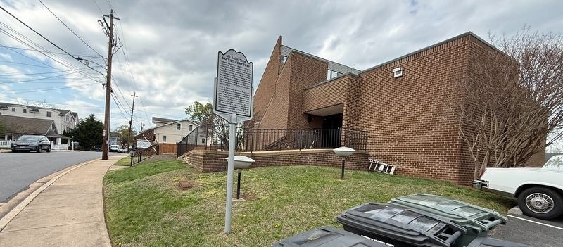
Mt. Salvation Baptist Cemetery

The Mt. Salvation Baptist Church trustees have maintained this cemetery since June 7, 1884, when they bought the property for $80. Reverend Cyrus Carter cultivated the congregation which began at the nearby home of Isabella Washington and Moses Pelham, Sr. The cemetery contains 89 known burials from 1916 to 1974, although earlier burials were likely.
This is the final resting place of many community leaders, including those who were formerly enslaved and their descendants. Members of this church provided stability and social support throughout segregation and served as a pillar of Arlington's African American community. The cemetery became an Arlington Historic District in 2021.
Erected 2022 by Arlington County, Virginia.
Topics. This historical marker is listed in these topic lists: African Americans • Cemeteries & Burial Sites • Religion & Religious Structures. A significant historical date for this entry is June 7, 1884.
Location. 38° 53.672′ N, 77° 7.533′ W. Marker is in Arlington, Virginia, in Arlington County. It is in High View Park. It is on North Culpeper Street north of 19th Street North, on the right
this page online

Regionally, this marker is in the Washington Metropolitan Area and in Northern Virginia. It is also in the American South, specifically in the Upper South, in the Mid-Atlantic, and on the Eastern Seaboard. Globally, it is in the North Atlantic Region, North America, the Western Hemisphere, the Western World, and the Anglosphere. Historically, it finds itself in what was once the territory of the Mississippian Culture, one of the original Thirteen Colonies, one of the Confederate States of America, and the Antebellum South.
Other nearby markers. At least 8 other markers are within walking distance of this marker: Mt. Salvation Baptist Church (within shouting distance of this marker); In Honor of Dr. Harold Johnson / In Honor of Dr. Edward T. Morton (approx. 0.2 miles away); Wunder's Crossroads (approx. 0.3 miles away); Hall's Hill Wall (approx. 0.3 miles away); The Glebe of Fairfax Parish (approx. half a mile away); Mt. Olivet Methodist Church (approx.
Photographed by Devry Becker Jones (CC0), April 6, 2026
2. Mt. Salvation Baptist Cemetery Marker with the church in the background

Photographed by Devry Becker Jones (CC0)
3. Mt. Salvation Baptist Cemetery, just beyond the church parking lot
Credits. This page was last revised on April 6, 2026. It was originally submitted on April 6, 2026, by Devry Becker Jones of Washington, District of Columbia. This page has been viewed 12 times since then. Photos: 1, 2, 3. submitted on April 6, 2026, by Devry Becker Jones of Washington, District of Columbia.
