Montrose in Glendale in Los Angeles County, California — The American West (Pacific Coastal)
Honolulu Avenue
| — | Historic Montrose | — |

Photographed by Craig Baker
1. Honolulu Avenue Marker
The Crescenta Valley evolved from isolated ranches to a suburban community in a short period of time. All but the youngest of the early settlers moved here from somewhere else, of course, since it didn't exist as La Crescenta until Benjamin Briggs founded it in the 1880s. Many of these newcomers named the local streets after their home towns or states, such as New York, Pennsylvania, and Boston. Lambert A. Thompson, an early local rancher, named this dirt trail after his boyhood home of Honolulu, Hawaii, where his parents were missionaries.
Erected by Montrose Shopping Park Association, Historical Society of the Crescenta Valley, and Boy Scout Troop 317.
Topics. This historical marker is listed in these topic lists: Industry & Commerce • Roads & Vehicles.
Location. 34° 12.393′ N, 118° 13.834′ W. Marker is in Glendale, California, in Los Angeles County. It is in Montrose. It is at the intersection of Honolulu Avenue and Wickham Way, on the right when traveling west on Honolulu Avenue. Touch for map. Marker is at or near this postal address: 2405
this page online

Regionally, this marker is in Greater Los Angeles and in the Transverse Ranges. It is also on the American Pacific Coast. Globally, it is in North America, on the Ring of Fire, on the Pacific Rim, in the Western Hemisphere, in the Western World, and in the Anglosphere. Historically, it finds itself in what was once New Spain and also Mexico’s Alta California.
Other nearby markers. At least 8 other markers are within walking distance of this marker: No More Parking Meters (within shouting distance of this marker); Faye’s (within shouting distance of this marker); Hollywood Location (within shouting distance of this marker); Montrose Shopping Park Association (within shouting distance of this marker); Last Remaining Homes (within shouting distance of this marker); Montrose Shopping Park Redevelopment (about 300 feet away, measured in a direct line); Zwick’s Plaza (about 400 feet away); City Hall Coffee Shop (about 500 feet away). Touch for a list and map of all markers in Glendale.
Photographed by Craig Baker, April 5, 2026
2. Honolulu Avenue Marker

Photographed by Craig Baker, April 5, 2026
3. Honolulu Avenue Marker
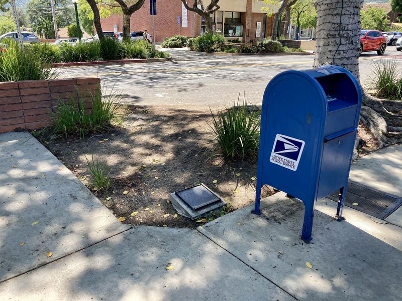
The marker lays flat in the landscaping.

Photographed by Craig Baker, April 5, 2026
4. Honolulu Avenue
Credits. This page was last revised on April 7, 2026. It was originally submitted on April 7, 2026, by Craig Baker of Sylmar, California. This page has been viewed 19 times since then. Photos: 1, 2, 3, 4. submitted on April 7, 2026, by Craig Baker of Sylmar, California.
