
Krondorf in Schwandorf, Bavaria, Germany — Central Europe
Wasserräder mit langer Geschichte
⎯⎯⎯
Water wheels with a long history
Photographed by James Hulse, March 20, 2026
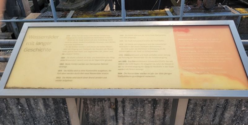
1. Wasserräder mit langer Geschichte / Water wheels with a long history Marker

1006 Schon bei der ersten urkundlichen Erwähnung Schwandorfs werden bestehende Mühlstätten erwähnt. Direkt an der Naab befand sich eine Ansiedlung, bestehend aus einem landwirtschaftlichen Anwesen, zwei Mühlen und einer Schiffslände. An die Mühlen erinnern noch heute die beiden Wasserräder am Eingang zum Stadtpark. Am Standort der Wasserräder gab es zwei Mahl- und Sägemühlen: die „obere“ und die „niedere“ Mühle.
1650 Die Mühle arbeitet als Walk- und Mahlmühle des Pflegamts Schwandorf, danach wird sie als Sägemühle genutzt.
1863 Beide Mühlen werden von Hieronymus Stettner vereinigt.
1875 Die Mühle wird zu einer Kunstmühle ausgebaut; die fünf alten werden durch drei neue Wasserräder ersetzt.
1912 Die Mühle wird durch einen Brand zerstört und wieder aufgebaut.
1956 Die Mühle wird von der Firma Tivoli übernommen und 1969 stillgelegt.
1975 Die Stadt Schwandorf erwirbt die Tivoli-Mühle.
1978 Die Mühle wird abgerissen und die restaurierten Mühlräder in den neuen Stadtpark übernommen.
Bis 1995 laufen die Mühlräder in Erinnerung an die Mühlentradition der Stadt zu Schauzwecken.
1994 Elektrizitätswerk und
this page online
seit 1995 Das Elektrizitätswerk Schwandorf (EWS), das seit 2005 in die E.ON Bayern AG integriert ist, setzt die Wasserräder zur Stromerzeugung ein: Circa 35 Haushalte in der Stadt werden mit Strom versorgt.
2006 Die Wasserräder werden im Jahr des 1000-jährigen Stadtjubiläums grundlegend restauriert.
Technische Daten
Wasserkraft der Naab: zwischen 4 m³ und 300 m³ pro Sekunde, je nach Jahreszeit; bei Hochwasser maximal 400 m³
Raddurchmesser: 4,8 bzw. 6,0 Meter
Kraftübertragung durch Eisenwellen mit 16 bzw. 17,5 cm Durchmesser, mit einer Drehzahl von 5,5 U/min. Erhöhung der Drehzahl in den Stirnradgetrieben auf rund 300 U/min. Übertragung von dort per Riemenübersetzung zum Antrieb der Generatoren mit 76,5 U/min.
Nennleistung: 20 bzw. 30 kW Drehstrom
Jährliche Stromerzeugung: ca. 120.000 kWh
1006 At the first documented mention of Schwandorf, existing mill sites are already recorded. Directly on the Naab River there was a settlement consisting of a farmstead, two mills, and a landing place for boats. The two water wheels
Photographed by James Hulse, March 20, 2026
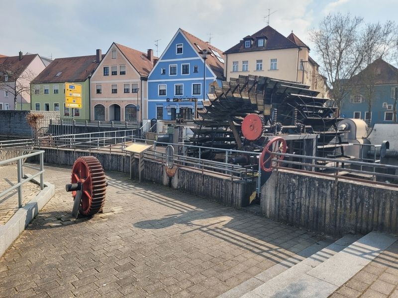
2. Wasserräder mit langer Geschichte / Water wheels with a long history Marker
The marker is located left of the water wheel.
1650 The mill operated as a fulling and grinding mill of the Schwandorf administrative office, later being used as a sawmill.
1863 Both mills were united by Hieronymus Stettner.
1875 The mill was converted into an industrial flour mill; the five old water wheels were replaced by three new ones.
1912 The mill was destroyed by fire and rebuilt.
1956 The mill was taken over by the Tivoli company and shut down in 1969.
1975 The city of Schwandorf acquired the Tivoli mill.
1978 The mill was demolished, and the restored water wheels were incorporated into the new city park. Until 1995, the wheels operated for demonstration purposes in memory of the city’s milling tradition.
1994 The power company and the city concluded an agreement to use the water wheels for electricity generation.
since 1995 The Schwandorf electricity utility (EWS), which has been part of E.ON Bayern AG since 2005, has used the water wheels to generate electricity, supplying about 35 households in the city.
2006
Photographed by James Hulse, March 20, 2026
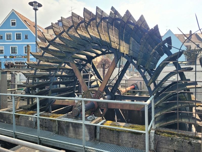
3. Wasserräder mit langer Geschichte / Water wheels with a long history Marker
Closeup of the wooden water wheel.
Technical data
Water flow of the Naab: between 4 m³ and 300 m³ per second depending on the season; during flooding up to a maximum of 400 m³
Wheel diameter: 4.8 and 6.0 meters
Power transmission via iron shafts with diameters of 16 and 17.5 cm, rotating at 5.5 rpm. The speed is increased in the spur gear systems to around 300 rpm, and from there transmitted via belt drive to operate the generators at 76.5 rpm.
Rated output: 20 and 30 kW (three-phase current)
Annual electricity production: approx. 120,000 kWh
Topics. This historical marker is listed in these topic lists: Industry & Commerce • Waterways & Vessels.
Location. 49° 19.82′ N, 12° 6.332′ E. Marker is in Schwandorf, Bayern (Bavaria). It is in Krondorf. It is on Naabuferstraße just west of Nürnberger Str., on the right when traveling west. Touch for map. Marker is at or near this postal address: Naabuferstraße 4, Schwandorf BY 92421, Germany. Touch for directions.

Regionally, it is in Europe, the European Union,
Photographed by James Hulse, March 20, 2026
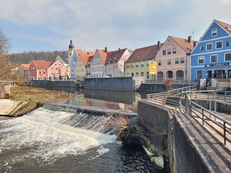
4. Wasserräder mit langer Geschichte / Water wheels with a long history Marker
The water power for the mill is a dam along the Naab River.
Other nearby markers. At least 8 other markers are within walking distance of this marker: Mühlräder / Mill wheels (a few steps from this marker); Stettner Haus / Stettner House (within shouting distance of this marker); Hochzeit im Alten Rathaus zu Schwandorf / Wedding at the Old Town Hall of Schwandorf (about 90 meters away, measured in a direct line); Stadtmuseum / City Museum (about 90 meters away); Hufschmiede / Farrier’s Forge (about 90 meters away); Stadtschreiberhaus / Town Clerk’s House (about 90 meters away); Färberhaus / Dyer’s House (about 120 meters away); Stadtmauergasse 4 (about 150 meters away). Touch for a list and map of all markers in Schwandorf.
Credits. This page was last revised on April 10, 2026. It was originally submitted on April 7, 2026, by James Hulse of Medina, Texas. This page has been viewed 36 times since then. Photos: 1, 2, 3, 4. submitted on April 10, 2026, by James Hulse of Medina, Texas.
