
Krondorf in Schwandorf, Bavaria, Germany — Central Europe
Der Oberpfälzer Jakobsweg
⎯⎯⎯
The Upper Palatinate Way of St. James
Photographed by James Hulse, March 20, 2026
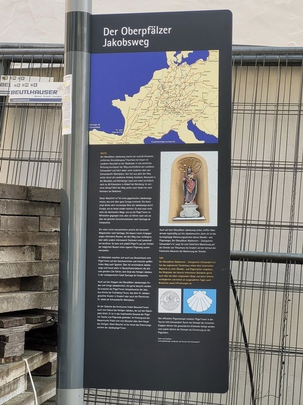
1. Der Oberpfälzer Jakobsweg / The Upper Palatinate Way of St. James Marker

Route:
Der Oberpfälzer Jakobsweg startet am rund 60 Kilometer entfernten Grenzübergang Tillyschanz bei Eslarn im Landkreis Neustadt an der Waldnaab. In südwestlicher Richtung durchquert der Weg anschließend den Landkreis Schwandorf und führt dabei unter anderem über den Schwandorfer Marktplatz. Von hier aus geht der Weg weiter durch die Landkreise Amberg-Sulzbach, Neumarkt in der Oberpfalz und Nürnberger Land und endet schließlich nach ca. 80 Kilometern in Altdorf bei Nürnberg. Im weiteren Verlauf führt der Weg weiter nach Süden bis nach Konstanz am Bodensee.
Dieser Abschnitt ist Teil eines gigantischen Jakobswegenetzes, das sich über ganz Europa erstreckt. Die Karte zeigt dieses weit verzweigte Netz der Jakobswege durch Europa, wie es heute wieder existiert. Es sind zwar nicht mehr die identischen Wege, wie sie die Pilger im Mittelalter gegangen sind, aber sie führen nach wie vor über die gleichen Zwischenstationen nach Santiago de Compostela.
Die roten Linien kennzeichnen jeweils die kürzesten Wegstrecken nach Santiago. Die blauen Linien hingegen zeigen alternative Routen, die den Weg zwar verlängern,
this page online
Im Mittelalter machten sich auch aus Deutschland viele Pilger auf den beschwerlichen und mitunter gefährlichen Weg nach Spanien. Über 40 verschiedene Jakobswege sind heute allein in Deutschland bekannt, die alle zum gleichen Ziel führen, dem Grab des Heiligen Jakobus in der nordspanischen Stadt Santiago de Compostela.
Auch auf den Etappen des Oberpfälzer Jakobsweges finden sich einige Jakobskirchen, die gerne besucht werden. So erwarten die Pilger beispielsweise die Jakobuskirche bei Fuchsberg/Teunz, das dem Hl. Jakobus geweihte Kloster in Ensdorf oder auch die Pfarrkirche St. Jakob am Schwandorfer Marktplatz.
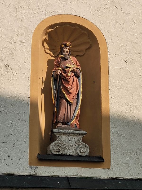
An der Südseite des Kirchturms finden Besucher auch eine Statue des Heiligen Jakobus, der auf den Marktplatz blickt. Er ist in das traditionelle Gewand der Pilger mit Tasche und Pilgerstab gekleidet. Im Hintergrund der Mauernische findet sich eine Muschel über dem Haupt des Heiligen. Diese Muschel ist bis heute das Erkennungszeichen der Jakobspilger.
Photographed by James Hulse, March 20, 2026
2. Der Oberpfälzer Jakobsweg / The Upper Palatinate Way of St. James Marker
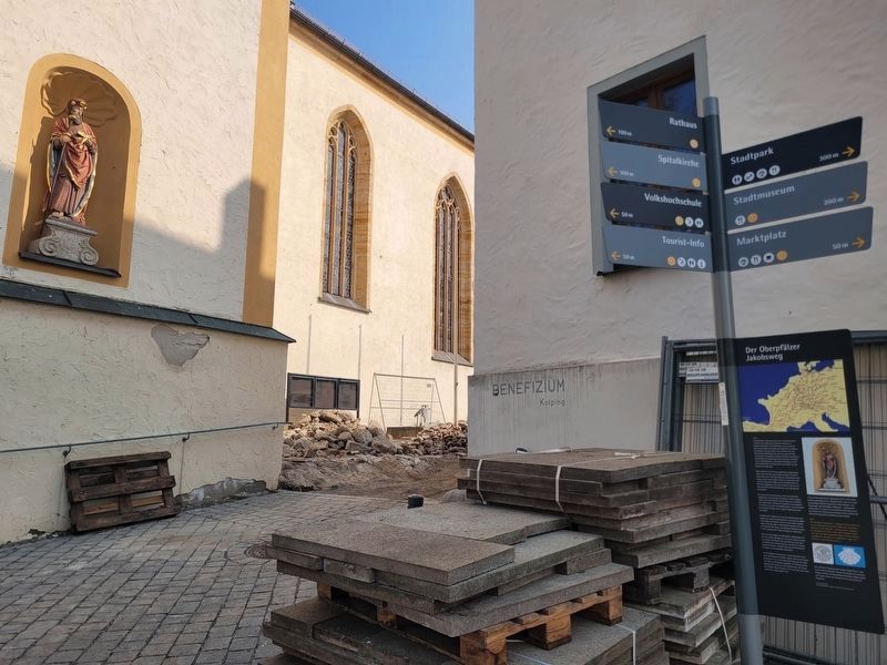
There is construction going on next to the marker and the statue of Saint James is in the background.
Tipp:
Der Oberpfälzer Waldverein – Zweigverein Schwandorf e.V. hat das sogenannte Türmerhaus neben dem historischen Blasturm zu einer Wander- und Pilgerstation umgebaut. Die Mitglieder des Vereins informieren Wanderer gerne auch über die (über-)regionalen Wege und deren Sehenswürdigkeiten und bieten an ausgewählten Tagen auch Brotzeiten sowie Erfrischungen an. Den offiziellen Pilgerstempel erhalten Pilger in der Tourist-Info Schwandorf. Durch die Stempel der einzelnen Etappen können die gewanderten Kilometer belegt werden; zudem dienen die Stempel als Erinnerung an die Pilgerfahrt.
Texte und Grafiken:
www.jakobswege-europa.de und Tourist-Info Schwandorf
Route:
The Upper Palatinate Way of St. James begins at the border crossing
Photographed by James Hulse, March 20, 2026
3. Der Oberpfälzer Jakobsweg / The Upper Palatinate Way of St. James Marker
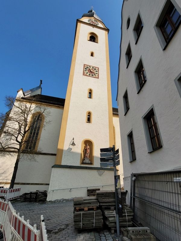
The view of the tower and marker from Marktplat.
This section is part of a vast network of pilgrimage routes that extends across all of Europe. The map shows this extensive network of Ways of St. James as it exists today. While the exact routes are not identical to those used by medieval pilgrims, they still lead via the same intermediate destinations to Santiago de Compostela.
The red lines indicate the shortest routes to Santiago, while the blue lines show alternative routes that are longer but pass through other interesting locations and landscapes. Pilgrims can therefore choose their own path from the wide variety of possible routes.
In the Middle Ages, many pilgrims from Germany
Photographed by James Hulse, March 20, 2026
4. Der Oberpfälzer Jakobsweg / The Upper Palatinate Way of St. James Marker
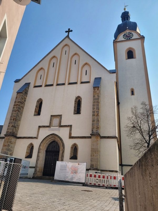
The view of the front of the St. Jacob Church.
Along the stages of the Upper Palatinate Way of St. James, there are also several churches dedicated to St. James that are popular stops. These include the Church of St. James near Fuchsberg/Teunz, the monastery in Ensdorf dedicated to St. James, and the parish church of St. Jakob on Schwandorf’s market square.
On the south side of the church tower, visitors will also find a statue of Saint James overlooking the market square. He is dressed in the traditional attire of pilgrims, with a bag and staff. In the niche behind him is a shell above his head—the scallop shell, which remains the symbol of pilgrims on the Way of St. James. This shell also appears repeatedly along the Upper Palatinate route, serving as the consistent waymark for this hiking and pilgrimage path. The Upper Palatinate Forest Association (Schwandorf branch) maintains the markings from Tillyschanz
Photographed by James Hulse, March 20, 2026
5. Der Oberpfälzer Jakobsweg / The Upper Palatinate Way of St. James Marker
The statue of Saint James overlooking the market square.
Tip:
The Upper Palatinate Forest Association (Schwandorf branch) has converted the so-called Türmerhaus next to the historic Blasturm into a hiking and pilgrimage station. Members of the association are happy to provide information about regional and supraregional routes and their sights, and on selected days they offer snacks and refreshments. Pilgrims can obtain the official pilgrimage stamp at the Schwandorf Tourist Information Office. These stamps document the distance traveled and also serve as a keepsake of the pilgrimage.
Texts and graphics:
www.jakobswege-europa.de and Schwandorf Tourist Information Office
Topics. This historical marker is listed in these topic lists: Religion & Religious Structures • Roads & Vehicles.
Location. 49° 19.86′ N, 12° 6.507′ E. Marker is in Schwandorf, Bayern (Bavaria). It is in Krondorf. It is at the intersection of Marktplatz and Kirchengasse on Marktplatz. Touch for map. Marker is at or near this postal address: Marktpl 14, Schwandorf BY 92421, Germany. Touch for directions.

Regionally, it is in Europe, the European Union, Atlantic Europe, Central Europe, the Schengen Area, Western Europe, and the Western World. Historically, it finds itself in what was once the Holy Roman Empire and also the former West Germany.
Other nearby markers. At least 8 other markers are within walking distance of this marker: Kirche St. Jakob / St. James Church (a few steps from this marker); Pflegehof / Administrative Court Estate (within shouting distance of this marker); Marktplatz 21 (within shouting distance of this marker); Geburtsstätte verdienter Männer / Birthplace of Distinguished Men (within shouting distance of this marker); Pfarrhof St. Jakob / Parish House of St. Jakob (within shouting distance of this marker); Spitalkirche / Hospital Church (about 90 meters away, measured in a direct line); Konrad Max Kunz (about 120 meters away); Gasthof zur Post / Inn “Zur Post” (about 120 meters away). Touch for a list and map of all markers in Schwandorf.
Credits. This page was last revised on April 12, 2026. It was originally submitted on April 8, 2026, by James Hulse of Medina, Texas. This page has been viewed 18 times since then. Photos: 1, 2, 3, 4, 5. submitted on April 12, 2026, by James Hulse of Medina, Texas.
