Yorkville in Kendall County, Illinois — The American Midwest (Great Lakes)
Bristol Churches and the Underground Railroad
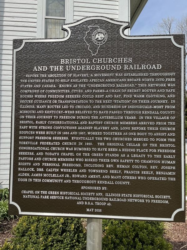
Photographed by Sean Higgins, April 9, 2026
1. Bristol Churches and the Underground Railroad Marker
Before the abolition of slavery, a movement was established throughout the United States to help enslaved African Americans escape north into free states and Canada. Known as the "Underground Railroad," this network was comprised of communities, cities, and farms—a chain of secret routes and safe houses where freedom seekers could rest and eat, find warm clothing, and secure guidance or transportation to the next "station" on their journey. In Illinois, many routes led to Chicago, and hundreds of individuals—most from Missouri and Kentucky—were believed to have passed through Kendall County on their journey to freedom during the antebellum years. In the village of Bristol, early Congregational and Baptist church members arrived from the east with strong convictions against slavery and, long before their church edifices were built in 1855 and 1867, worked together as one body to assist and support freedom seekers. Eventually the two churches merged to form the Yorkville Federated Church in 1920. The original cellar of the Bristol Congregational Church was rumored to have been a hiding place for freedom seekers, and today's
this page online
Erected 2025 by Chapel on the Green Historical Society NFP • Illinois State Historical Society • National Park Service National Underground Railroad Network to Freedom • B.S.A. Troop 40.
Topics and series. This historical marker is listed in these topic lists: Abolition & Underground RR • Religion & Religious Structures. In addition, it is included in the Illinois State Historical Society, and the Network to Freedom series lists. A significant historical year for this entry is 1855.
Location. 41° 38.843′ N, 88° 26.824′ W. Marker is in Yorkville, Illinois, in Kendall County. It is on West Center Street east of Church Street, on the left when traveling east. The marker stands in front of the Chapel on the Green. Touch for map. Marker is
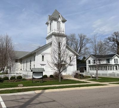
Photographed by Sean Higgins, April 9, 2026
2. Chapel on the Green with Bristol Churches and the Underground Railroad Marker

Regionally, this marker is in Greater Chicago. It is also in the American Midwest and in the Corn Belt. Globally, it is in North America, the Western Hemisphere, the Western World, and the Anglosphere. Historically, it finds itself in what was once the territory of the Mississippian Culture and also the Northwest Territory.
Other nearby markers. At least 8 other markers are within walking distance of this marker: Yorkville Congregational Church (a few steps from this marker); Kendall County Veterans Memorial (about 300 feet away, measured in a direct line); The Mills of Kendall County (about 400 feet away); Rachel L. Wright (approx. 0.4 miles away); Yorkville's Blackberry Creek Mill Stone (approx. 0.4 miles away); Illinois' Northern Boundary (approx. 0.4 miles away); Kendall County Historic Courthouse (approx. half a mile away); Lisa Pickering (approx. half a mile away). Touch for a list and map of all markers in Yorkville.
Credits. This page was last revised on April 13, 2026. It was originally submitted on April 9, 2026, by Sean Higgins of Rochester Hills, Michigan. This page has been viewed 38 times since then. Photos: 1, 2. submitted on April 9, 2026, by Sean Higgins of Rochester Hills, Michigan. • Devry Becker Jones was the editor who published this page.
