Hot Springs National Park in Garland County, Arkansas — The American South (West South Central)
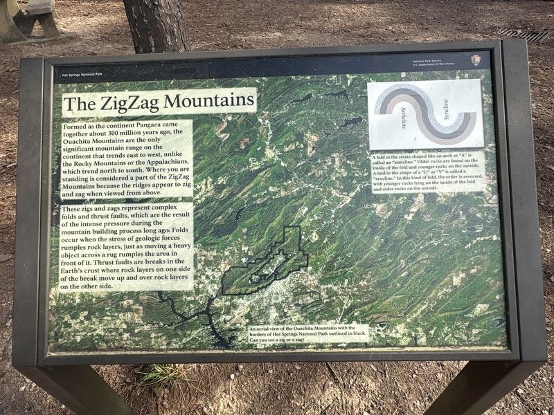
The Zig Zag Mountains
Photographed by Darren Jefferson Clay, March 22, 2026
1. The Zig Zag Mountains Marker
These zigs and zags represent complex folds and thrust faults, which are the result of the intense pressure during the mountain building process long ago. Folds occur when the stress of geologic forces rumples rock layers, just as moving a heavy object across a rug rumples the area in front of it. Thrust faults are breaks in the Earth's crust where rock layers on one side of the break move up and over rock layers on the other side.
Captions:
A fold in the strata shaped like an arch or "A" is called an "anticline." Older rocks are found on the inside of the fold and younger rocks on the outside. A fold in the shape of a "U" or "V" is called a "syncline." In this kind fold, the order is reversed, with younger rocks
this page online
An aerial view of the Ouachita Mountains with the borders of Hot Springs National Park outlined in black. Can you see a zig or a zag?
Topics. This historical marker is listed in this topic list: Natural Features.
Location. 34° 30.949′ N, 93° 2.856′ W. Marker is in Hot Springs, Arkansas, in Garland County. It is in Hot Springs National Park. It is on N Mountain Drive, on the right when traveling north. Touch for map. Marker is in this post office area: Hot Springs National Park AR 71901, United States of America. Touch for directions.

Regionally, this marker is in the Ouachita Mountains. It is also in the American South and specifically in the Upper South. Globally, it is in North America, the Western Hemisphere, the Western World, and the Anglosphere. Historically, it finds itself in what was once the territory of the Mississippian Culture, the Louisiana Purchase, one of the Confederate States of America, and the Antebellum South.
Other nearby markers. At least 8 other markers are within walking distance

Photographed by Darren Jefferson Clay, March 22, 2026
2. The Zig Zag Mountains Marker
Credits. This page was last revised on April 11, 2026. It was originally submitted on April 9, 2026, by Darren Jefferson Clay of Duluth, Georgia. This page has been viewed 24 times since then. Photos: 1, 2. submitted on April 10, 2026, by Darren Jefferson Clay of Duluth, Georgia. • Andrew Ruppenstein was the editor who published this page.
