Near Spotsylvania Courthouse in Spotsylvania County, Virginia — The American South (Mid-Atlantic)
Spotsylvania Campaign
Photographed by Craig Swain, July 6, 2008
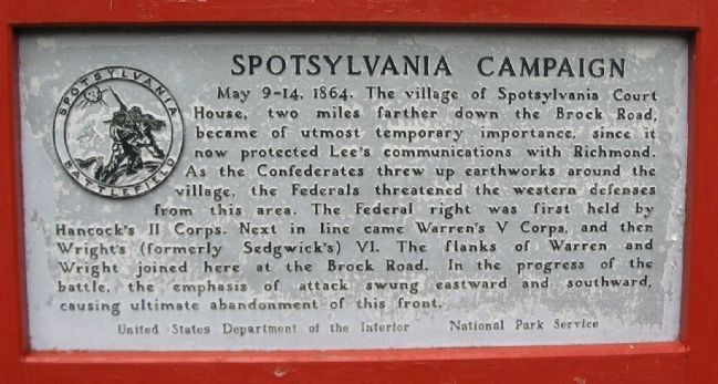
1. Spotsylvania Campaign Marker
May 9-14, 1864. The village of Spotsylvania Court House, two miles farther down the Brock Road, became of utmost temporary importance, since it now protected Lee's communications with Richmond. As the Confederates threw up earthworks around the village, the Federals threatened the western defenses from this area. The Federal right was first held by Hancock's II Corps. Next in line came Warren's V Corps, and then Wright's (formerly Sedgwick's) VI. The flanks of Warren and Wright joined here at the Brock Road. In the progress of the battle, the emphasis of attack swung eastward and southward causing ultimate abandonment of this front.
Erected by National Park Service, U.S. Department of the Interior.
Topics. This historical marker is listed in this topic list: War, US Civil. A significant historical year for this entry is 1864.
Location. Marker has been permanently removed. It was located near 38° 13.082′ N, 77° 36.862′ W. Marker was near Spotsylvania Courthouse, Virginia, in Spotsylvania County. It was at the intersection of Grant Drive and Brock Road (County Route 613), on the right when traveling north on Grant Drive.
this page online
We have been informed that this marker is no longer there and will not be replaced. This page is an archival view of what was.
Regionally, this marker was in the Washington Metropolitan Area, in Northern Virginia, and in the Piedmont. It was also in the American South, specifically in the Upper South, in the Mid-Atlantic, and on the Eastern Seaboard. Globally, it was in the North Atlantic Region, North America, the Western Hemisphere, the Western World, and the Anglosphere. Historically, it found itself in what was once the territory of the Mississippian Culture, one of the original Thirteen Colonies, one of the Confederate States of America, and the Antebellum South.

Other nearby markers. At least 8 other markers are within walking distance of this location: Laurel Hill Trail (a few steps from this marker); The Death of Sedgwick (a few steps from this marker); Sedgwick
Photographed by Craig Swain, July 6, 2008
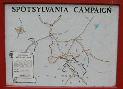
2. Situation May 8-10, 1864
Note the north seeking arrow points to the bottom of the map. Double click the photo to see more detail of the map.
Warren and Wright failed to break Anderson's line. Ewell's Corps and Hill's Corps (temporarily under Early) extended the Confederate trenches eastward and southward. Burnside's Corps failed to reach Spotsylvania from the east. Hancock attacked Lee's left but was recalled.
Warren and Wright failed to break Anderson's line. Ewell's Corps and Hill's Corps (temporarily under Early) extended the Confederate trenches eastward and southward. Burnside's Corps failed to reach Spotsylvania from the east. Hancock attacked Lee's left but was recalled.
Another marker is no longer nearby. Spotsylvania Campaign (was here, next to this marker but has been permanently removed).
Photographed by Craig Swain
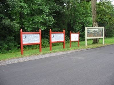
3. West Entrance to Spotsylvania Battlefield
Two Department of the Interior markers, with an interpretive map, stand next to a painting depicting the death of Sedgwick.
Photographed by Craig Swain, August 24, 2008
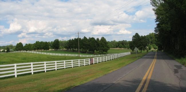
4. Hancock and Heth Battle on May 10
On May 9, Hancock's II Corps attempted to flank the Confederate lines near the Po River (to the west of the modern battlefield park) as far as the Block House Bridge (along Modern CR 608). On the morning of the 10th, while Hancock's men were retiring to align Warren's Corps to the east, they were attacked by Heth's Confederate division. The fighting took place across the open ground to the north (left of this photo) of CR 608.
Credits. This page was last revised on April 13, 2026. It was originally submitted on August 13, 2008, by Craig Swain of Leesburg, Virginia. This page has been viewed 1,220 times since then and 26 times this year. Last updated on April 12, 2026, by Mike McKeown of Baltimore, Maryland. Photos: 1, 2, 3. submitted on August 13, 2008, by Craig Swain of Leesburg, Virginia. 4. submitted on August 25, 2008, by Craig Swain of Leesburg, Virginia. • Devry Becker Jones was the editor who published this page.
