Scotland in St. Mary's County, Maryland — The American Northeast (Mid-Atlantic)
Civil War Fort #3
Point Lookout State Park
| — | Maryland Park Service | — |

Officially designated by the Army Corps of Engineers as "Fort #3," this earthen redoubt is the only remaining fort of three that were constructed here at Point Lookout during the civil War. Logistically, the fort is 60 yards square and was constructed as a "six gun" (cannon) fort. It featured a cannon platform in each of its corners and one double-ramp for two guns on its Northern wall. Each fort could house a "company" of 100 infantrymen (3 officers, 5 sergeants, 8 corporals and 84 privates).
Construction on the three forts began July 26, 1864. At the time of construction, prisoners outnumbered guards 28 to 1, creating a situation conducive to mass prisoner breakout. A main function of these three forts was to provide refuge and protection for Union guards in the event of the fears of a breakout becoming a reality. The forts could also act as defensive positions if Point Lookout was ever under attack from Confederate forces.
The construction of the three forts continued until May 3, 1865, when official orders were received to cease all work. Even though the three forts were operational, they were never fully completed
this page online
Fort #1 was armed with four 12-lb Napoleons while Fort #2 had three 12-lb Howitzers and one 4 1/2 inch rifled cannon. Fort #3 was never armed. As you will see upon entering the fort, the interior was made up of four basic buildings: two officers's quarters (located along the North wall), an enlisted man's barracks (located along the East wall), a guardhouse (located in the South-eastern corner) and a powder magazine (located along the West wall).
Erected by Maryland Park Service; Maryland Department of Natural Resources.
Topics. This historical marker is listed in these topic lists: Forts and Castles • War, US Civil. A significant historical date for this entry is May 3, 1865.
Location. 38° 2.891′ N, 76° 19.549′ W. Marker is in Scotland, Maryland, in St. Mary's County. It can be reached from Point Lookout Road (Maryland Route 5) 1.6 miles south of 3rd Way, on the right when traveling east. Touch for map.
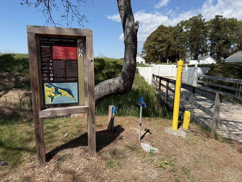
Photographed by Devry Becker Jones (CC0), April 11, 2026
2. Civil War Fort #3 Marker near the entrance to the reconstructed fort

Regionally, this marker is in Southern Maryland. It is also in the American South, specifically in the Upper South, in the Mid-Atlantic, in the Tidewater, in the Chesapeake Bay Region, and on the Eastern Seaboard. Globally, it is in the North Atlantic Region, North America, the Western Hemisphere, the Western World, and the Anglosphere. Historically, it finds itself in what was once one of the original Thirteen Colonies and also the Antebellum South.
Other nearby markers. At least 8 other markers are within walking distance of this marker: Defense Strategies (here, next to this marker); A Crucial Point (a few steps from this marker); Storm Blocks the Road to Freedom (a few steps from this marker); Redoubt #3 (a few steps from this marker); The Veteran Reserve Corps (within shouting distance of this marker); The 5th Massachusetts Colored Cavalry (within shouting distance of this marker); United States Colored Troops (within shouting distance of this marker); The Armaments of Point Lookout (within shouting distance of this marker). Touch for a list and map of all markers in Scotland.
Other markers no longer nearby. Fort Lincoln (was here, next to this marker but has been replaced with another marker now near it); Shipwreck! (was within shouting distance of this marker but has been permanently removed).
Credits. This page was last revised on April 13, 2026. It was originally submitted on April 13, 2026, by Devry Becker Jones of Washington, District of Columbia. This page has been viewed 28 times since then. Photos: 1, 2. submitted on April 13, 2026, by Devry Becker Jones of Washington, District of Columbia.
