Ringwood in Maroondah, Victoria, Australia — Oceania
Ringwood Primary School - 1921
| — | Maroondah Federation Estate Sensory Time Trail | — |
Photographed by Dean Barton-Ancliffe, April 8, 2026
1. Ringwood Primary School - 1921 Marker
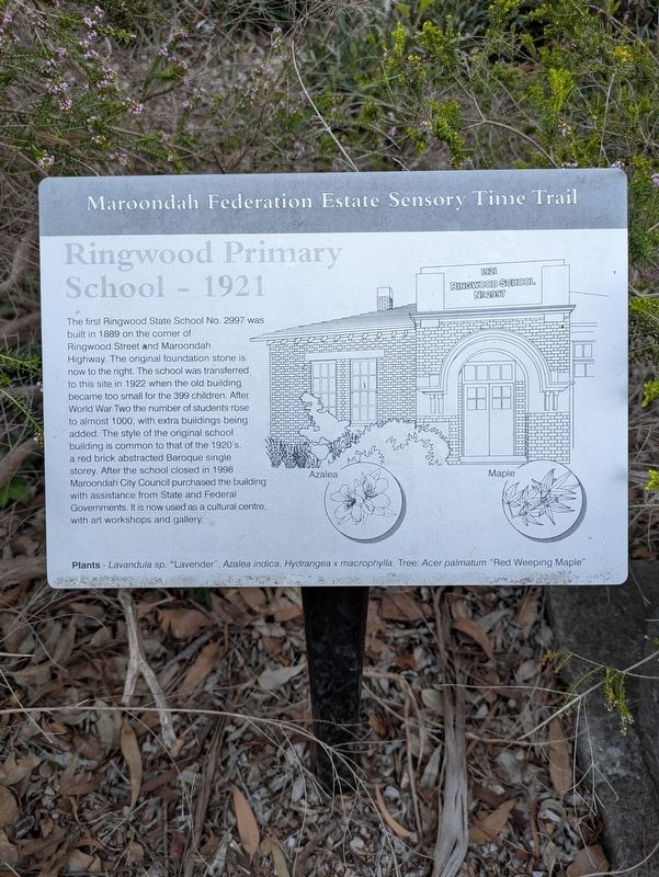
Ringwood Primary School - 1921
The first Ringwood State School No. 2997 was built in 1889 on the corner of Ringwood Street and Maroondah Highway. The original foundation stone is now to the right. The school was transferred to this site in 1922 when the old building became too small for the 399 children. After World War Two the number of students rose to almost 1000, with extra buildings being added. The style of the original school building is common to that of the 1920's, a red brick abstracted Baroque single storey. After the school closed in 1998, Maroondah City Council purchased the building with assistance from State and Federal Governments. It is now used as a cultural centre, with art workshops and gallery.
Plants - Lavandula sp. "Lavender" Azalea indica, Hydrangea x macrophylla, Tree: Acer palmatum "Red Weeping Maple"
Topics. This historical marker is listed in these topic lists: Architecture • Colonial Era • Education. A significant historical year for this entry is 1921.
Location. 37° 49.162′ S, 145° 13.844′ E. Marker is in Ringwood, Victoria, in Maroondah. It can be reached from Greenwood Avenue
this page online

Regionally, it is in Oceania, in Australasia, in the Pacific Ocean, in South Pacific, on the Pacific Rim, in the Western World, and in the Anglosphere. Historically, it finds itself in what was once a British colony.
Other nearby markers. At least 8 other markers are within walking distance of this marker: Ringwood RSL Memorial Marker (approx. 0.4 kilometers away); Ringwood's WWI Honour Boards (approx. 0.4 kilometers away); Ringwood RSL Women's Auxilliary (approx. 0.4 kilometers away); Conscription and Honours (approx. 0.4 kilometers away); Ringwood's WWI Casualties (approx. 0.4 kilometers away); Ringwood Methodist Church memorial windows (approx. 0.4 kilometers away); Ringwood Station History (approx. 0.4 kilometers away); Brick Station Building 1889 (approx. 0.4 kilometers away). Touch for a list and map of all markers in Ringwood.
Also see . . . Former Ringwood State School.
Photographed by Dean Barton-Ancliffe, April 8, 2026
2. Ringwood Primary School - 1921 Marker
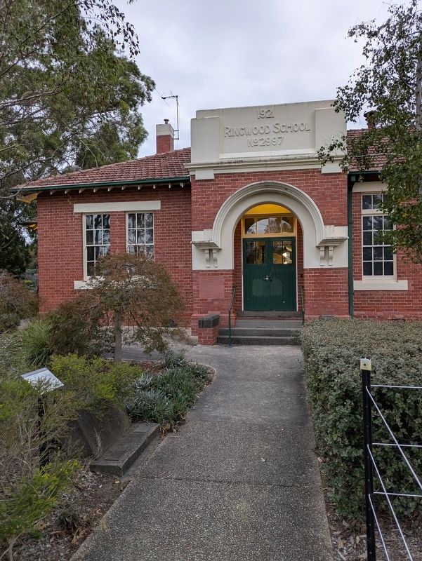
On left of path approaching the main door
Former Ringwood (State) School No.2997 opened in 1874 in a leased hall, as an annexe to Ringwood State School No.1451 which opened in the same year. This brick school succeeded it in 1921-22 and closed in 1998. It is historically significant to the municipality for its long association with educational developments in Ringwood. The present campus demonstrates a changing sequence of occupancy pattern and of the local population as extra land was purchased and buildings such as new classrooms, Bristols and L.T.C.s were added over time. The school was historically significant for the pioneering success of its recorder band. It is architecturally significant as a characteristic and relatively intact abstracted Baroque design from the Public Works Department under Edwin Evan Smith as Chief Architect. It is socially significant as being known and valued by the Ringwood community and their children over 125 years (76 years in this building).(Submitted on April 14, 2026, by Dean Barton-Ancliffe of Rowville, Victoria.)
Credits. This page was last revised on April 14, 2026. It was originally submitted on April 14, 2026, by Dean Barton-Ancliffe of Rowville, Victoria. This page has been viewed 13 times since then. Photos: 1, 2. submitted on April 14, 2026, by Dean Barton-Ancliffe of Rowville, Victoria. • Andrew Ruppenstein was the editor who published this page.
