Kennewick in Benton County, Washington — The American West (Northwest)
Indian Petroglyphs

Photographed by Clayton Pickett, April 14, 2026
1. Indian Petroglyphs Marker
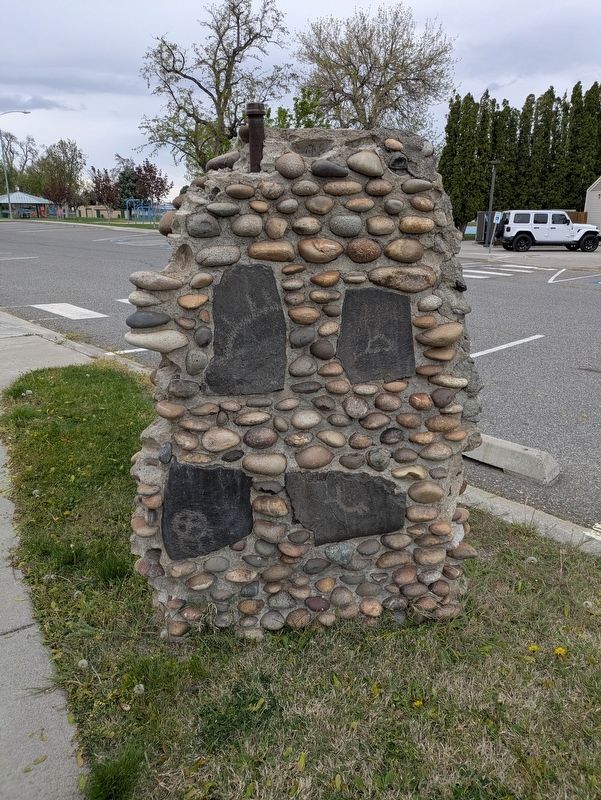
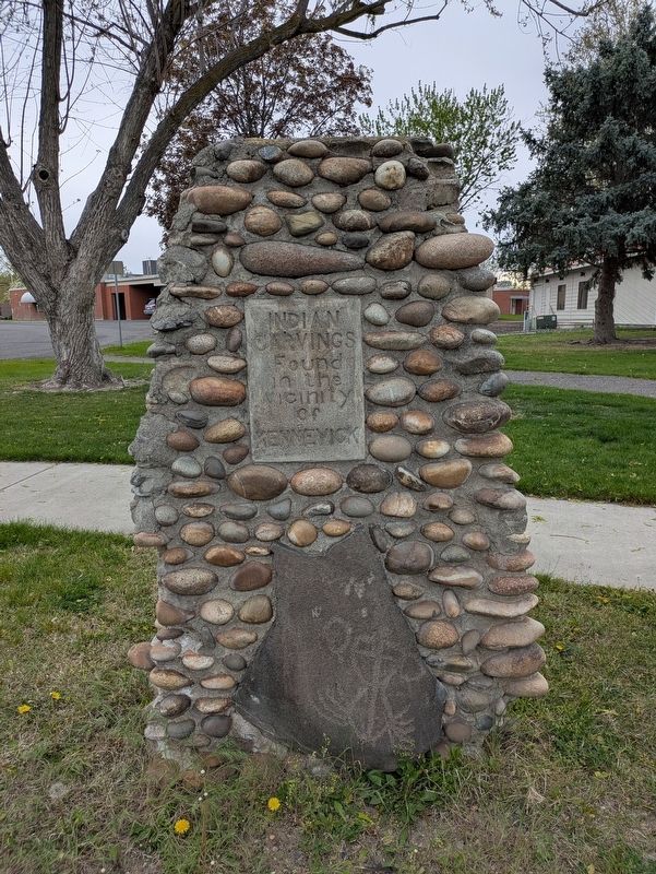
These ancient Indian petroglyphs were recovered from Blalock Island near Paterson and encased in stone pillars by representatives of the Kiwanis Club of Kennewick. They were dedicated at the west end of Keewaydin Park September 1, 1939. These petroglyphs were moved to the present site and dedicated by the Kiwanis Club of Kennewick and the East Benton County Historical Society June 19, 1989.
Erected 1989 by Kiwanis Club of Kennewick and the Kiwanis Club of the Columbia.
Topics. This historical marker is listed in these topic lists: Communications • Indigenous Peoples and Communities. A significant historical date for this entry is June 19, 1989.
Location. 46° 12.221′ N, 119° 7.197′ W. Marker is in Kennewick, Washington, in Benton County. It is on West Keewaydin Drive 0.1 miles South Auburn Street, on the left when traveling west. Touch for map. Marker is at or near this postal address: 205 W Keewaydin Dr, Kennewick WA 99336, United States of America. Touch for directions.

Regionally, this marker is in the Columbia Basin and in Yakima Valley. It is also in the American Mountain West and in the Lewis & Clark Corridor.
this page online
Other nearby markers. At least 8 other markers are within walking distance of this marker: Kennewick Man (within shouting distance of this marker); Intercity Green Bridge (within shouting distance of this marker); Downtown Kennewick (approx. 0.3 miles away); First Methodist Church (approx. 0.4 miles away); The Shootout at Poplar Grove (approx. 0.4 miles away); Gerald Carmichael (approx. 0.4 miles away); Vietnam Veterans Memorial (approx. one mile away); Clover Island (approx. one mile away). Touch for a list and map of all markers in Kennewick.
Photographed by Clayton Pickett, April 14, 2026
2. Indian petroglyphs encased in west pillar
Photographed by Clayton Pickett, April 14, 2026
3. Front side of west pillar

Photographed by Clayton Pickett, April 14, 2026
4. East pillar
Credits. This page was last revised on April 15, 2026. It was originally submitted on April 14, 2026, by Clayton Pickett of Richland, Washington. This page has been viewed 35 times since then. Photos: 1, 2, 3, 4. submitted on April 14, 2026, by Clayton Pickett of Richland, Washington. • Devry Becker Jones was the editor who published this page.
