Kettering in Prince George's County, Maryland — The American Northeast (Mid-Atlantic)
“Mount Lubentia”
(Patented by Ninian Beall as "Largo," 1686)
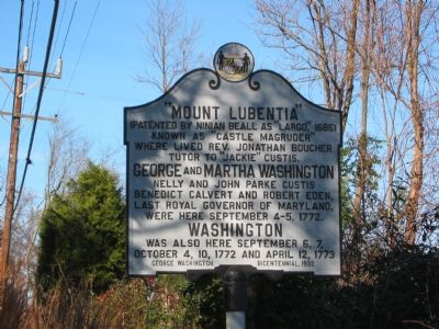
Photographed by F. Robby, November 26, 2004
1. "Mount Lubentia" Marker
Known as “Castle Magruder” where lived Rev. Jonathan Boucher, tutor to “Jackie” Custis.
Erected 1932 by George Washington Bicentennial.
Topics and series. This historical marker is listed in these topic lists: Colonial Era • Forts and Castles • Religion & Religious Structures • Settlements & Settlers. In addition, it is included in the Former U.S. Presidents: #01 George Washington, and the George Washington Slept Here series lists. A significant historical month for this entry is April 1802.
Location. Marker is missing. It was located near 38° 52.954′ N, 76° 48.8′ W. Marker was in Kettering, Maryland, in Prince George's County. It was on Largo Road (Route 202) 0.1 miles south of Kettering Drive, on the right when traveling south. Marker is a few feet off the roadway. Touch for map. Marker was at or near this postal address: 11201 Homestead Dr, Upper Marlboro MD 20774,
this page online

Regionally, this marker was in the Washington Metropolitan Area. It was also in the American South, specifically in the Upper South, in the Mid-Atlantic, and on the Eastern Seaboard. Globally, it was in the North Atlantic Region, North America, the Western Hemisphere, the Western World, and the Anglosphere. Historically, it found itself in what was once one of the original Thirteen Colonies and also the Antebellum South.
Other nearby markers. At least 8 other markers are within 3 miles of this location, measured as the crow flies: The Chesapeake Carousel (approx. 1.1 miles away); Weary Warriors (approx. 1.4 miles away); Archaeology at the Brick Quarters (approx. 1.4 miles away); Seeking Freedom (approx. 1.4 miles away); Northampton Slave Quarters and Archaeological Park (approx. 1.4 miles away); Archaeology at the Frame Quarters (approx. 1½ miles away); The History of Watkins Regional Park (approx. 1½ miles away); Ridgley (approx. 2.2 miles away). Touch for a list and map of all markers in Kettering.
Another marker is no longer nearby. Northampton Plantation Slave Quarters
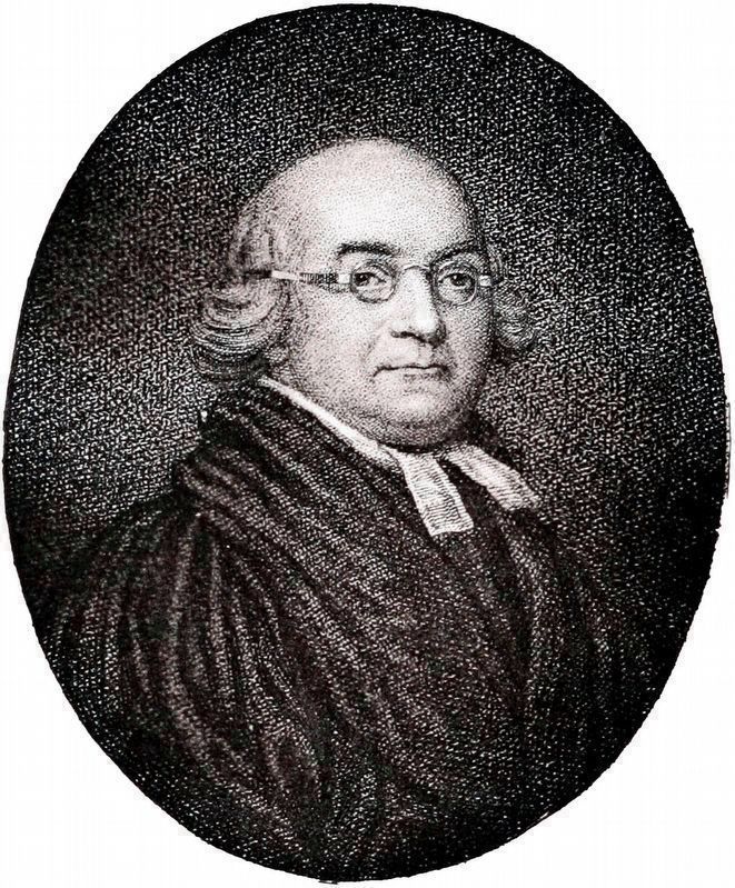
Internet Archive
2. Jonathan Boucher, M.A.
Jonathan Boucher, pastor, teacher, staunch Tory and friend of George Washington, lived and taught in the house that preceded the c. 1798 house on this site. Before Boucher returned to England in September of 1775, he wrote to George Washington, "You are no longer worthy of my friendship: a man of honour can no longer without dishonour be connected with you. With your cause I renounce you; and now for the last time subscribe myself, sir, Your humble servant, Jonathan Boucher." Portrait from Letters of Jonathan Boucher to George Washington, 1899
Also see . . . Mount Lubentia, PG:73-16. National Register Registration Form. “Mount Lubentia is a large hip-roofed Federal-style Flemish bond brick dwelling built c. 1798, possibly on the foundation of an earlier dwelling.” (Submitted on November 7, 2017, by Allen C. Browne of Silver Spring, Maryland.)
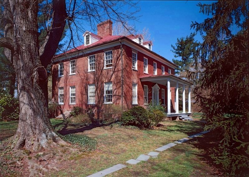
Library of Congress - HABS
3. Mount Lubentia
601 Largo Road
601 Largo Road
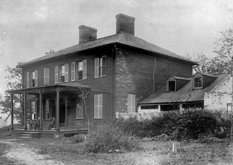
Library of Congress - HABS
4. Mount Lubentia, 1888
Credits. This page was last revised on April 15, 2026. It was originally submitted on November 18, 2007, by F. Robby of Baltimore, Maryland. This page has been viewed 2,308 times since then and 53 times this year. Last updated on April 15, 2026, by Rico Ramirez of Prince Frederick, Maryland. Photos: 1. submitted on November 18, 2007, by F. Robby of Baltimore, Maryland. 2, 3, 4. submitted on November 7, 2017, by Allen C. Browne of Silver Spring, Maryland. • Devry Becker Jones was the editor who published this page.
Editor’s want-list for this marker. A wide shot of the marker and its surroundings. • Can you help?
