Stoney Creek Crossing in Tallahassee in Leon County, Florida — The American South (South Atlantic)
The Block-Sterns Site

Photographed by Tim Fillmon, April 15, 2026
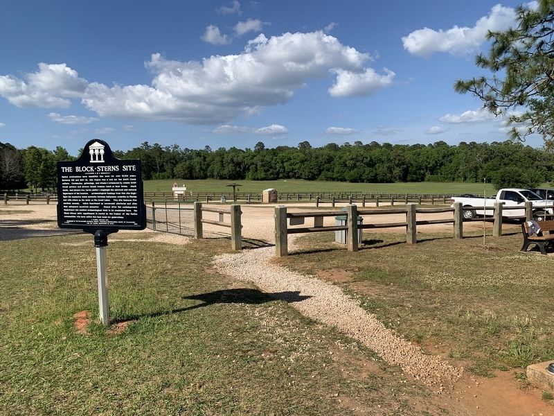
1. The Block-Sterns Site Marker
Native civilizations have inhabited this area for over 12,000 years. Between 100 and 800 CE. this region was a hub for the Swift Creek culture. Ceremonies, gatherings, and rituals - evidenced by ornate Swift Creek pottery and diverse faunal remains (such as bear bones, shark teeth, and stacked box turtle shells) - highlight the spiritual and cultural importance of the location. Archaeological findings from this site highlight the expansive trade networks between indigenous societies in Florida and with others as far away as the Great Lakes. This site features five earthen mounds, which functioned as ceremonial platforms and sites that safeguard ancestral memories. Named after the contemporary landowners who enabled archaeological work to be conducted here, the Block-Sterns site's significance is rooted in the legacy of the Native communities who have called this land home for generations.
Erected 2024 by The Tallahassee Historical Society, Panhandle Archaeological Society at Tallahassee, and the Florida Department of State. (Marker Number F-1270.)
Topics. This historical marker is listed in this
this page online
Location. 30° 26.629′ N, 84° 10.531′ W. Marker is in Tallahassee, Florida, in Leon County. It is in Stoney Creek Crossing. It can be reached from Pedrick Road 0.1 miles east of Stoney Creek Way. Marker is located in the parking area for J. R. Alford Greenway at the end of Pedrick Road. Touch for map. Marker is at or near this postal address: 2500 Pedrick Rd, Tallahassee FL 32317, United States of America. Touch for directions.

Regionally, this marker is in North Florida. It is also in the American South and specifically in the Deep South. Globally, it is in the North Atlantic Region, North America, a Gulf of Mexico state, the Western Hemisphere, the Western World, and the Anglosphere. Historically, it finds itself in what was once New Spain, the territory of the Mississippian Culture, one of the Confederate States of America, and the Antebellum South.
Other nearby markers. At least 8 other markers are within 3 miles of this marker, measured as the crow flies: Site of the Raid on Chaires Plantation (approx. half a mile away); Under Cover of Corn
Photographed by Tim Fillmon, April 15, 2026
2. The Block-Sterns Site Marker
Another marker is no longer nearby. Eastern Boundary of Lafayette Land Grant (was approx. 2.4 miles away but has been confirmed missing).
Also see . . . 1973 and 1994 excavations at the Block-Sterns Site. (Submitted on April 15, 2026, by Tim Fillmon of Webster, Florida.)
Credits. This page was last revised on August 10, 2026. It was originally submitted on April 15, 2026, by Tim Fillmon of Webster, Florida. This page has been viewed 45 times since then. Photos: 1, 2. submitted on April 15, 2026, by Tim Fillmon of Webster, Florida.
