
Mechanicsville in Hanover County, Virginia — The American South (Mid-Atlantic)
Hot Work at Cold Harbor

Photographed by Evan Dwyer, December 27, 2025
1. Hot Work at Cold Harbor Marker
"The rebel fire was very effective and it seemed to us from where we stood that our poor fellows would all get shot. The ground over which they passed was covered with men. We could see them fall in all shapes. Some would fall forward as if they had caught their feet and tripped and fell. Others would stagger about a few paces before they dropped."
(caption) An assault on the Cold Harbor trenches
Erected by National Park Service, U.S. Department of the Interior.
Topics. This historical marker is listed in this topic list: War, US Civil. A significant historical date for this entry is June 1, 1864.
Location. 37° 35.35′ N, 77° 17.01′ W. Marker is in Mechanicsville, Virginia, in Hanover County. It can be reached from Anderson-Wright Drive north of Cold Harbor Road (Virginia
this page online

Regionally, this marker is in Virginia’s Piedmont, in Central Virginia, and in the Richmond Metropolitan Area. It is also in the American South, specifically in the Upper South, and on the Eastern Seaboard. Globally, it is in the North Atlantic Region, North America, the Western Hemisphere, the Western World, and the Anglosphere. Historically, it finds itself in what was once the territory of the Mississippian Culture, one of the original Thirteen Colonies, one of the Confederate States of America, and the Antebellum South.
Other nearby markers. At least 8 other markers are within walking distance of this marker: We Have Broken Through (within shouting distance of this marker); A Captured Trench (within shouting distance of this marker); Keep Digging (about 300 feet away, measured in a

Photographed by Evan Dwyer, December 27, 2025
2. Hot Work at Cold Harbor Marker
View facing up the slope the 2nd Connecticut had to traverse.
Also see . . . Touring Cold Harbor Battlefield. National Park Service (Submitted on April 19, 2026.)
Photographed by Evan Dwyer, December 27, 2025
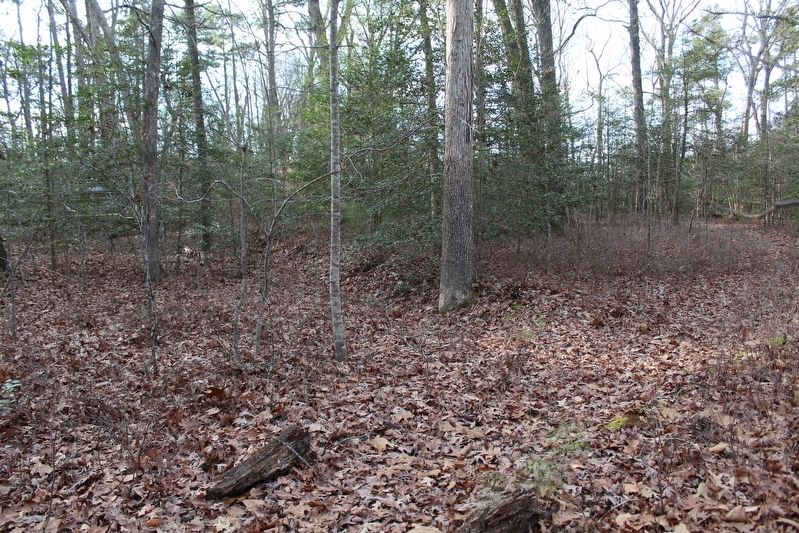
3. Trace of the Confederate Line
The line assaulted by the 2nd Connecticut on 1 June 1864 is visible as an eroded breastwork just up the hill from the marker to the west.

Photographed by Usgs
4. Depression & Confederate Line
This LiDAR image from the USGS' 3D Elevation Program (3DEP) shows the marker's location (white circle) in between the hills to the east and west of its position. The Confederate line on the slope to the west is evident running roughly north-south. The dark curving feature cutting through the Confederate earthworks and running down into the depression is the park walking trail.
Credits. This page was last revised on April 19, 2026. It was originally submitted on April 16, 2026, by Evan Dwyer of Richmond, Virginia. This page has been viewed 19 times since then. Photos: 1, 2, 3, 4. submitted on April 16, 2026, by Evan Dwyer of Richmond, Virginia. • Bernard Fisher was the editor who published this page.
