Chapel Hill in Marshall County, Tennessee — The American South (East South Central)
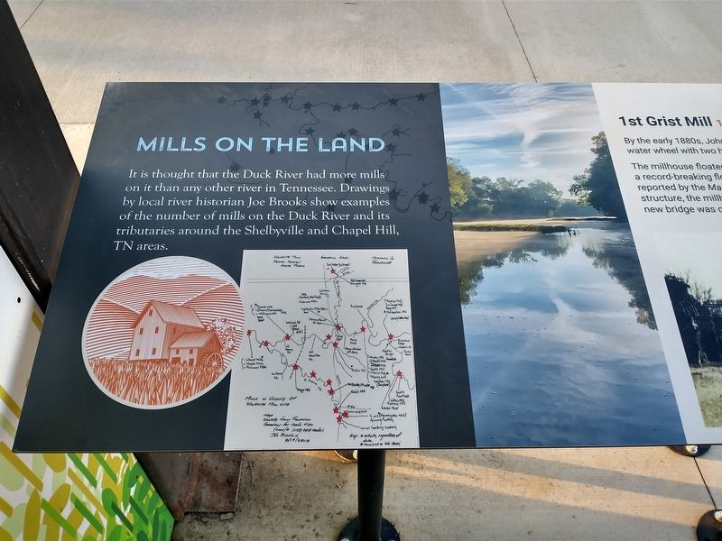
Mills on the Land
Photographed by Tom Bosse, April 11, 2026
1. Mills on the Land Marker
It is thought that the Duck River had more mills on it than any other river in Tennessee. Drawings by local river historian Joe Brooks show examples of the number of mills on the Duck River and its tributaries around the Shelbyville and Chapel Hill, Tn areas.
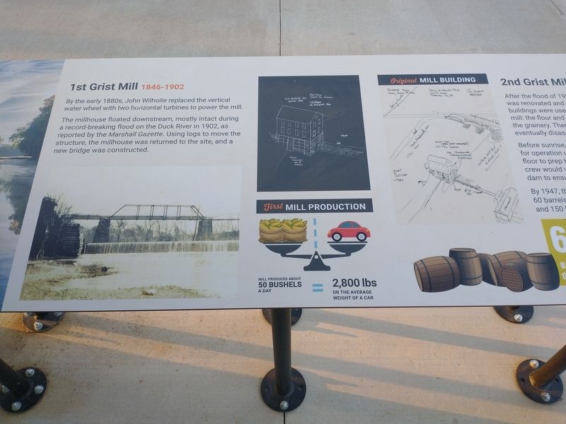
1st Grist Mill 1846 – 1902
By the early 1880s, John Wilhoite replaced the vertical water wheel with two horizontal turbines to power the mill.
The millhouse floated downstream, mostly intact during a record-breaking flood on the Duck River in 1902, as reported by the Marshall Gazette. Using logs to move the structure, the millhouse was returned to the site, and a new bridge was constructed.
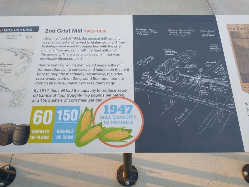
2nd Grist Mill 1902 – 1950
After the flood of 1902, the original mill building was renovated and moved to higher ground. Three buildings were used in conjunction with the grist mill: the flour and corn mill, the feed mill, and the grainery. There was also a sawmill that was eventually disassembled.
Before sunrise, young men would prepare the mill for operation using catwalks and ladders on the third floor to prep the machinery. Meanwhile, the older crew would work
this page online
By 1947, this mill had the capacity to produce about 60 barrels of flour (roughly 196 pounds per barrel) and 150 barrels of corn meal per day.
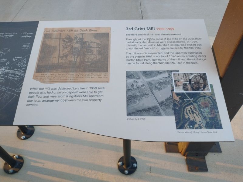
When the mill was destroyed by a fire in 1950, local people who had grain on deposit were able to get their flour and meal from Kingston’s Mill upstream due to an arrangement between the two property owners.
3rd Grist Mill 1950 – 1959
The third and final mill was diesel-powered.
Throughout the 1950s, most of the mills on the Duck River had already shut down or were disassembled. In 1959, this mill, the last mill in Marshall County, was closed due to continued financial struggles caused by the fire of 1950.
The mill was disassembled, and the land was purchased by the state in 1961 – a total of 1,140 acres, creating Henry Horton State Park. Remnants of the mill and the old bridge can be found along the Wilhoite Mill Trail in the park.
[Captions:]
Wilhoite Mill 1958
Current view of Henry Horton State Park
Erected by Friends of Henry Horton State Park.
Topics. This historical marker is
Photographed by Tom Bosse, April 11, 2026
2. Mills on the Land Marker
Location. 35° 35.387′ N, 86° 41.638′ W. Marker is in Chapel Hill, Tennessee, in Marshall County. It is at the intersection of Nashville Highway and N Park Road, on the left when traveling south on Nashville Highway. Marker is located near the visitor's center at Henry Hill State Park. Touch for map. Marker is at or near this postal address: 4209 Nashville Hwy, Chapel Hill TN 37034, United States of America. Touch for directions.

Regionally, this marker is in Middle Tennessee and in the Highland Rim. It is also in the American South and specifically in the Upper South. Globally, it is in North America, the Western Hemisphere, the Western World, and the Anglosphere. Historically, it finds itself in what was once the territory of the Mississippian Culture, one of the Confederate States of America, and the Antebellum South.
Other nearby markers. At least 8 other markers are within 5 miles of this marker, measured as the crow flies: Wilhoite History Timeline (here, next to this marker); Henry Hollis Horton
Photographed by Tom Bosse, April 11, 2026
3. Mills on the Land Marker
Related markers. Click here for a list of markers that are related to this marker.
Photographed by Tom Bosse, April 11, 2026
4. Mills on the Land Marker

Photographed by Tom Bosse, April 11, 2026
5. Mills on the Land Marker
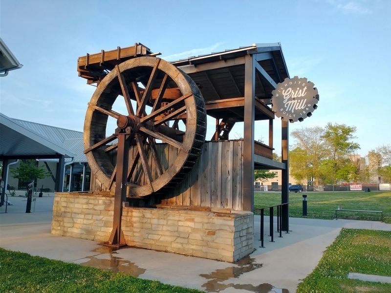
Photographed by Tom Bosse, April 11, 2026
6. Wilhoite Grist Mill
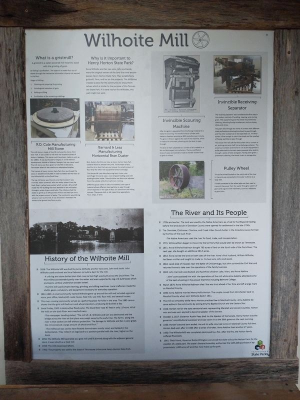
Photographed by Tom Bosse, April 11, 2026
7. Wilhoite Mill

Photographed by Tom Bosse, April 11, 2026
8. Barnard and Leas Manufacturing Horizontal Bran Duster
Credits. This page was last revised on May 11, 2026. It was originally submitted on April 17, 2026, by Tom Bosse of Jefferson City, Tennessee. This page has been viewed 41 times since then. Photos: 1, 2, 3, 4, 5, 6. submitted on April 17, 2026, by Tom Bosse of Jefferson City, Tennessee. 7, 8. submitted on May 10, 2026, by Tom Bosse of Jefferson City, Tennessee. • James Hulse was the editor who published this page.
