Laneview in Middlesex County, Virginia — The American South (Mid-Atlantic)
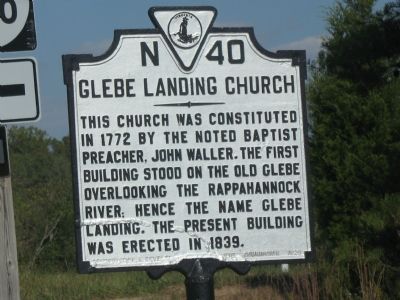
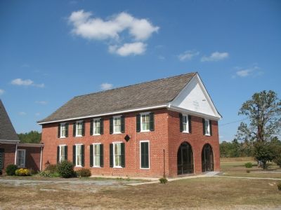
Glebe Landing Church
Erected 1929 by Conservation and Development Commission. (Marker Number N-40.)
Topics and series. This historical marker is listed in these topic lists: Churches & Religion • Colonial Era. In addition, it is included in the Virginia Department of Historic Resources (DHR) series list. A significant historical year for this entry is 1772.
Location. Marker has been reported missing. It was located near 37° 44.601′ N, 76° 43.239′ W. Marker was in Laneview, Virginia, in Middlesex County. Marker was at the intersection of George Washington Memorial Highway (U.S. 17) and Lovelanding Road (County Route 606), on the right when traveling north on George Washington Memorial Highway. Touch for map. Marker was at or near this postal address: 1439 Glebe Landing Rd, Laneview VA 22504, United States of America. Touch for directions.
Other nearby markers. At least 8 other markers are within 8 miles of this location, measured as the crow flies. Middlesex County / Essex County (approx. 0.9 miles away); Mann Meeting House (approx. 3.6 miles away); Lower King and Queen Baptist Church (approx. 4.7 miles away); Thomas Washington Lynched (approx. 5.8 miles away); Morattico Historic District (approx. 5.8 miles away); Trade Routes (approx. 7.3 miles away); Angel Visit Baptist Church (approx. 7.4 miles away); Pamunkey Indians Attacked by Nathaniel Bacon (approx. 7.7 miles away).
More about this marker. The marker is on the right hand side heading north and the church it self if across the highway
Credits. This page was last revised on November 23, 2021. It was originally submitted on October 14, 2007, by Laura Troy of Burke, Virginia. This page has been viewed 1,233 times since then and 28 times this year. Photos: 1, 2. submitted on October 14, 2007, by Laura Troy of Burke, Virginia. • J. J. Prats was the editor who published this page.

