
Cottage Grove in Lane County, Oregon — The American West (Northwest)
The Knott Mine Gold Ore Stamp Mill
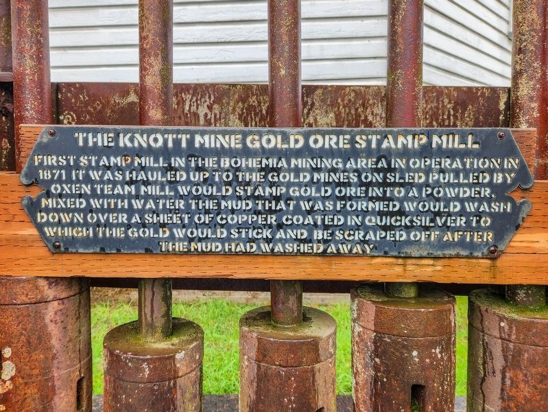
Photographed by Douglass Halvorsen, April 11, 2026
1. The Knott Mine Gold Ore Stamp Mill Marker
Topics. This historical marker is listed in these topic lists: Industry & Commerce • Man-Made Features. A significant historical year for this entry is 1871.
Location. 43° 47.95′ N, 123° 3.898′ W. Marker is in Cottage Grove, Oregon, in Lane County. It is at the intersection of North H Street and Birch Avenue, on the left when traveling west on North H Street. Touch for map. Marker is at or near this postal address: 147 N H Street, Cottage Grove OR 97424, United States of America. Touch for directions.

Regionally, this marker is in Oregon’s Willamette Valley. It is also on the American Pacific Coast, in the Pacific Northwest, and in the Lewis & Clark Corridor. Globally, it is in North America, in the Cascade Range, on the Ring of Fire, in the Pacific Rim,
this page online
Other nearby markers. At least 8 other markers are within walking distance of this marker: Cottage Grove Museum (here, next to this marker); Cottage Grove Historical Museum (a few steps from this marker); River Road (about 600 feet away, measured in a direct line); The Applegate Trail - Southern Route to Oregon (about 600 feet away); The Changing Trail to Oregon (about 600 feet away); Crossing the Calapooya Mountains (about 600 feet away); A Trail by Any Other Name (about 600 feet away); Cottage Grove Veterans Memorial (about 600 feet away). Touch for a list and map of all markers in Cottage Grove.
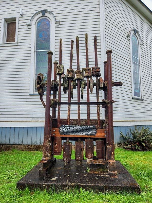
Photographed by Douglass Halvorsen, April 11, 2026
2. The Knott Mine Gold Ore Stamp Mill Marker

Photographed by Douglass Halvorsen, April 11, 2026
3. The Knott Mine Gold Ore Stamp Mill Marker

Photographed by U.S. Geological Survey
4. Geologic Map of Bohemia District
This geologic map from 1935 shows the Knott mining shafts where the Knott Mine gold ore stamp mill would have been used in the 1870s, as shown inside the green rectangle. Also notice the 'Knott Cabin' landmark near the Knott shafts.
Credits. This page was last revised on April 17, 2026. It was originally submitted on April 17, 2026, by Douglass Halvorsen of Klamath Falls, Oregon. This page has been viewed 26 times since then. Photos: 1, 2, 3, 4. submitted on April 17, 2026, by Douglass Halvorsen of Klamath Falls, Oregon. • Andrew Ruppenstein was the editor who published this page.
