Richland in Benton County, Washington — The American West (Northwest)
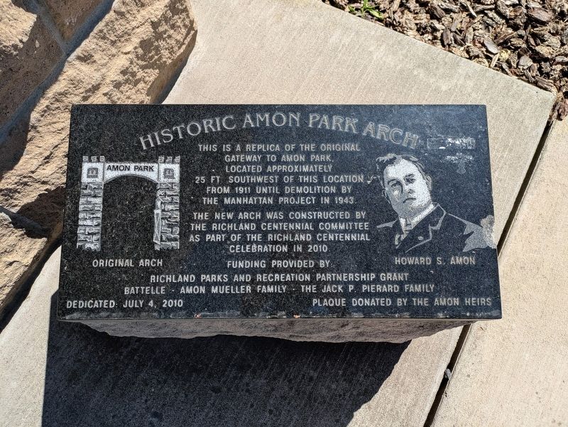
Historic Amon Park Arch
Photographed by Clayton Pickett, April 15, 2026
1. Historic Amon Park Arch Marker
The new arch was constructed by the Richland Centennial Committee as part of the Richland Centennial celebration in 2010.
Erected 2010 by Amon heirs.
Topics. This historical marker is listed in these topic lists: Architecture • Parks & Recreational Areas. A significant historical year for this entry is 1911.
Location. 46° 16.484′ N, 119° 16.332′ W. Marker is in Richland, Washington, in Benton County. It is at the intersection of Lee Boulevard and Amon Park Drive, on the right when traveling east on Lee Boulevard. Touch for map. Marker is at or near this postal address: 69 Lee Blvd, Richland WA 99352, United States of America. Touch for directions.

Regionally, this marker is in the Columbia Basin and in Yakima Valley. It is also in the American Mountain West and in the Lewis & Clark Corridor. Globally, it is in North America, on the Pacific Rim, in the Western Hemisphere, in the Western World, and in the Anglosphere.
Other nearby markers. At
this page online
Photographed by Clayton Pickett, April 15, 2026
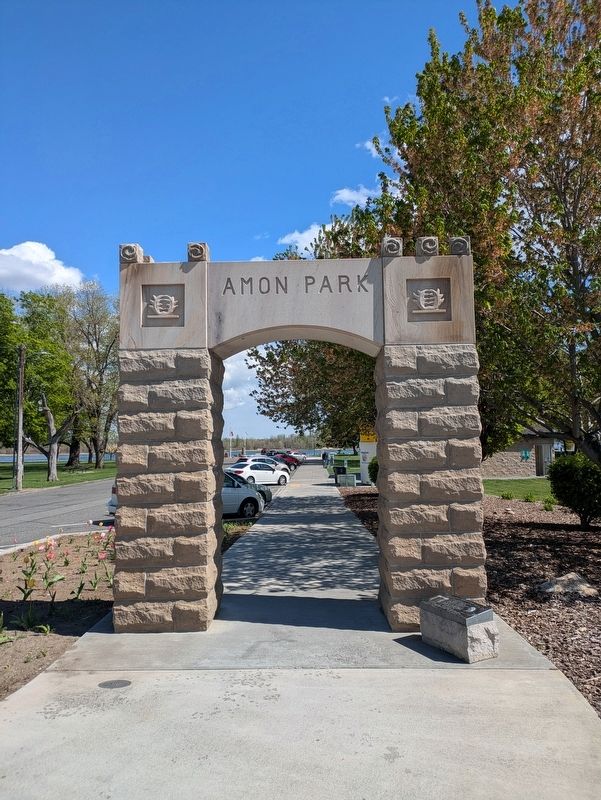
2. Amon Park Arch
Credits. This page was last revised on April 24, 2026. It was originally submitted on April 17, 2026, by Clayton Pickett of Richland, Washington. This page has been viewed 18 times since then. Photos: 1, 2. submitted on April 17, 2026, by Clayton Pickett of Richland, Washington. • James Hulse was the editor who published this page.
