Richland in Benton County, Washington — The American West (Northwest)
USS Triton (SSRN 586) History

Photographed by Clayton Pickett, April 15, 2026
1. USS Triton (SSRN 586) History Marker
Decommissioned: May 3, 1969
USS Triton Sail Park Dedication: November 10, 2011 Port of Benton worked with the U.S. Navy to preserve the sail and conning tower.
Operation Sandblast: February 24-April 25, 1960 Military Code Name for Triton's Undersea Mission
Aboard During Operation Sandblast: 176 Crew, Eight Technical and Scientific Personnel
Triton's Deployments
August 1960: Radar Picket
June 1962: Arrived at Portsmouth Naval Shipyard for Conversion to an Attack Submarine
March 1964: Overhaul to Attack Submarine Complete
April 1964 to June 1967: Flagship for Submarine Force, Atlantic Fleet
1967: Navy Scheduled Triton for Inactivation
Commanding Officers
Edward L. Beach Jr., November 1959-July 1961
George Morin, July 1961-September 1964
Robert Rawlins, September 1964-November 1966
Frank Wadsworth, November 1966-May 1969
Erected 2011.
Topics. This historical marker is listed in this topic list: Waterways & Vessels.
Location. 46° 20.92′ N, 119° 16.185′ W. Marker is in Richland, Washington, in Benton County. It can be reached from the intersection of Port
this page online

Regionally, this marker is in the Columbia Basin and in Yakima Valley. It is also in the American Mountain West and in the Lewis & Clark Corridor. Globally, it is in North America, on the Pacific Rim, in the Western Hemisphere, in the Western World, and in the Anglosphere.
Other nearby markers. At least 8 other markers are within 5 miles of this marker, measured as the crow flies: First to Circumnavigate the Earth Submerged (here, next to this marker); USS Triton Specifications (here, next to this marker); The Manhattan Project (about 400 feet away, measured in a direct line); Black Pioneers (approx. 1.2 miles away); F.A. Friermood House (approx. 3 miles away); Col. Thomas William Symons (approx. 4.2 miles away); In Honor of Central United Protestant Church (2016) (approx. 4½ miles away); A River of History (approx. 4.7 miles away). Touch for a list and map of all markers in Richland.
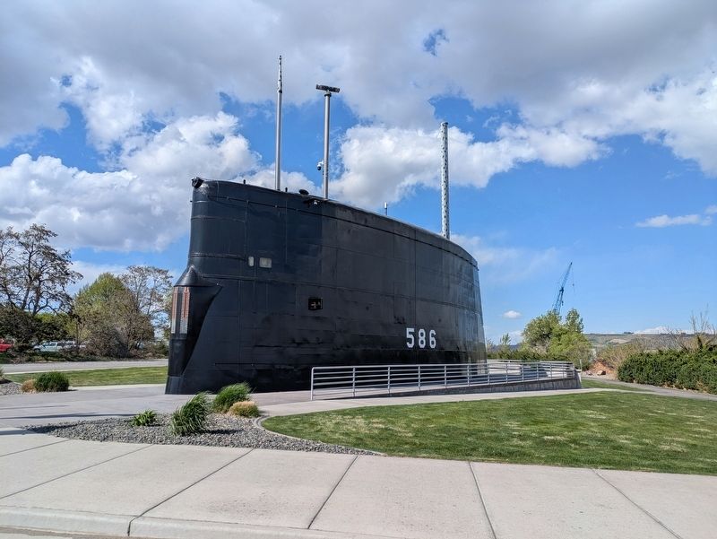
Photographed by Clayton Pickett, April 15, 2026
2. USS Triton Sail
Credits. This page was last revised on May 5, 2026. It was originally submitted on April 17, 2026, by Clayton Pickett of Richland, Washington. This page has been viewed 28 times since then. Photos: 1, 2. submitted on April 17, 2026, by Clayton Pickett of Richland, Washington. • Bill Pfingsten was the editor who published this page.
