Richland in Benton County, Washington — The American West (Northwest)
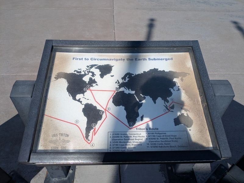
First to Circumnavigate the Earth Submerged
Photographed by Clayton Pickett, April 15, 2026
1. First to Circumnavigate the Earth Submerged Marker
1: 2/16/60 Groton, Connecticut
2: 2/24/60 St. Peter/St. Paul Rocks (Operation Sandblast Begins)
3: 3/5/60 Montevideo, Uruguay
4: 3/7/60 Cape Horn, Argentina
5: 3/13/60 Easter Islands
6: 3/28/60 Agat, Guam
7: 4/1/60 Phillippines
8: 4/17/60 Cape of Good Hope
9: 4/25/60 St. Peter/St. Paul Rocks (Operation Sandblast Ends)
10: 5/2/60 Cadiz, Spain
11: 5/10/60 Rehoboth Beach, Delaware
Erected 2011.
Topics. This historical marker is listed in this topic list: Waterways & Vessels. A significant historical year for this entry is 1960.
Location. 46° 20.92′ N, 119° 16.184′ W. Marker is in Richland, Washington, in Benton County. It is at the intersection of Port of Benton Boulevard and Richardson Road, on the right when traveling north on Port of Benton Boulevard. Touch for map. Marker is at or near this postal address: 3250 Port of Benton Boulevard, Richland WA 99354, United States of America. Touch for directions.

Regionally, this marker is in the Columbia Basin and in Yakima Valley. It is also in the American Mountain West and in the Lewis & Clark Corridor. Globally, it is in North America, on the Pacific Rim, in
this page online
Other nearby markers. At least 8 other markers are within 5 miles of this marker, measured as the crow flies: USS Triton Specifications (here, next to this marker); USS Triton (SSRN 586) History (here, next to this marker); The Manhattan Project (about 400 feet away, measured in a direct line); Black Pioneers (approx. 1.2 miles away); F.A. Friermood House (approx. 3 miles away); Col. Thomas William Symons (approx. 4.2 miles away); In Honor of Central United Protestant Church (2016) (approx. 4½ miles away); A River of History (approx. 4.7 miles away). Touch for a list and map of all markers in Richland.
Photographed by Clayton Pickett, April 15, 2026
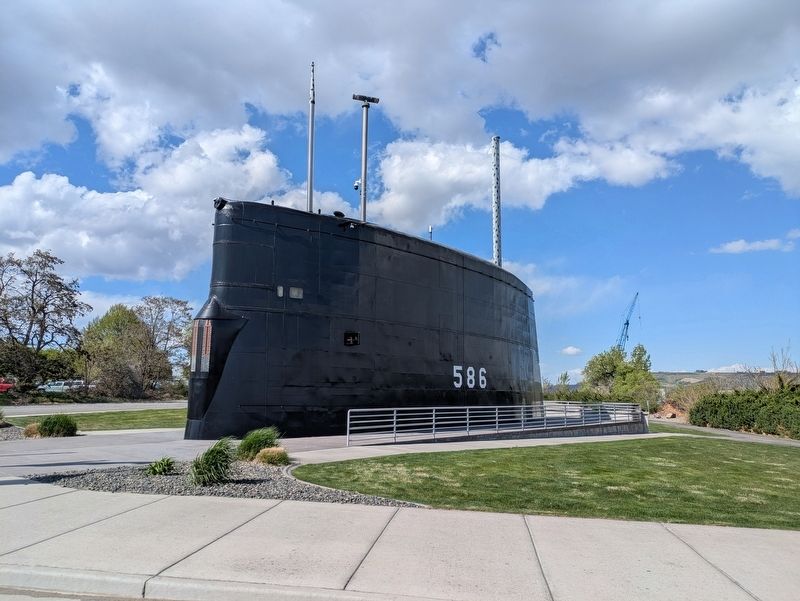
2. USS Triton Sail
Credits. This page was last revised on May 5, 2026. It was originally submitted on April 17, 2026, by Clayton Pickett of Richland, Washington. This page has been viewed 33 times since then. Photos: 1, 2. submitted on April 17, 2026, by Clayton Pickett of Richland, Washington. • Bill Pfingsten was the editor who published this page.
