Simsbury Center in Capitol Region, Connecticut — The American Northeast (New England)
Simsbury
(Massaco Plantation)
Photographed by Michael Herrick, August 28, 2015
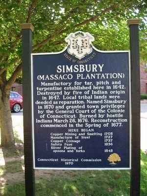
1. Simsbury Marker
Manufactory for tar, pitch, and turpentine established here in 1642. Destroyed by fire of Indian origin in 1647. Local tribal lands were deeded as reparation. Named Simsbury in 1670 and granted town privileges by the General Court of the Colonie of Connecticut. Burned by hostile Indians March 26, 1676. Reconstruction commenced in the Spring of 1677.
Here began
Copper Mining and Smelting 1705
Manufacture of Steel 1727
Copper Coinage 1737
Safety Fuse 1836
Silver Plating of spoons and forks 1845
Erected 1970 by Connecticut Historical Commission.
Topics and series. This historical marker is listed in these topic lists: Colonial Era • Industry & Commerce • Settlements & Settlers. In addition, it is included in the King Philip's War 1675-1676 series list. A significant historical date for this entry is March 26, 1676.
Location. 41° 52.816′ N, 72° 48.025′ W. Marker is in Simsbury in Capitol Region, Connecticut. It is in Simsbury Center. It is at the intersection of Hopmeadow Street (Connecticut Route 10) and Pent Road, on the left when traveling north on Hopmeadow Street. The marker stands in front of
this page online

Regionally, this marker is in the Connecticut River Valley, in Greater Hartford, and in the Knowledge Corridor. It is also in the American Northeast and in New England. Globally, it is in North America, the Western Hemisphere, the Western World, and the Anglosphere. Historically, it finds itself in what was once Hartford County and also one of the original Thirteen Colonies.
Other nearby markers. At least 8 other markers are within walking distance of this marker: This Elm Tree (within shouting distance of this marker); First Meeting House In Simsbury (approx. 0.4 miles away); The Landmark Building (approx. 0.4 miles away); Simsbury World War I Memorial (approx. 0.4 miles away); Simsbury Civil War Memorial (approx. 0.4 miles away); Simsbury Veterans Memorial (approx. 0.4 miles away); Simsbury Revolutionary War Memorial (approx. 0.4 miles away); Eno Memorial Hall (approx. 0.4 miles away). Touch for a list and map of all markers in Simsbury.
Also see . . .
1. Town of Simsbury.
Photographed by Michael Herrick, August 28, 2015
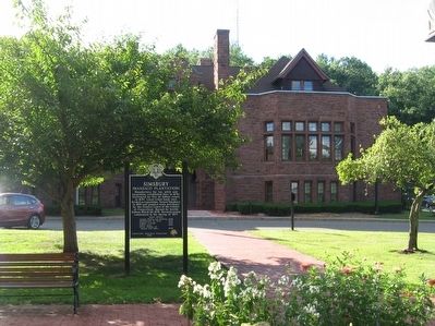
2. Simsbury Marker in front of Simsbury Town Hall
2. Simsbury, Connecticut on Wikipedia. (Submitted on August 30, 2015, by Michael Herrick of Southbury, Connecticut.)
3. Metacomet Ridge - Wikipedia.
According to legend, Metacomet orchestrated the burning of Simsbury, Connecticut, and watched the conflagration from Talcott Mountain near the cave now named after him. A number of features associated with the Metacomet Ridge are named after the sachem, including the Metacomet Trail, the Metacomet-Monadnock Trail, King Philip's Cave, King Philip Mountain, and Sachem Head.(Submitted on April 19, 2026, by G.W.Bartlett of Hingham, Massachusetts.)
Photographed by Michael Herrick, August 28, 2015
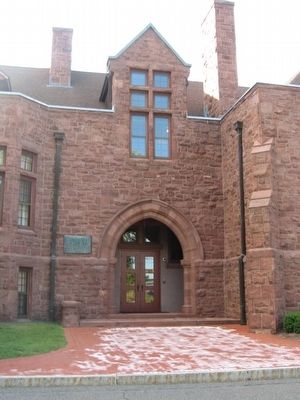
3. Simsbury Town Hall
Simsbury Town Hall was the high school, built in 1907
Photographed by Michael Herrick, August 28, 2015
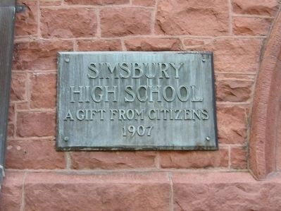
4. Simsbury Town Hall Marker
High School
A Gift From Citizens
1907
Credits. This page was last revised on May 19, 2026. It was originally submitted on August 30, 2015, by Michael Herrick of Southbury, Connecticut. This page has been viewed 1,215 times since then and 76 times this year. Last updated on April 19, 2026, by G.W.Bartlett of Hingham, Massachusetts. Photos: 1, 2, 3, 4. submitted on August 30, 2015, by Michael Herrick of Southbury, Connecticut. • Devry Becker Jones was the editor who published this page.
