Santa Ysabel in San Diego County, California — The American West (Pacific Coastal)
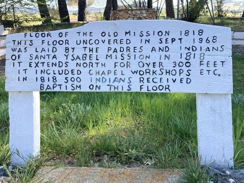
Floor of the Old Mission
1818
| — | Site of the First Chapel | — |
Photographed by Craig Baker, March 11, 2026
1. Floor of the Old Mission Marker
This floor, uncovered in Sept 1968, was laid by the Padres and Indians of Santa Ysabel Mission in 1818. It extends north for over 300 feet. It included chapel, workshops, etc. In 1818, 500 Indians received baptism on this floor.
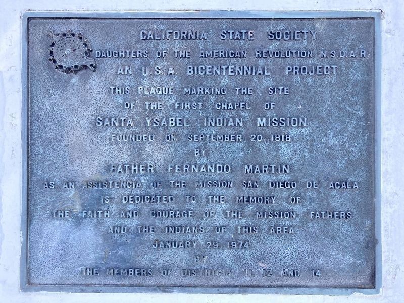
Santa Ysabel Indian Mission
California State Society Daughters of the American Revolution, N.S.D.A.R. An U.S.A Bicentennial project.
This plaque marking the site of the first chapel of Santa Ysabel Indian Mission, founded on Septemeber 20, 1818 by Father Fernando Martin as an Assistencia of the Mission San Diego De Acala, is dedicated to the memory of the faith and courage of the Mission Fathers and the Indians of this area, January 29, 1974, by the members of Districts 11, 12, and 14.
Topics. This historical marker is listed in these topic lists: Indigenous Peoples and Communities • Religion & Religious Structures. A significant historical year for this entry is 1818.
Location. 33° 7.797′ N, 116° 40.689′ W. Marker is in Santa Ysabel, California, in San Diego County. It can be reached from California 79 1½ miles north of California Route 78, on the right when
this page online

Regionally, this marker is in the Peninsular Ranges. It is also in the American Borderlands and on the Pacific Coast. Globally, it is in North America, on the Ring of Fire, on the Pacific Rim, in the Western Hemisphere, in the Western World, and in the Anglosphere. Historically, it finds itself in what was once New Spain and also Mexico’s Alta California.
Other nearby markers. At least 8 other markers are within 6 miles of this marker, measured as the crow flies: Santa Ysabel Asistencia Site (about 300 feet away, measured in a direct line); Angel of the Lost Bells (about 300 feet away); Inaja Forest Fire (approx. 2.3 miles away); Pioneer Cemetery (approx. 5½ miles away); Bailey House (approx. 5½ miles away); Jacoby Building (approx. 5.6 miles away); Honoring Black Pioneers of Julian (approx. 5.7 miles away); Julian Pioneer Museum (approx. 5.7 miles away). Touch for a list and map of all markers in Santa Ysabel.
Photographed by Craig Baker, March 11, 2026
2. Santa Ysabel Indian Mission Marker
Photographed by Craig Baker, March 11, 2026
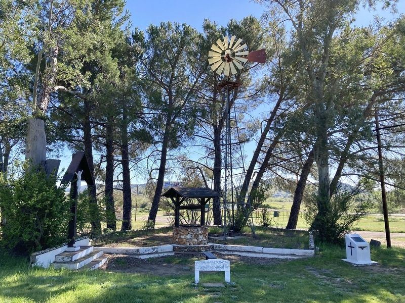
3. Floor of the Old Mission Marker
Photographed by Craig Baker, March 11, 2026
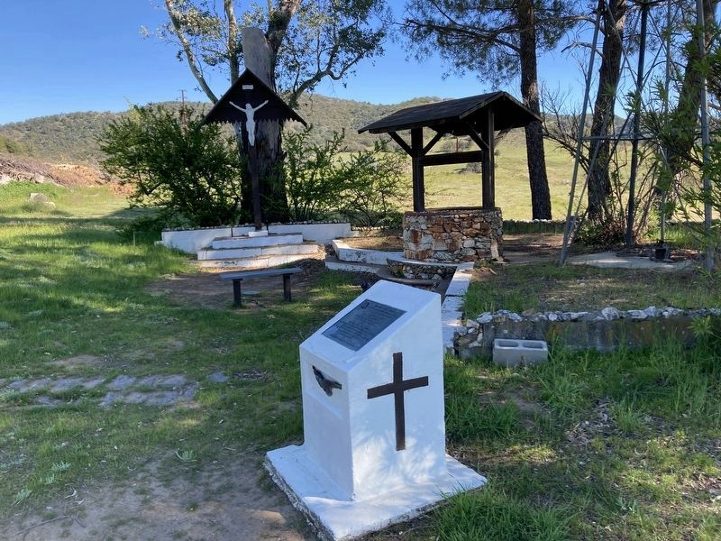
4. Santa Ysabel Indian Mission Marker
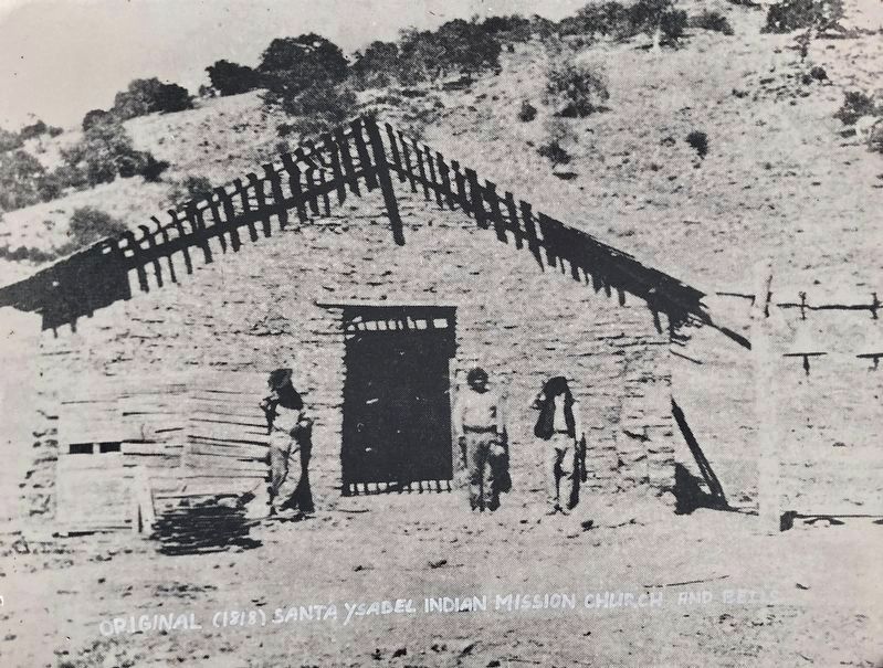
courtesy Indian Museum, circa 1875
5. Original 1818 Mission Church and Bells
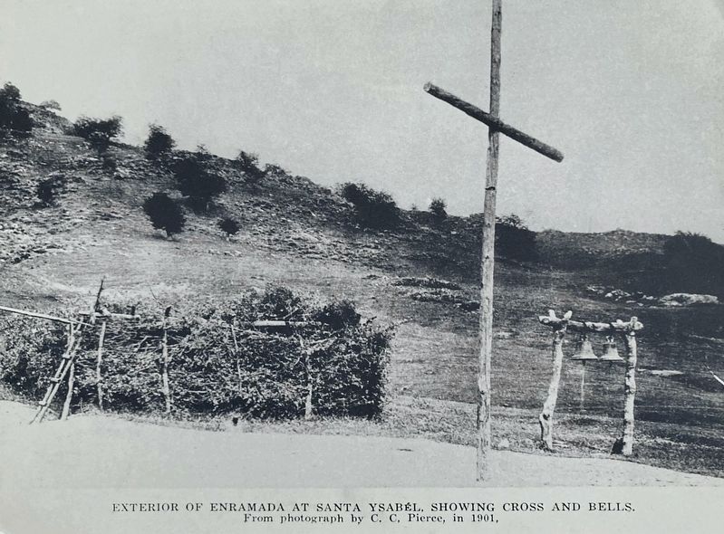
courtesy Indian Museum, circa 1901
6. Arbor, Cross, and Bells - 1901
Credits. This page was last revised on May 15, 2026. It was originally submitted on April 19, 2026, by Craig Baker of Sylmar, California. This page has been viewed 29 times since then. Photos: 1, 2, 3, 4, 5, 6. submitted on April 19, 2026, by Craig Baker of Sylmar, California.
