Northwest Harwinton in Litchfield County, Connecticut — The American Northeast (New England)
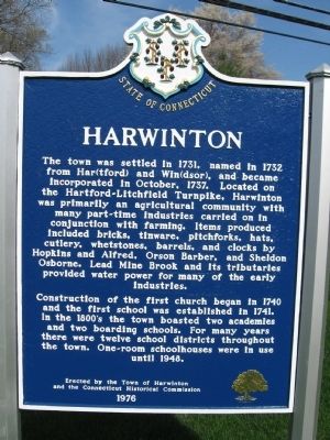
Harwinton
Construction of the first church began in 1740 and the first school was established in 1741. In the 1800's the town boasted two academies and two boarding schools. For many years there were twelve school districts throughout the town. One-room schoolhouses were in use until 1948.
Erected by the Town of Harwinton
and the Connecticut Historical Commission
1976
Erected 1976 by the Town of Harwinton, the Connecticut Historical Commission.
Topics. This historical marker is listed in these topic lists: Colonial Era • Settlements & Settlers. A significant historical month for this entry is October 1737.
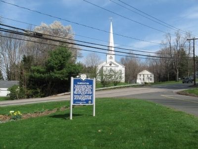
Location. 41° 46.261′ N, 73° 3.608′ W. Marker is in Harwinton, Connecticut, in Litchfield County . It is in Northwest Harwinton. Marker is at the intersection of Litchfield Road (Connecticut Route 118) and South Road, on the right when traveling east on Litchfield Road. Touch for map. Marker is in this post office area: Harwinton CT 06791, United States of America. Touch for directions.
Other nearby markers. At least 8 other markers are within 4 miles of this marker, measured as the crow flies. Harwinton Veterans Memorial (a few steps from this marker); Liberty Tree Memorial (approx. 0.6 miles away); Watering Trough & Fountain (approx. 0.7 miles away); Forever Mourned / Forever Honored (approx. 3 miles away); VFW 155mm Howitzer (approx. 3.7 miles away); Torrington Vietnam Monument (approx. 3.7 miles away); Torrington Veterans Memorial (approx. 3.7 miles away); Coe Memorial Park (approx. 3.7 miles away). Touch for a list and map of all markers in Harwinton.
Also see . . . Harwinton, Connecticut on Wikipedia. (Submitted on April 14, 2010, by Michael Herrick of Southbury, Connecticut.)
Credits. This page was last revised on February 10, 2023. It was originally submitted on April 14, 2010, by Michael Herrick of Southbury, Connecticut. This page has been viewed 1,140 times since then and 42 times this year. Photos: 1, 2. submitted on April 14, 2010, by Michael Herrick of Southbury, Connecticut.

