
East End in Bridgeport in Greater Bridgeport Region, Connecticut — The American Northeast (New England)
Johnson Oak Park
Photographed by Conrad Ward
1. Johnson Oak Park Marker
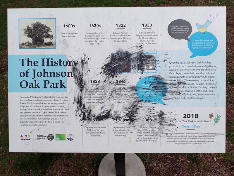
Once called "Bridgeport's oldest living resident," the Johnson Oak stood near the corner of Alex & Logan Streets. The Johnson Oak was a meeting place for neighbors and a shelter for weary riders travelling through on horseback. A small hole in the trunk of the oak became known as "Cupid's Post Office," where young lovers would leave notes for one another. The tree was more than 100 feet high and 29 feet in circumference. In honor of the tree, the area was renamed "Johnson Oak Park."
Over the year, Johnson Oak Park has provided much needed play and gathering space for community members of all ages. Kids played basketball near the park, and families and the community would gather for cookouts. There were occasional line dances and sack races. The park has long hosted the annual Firebird Society cookout. About the revitalization of the park, one long-time neighbor said, "the community members really led the charge."
1600s The Cupheag Tribe live in this area.
1630s Puritan settlers arrive, transforming this area into a robust agricultural site, which they called "New Field".
1822 Edward Johnson purchases
this page online
1830 Edward Johnson begins the construction of a 22-room Greek Revival mansion named Eagle's Nest.
1839 Capt. Henry Burroughs purchases a portion of the New Field land, which becomes a stronghold of African American property ownership.
1844 The Eagle's Nest is bought by Don Jose DeRivera, said to be Connecticut's first Puerto Rican resident.
1978 The Johnson Oak, which had stood for over 500 years, was struck by lightning.
1980s Eagle's Nest is torn down following an arson attack on the property.
2008 The Jettie S. Tisdale School is constructed. Wood from the original Eagle's Nest is used as part of the structure that stands in the schoolyard.
2018 Johnson Oak Park is revitalized.
Present Day The Trust for Public Land, the City of Bridgeport, the East End Neighborhood Revitalization Zone, and Jettie S. Tisdale School envisioned a new Johnson Oak Park beginning in 2014. Tisdale students and East End community members shared their ideas for improving the park through a participatory design process led by The Trust for Public Land.
(graphics)
—
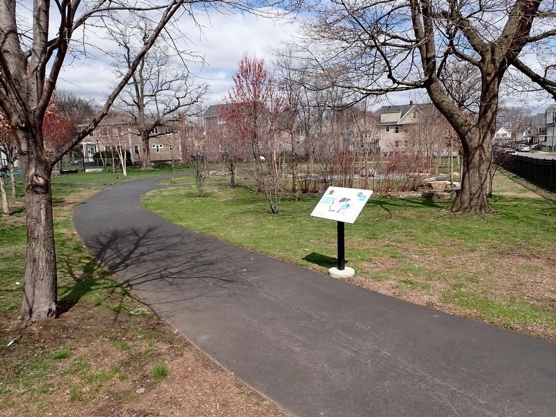
Photographed by Conrad Ward, April 13, 2025
2. Johnson Oak Park Marker
— "There'd be cookouts and picnics, the church family and community family were all there."
— "What I know is that young families want to have places to go with their young children, we need that."
Topics. This historical marker is listed in these topic lists: Charity & Public Work • Horticulture & Forestry • Parks & Recreational Areas • Settlements & Settlers. A significant historical year for this entry is 2018.
Location. 41° 10.718′ N, 73° 9.571′ W. Marker is in Bridgeport in Greater Bridgeport Region, Connecticut. It is in East End. It is on Alex Street west of Davenport Street, on the right when traveling west. Touch for map. Marker is in this post office area: Bridgeport CT 06607, United States of America. Touch for directions.

Regionally, this marker is on the Connecticut Shoreline. It is also in the American Northeast and in New England. Globally, it is in North America, the Western Hemisphere, the Western World, and the Anglosphere. Historically, it finds itself in what was once Fairfield County and also one of the original Thirteen Colonies.
Other nearby markers. At least 8 other markers are within 2 miles of this marker, measured as the crow flies: Andrew Leso House (approx. 1.3 miles away); Washington Park (approx. 1.3 miles away); a different marker also named Washington Park (approx. 1.4 miles away); James Henry O’Rourke (approx. 1.6 miles away); Abraham Lincoln’s Visit (approx. 1.6 miles away); Bridgeport Korean War Memorial (approx. 1.6 miles away); Bryant Electric Company World War I Monument (approx. 1.6 miles away); Bridgeport World War II Memorial (approx. 1.6 miles away). Touch for a list and map of all markers in Bridgeport.
Credits. This page was last revised on May 19, 2026. It was originally submitted on April 21, 2026, by Conrad Ward of Guilford, Connecticut. This page has been viewed 11 times since then. Photos: 1, 2. submitted on April 21, 2026, by Conrad Ward of Guilford, Connecticut. • Michael Herrick was the editor who published this page.
