Cottage Grove in Lane County, Oregon — The American West (Northwest)
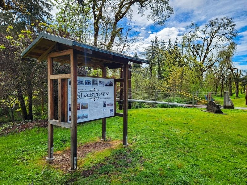
Welcome to Slabtown
...the First Cottage Grove

Photographed by Douglass Halvorsen, April 11, 2026
1. Welcome to Slabtown Marker
There’s a small cabin near the corner of where Harrison and River Road are today. This early structure first belonged to Henry Small in 1858 and was later sold to O.P. Adams. It served for a time as the area’s first store and post office. Oscar P. Adams, his wife and their six daughters live there now. Just this year, pioneers Harvey Hazelton and Samuel Geer are constructing a grist mill on the south side of Silk Creek. Farmers will now be able to bring their grain to be turned into flour. Before this, they traveled miles to get their grain milled. Hazelton, a jack-of-all-trades, will also build a wagon shop and lumber mill nearby.
Since the road beside you is so muddy during rainy season, Hazelton will lay wide wooden slabs from his lumber mill on the road to make it passable for horse-drawn wagons during the rainy season. Because of this, people began calling this place Slabtown.
Along
this page online
But the fate of bustling Salbtown/Cottage Grove had begun to shift in 1872 with the arrival of the Oregon and California Railroad. A platform appeared first near the new tracks on the east side of the river. Then later, a depot was built for passengers and commercial goods shipped out and arriving in this new and prospering place in the Southern Willamette Valley.
After the railroad arrived, the growth of the community on the east bank of the river created a good deal of friction between the west and east sides. There were disagreements over building sites, animal enclosures and bonding for the water system. There were also disagreements over which side the post office should be located. These arguments eventually made their way to the State Capitol. O.F. Knox
Photographed by Douglass Halvorsen, April 11, 2026
2. Welcome to Slabtown Marker
Darwin Bristow, banker and former mayor, represented the west-siders in the opposition to this petition. The east-siders were victorious and the town of Lemati was created in 1895 (note the official seal of the city of Lemtai at the right). The new post office was named Lemati on March 28, 1898 but on May 10th it was changed back to Cottage Grove. Finally, both factions agreed to iron out their differences. This resulted in an act which consolidated the two communities under the name of Cottage Grove. On January 24, 1899, Cottage Grove became an official incorporated City in the State of Oregon and by February the local newspaper reported that the new council met and, “peace, harmony and good fellowship prevailed.”
[Top photo captions]
Henry Small’s cabin, located near the corner of where Harrison Street and South River Road are today. It was through his land claim, along the old Kalapuya trail on the west bank of the Coast Fork River, where the town of Cottage Grove first took shape. Aobe in the yard, O.P. Adams’ grandaughter.
J.P. Currin’s drug store, located along today’s River Road on t he west side of river just south of the flour mill. It would later move to a more modern building just west of the Eakin and Bristow business near the corner of Main Street and River Road.
Elish and Frank Whipple’s store in Slabtown. Whipple served as postmaster and Wells Fargo agent. A telegraph office also operated out of the store.
Hazelton/Geer flour mill ca. 1890’s. The mill operated for many years under different owners. It was destroyed by fire in 1949. The south side of the mill avoided the fire and remains today as the Old Mill Feed Store.
Piper and Holderman’s Hardware Store, the first in Cottage Grove, on the northwest corner of South River Road and Willamette Court. Standing on the board sidewalk, left to right are Mirian, S.R. and Arch Piper. 1891
Eakin and Bristow Mercantile and bank was built in 1896. J.P. Currin relocated on the building’s west side. A second story was added to this building later and served as the local Masonic Lodge. Eakin and Bristow made their fortunes trading in grain. Darwin Bristow became a prominent banker, serving as the town’s mayor in 1889 and 1890.
West Cottage Grove/Slabtown History
Photographed by Douglass Halvorsen, April 11, 2026
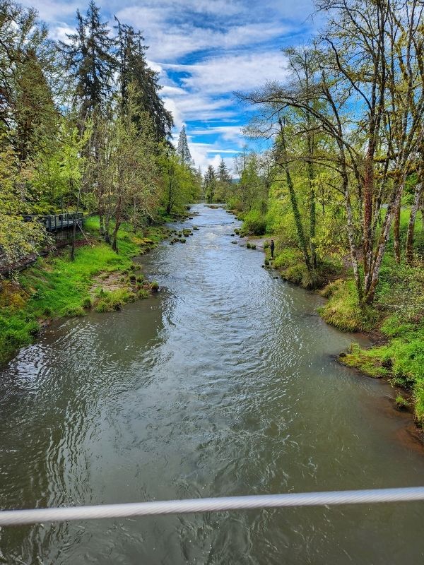
3. Coast Fork of Willamette River
View of the Coast Fork of the Willamette River looking south. Slabtown would have been located on the right, Lemati on the left.
Oscar P. Adams, wife Sarah and their six daughters. Adams became a prominent land owner in Slabtown. His wife opened a hat shop there and his daughters married into other pioneering families in town.
J.I. Jones, a businessman and lumber mill owner. Jones was elected mayor of Cottage Grove’s west side sometime during the 6 year feud between the west and east siders.
Preent day River Road and Main Street looking west, ca. 1900. Currin’s drug store is just west of Eakin and Bristow’s Mercantile. W.S. Crisman’s New York Racket Store, an early dry goods store, is on the left.
Slabtown had become very run-down by 1920. Note the early fire hose tower remaining on the right. Old timers remember the area as a red light district at the time. Only a handful of original houses still remain along River Road today.
The Company “E” 4th Infantry band marches on the muddy West Main Street at the junction with H Avenue in 1907. Albert Woodard carries the bass drum; Ernest Lebow holds french horn to the left of Woodard.
East Cottage Grove/Lemati History [photo captions]
O.F. Knox, an early merchant, school teacher and director. Knox was elected Mayor of Lemtai during the west vs. east squabble.
Established in 1880, this two-story school was located near the corner of Adams and 2nd. The above picture was taken in 1889 with then principal, Rufus Callison, and teacher, Sadie Myers standing in the doorway behind their assortment of students.
Post Office Stolen!
East-siders wanted the post office moved to their side of the river because they believed this was where the community’s growth was meant to take place. This idea was met with violent protest by the west-siders. Sometime in the 1890s, Perry Sherwood, the Lemati postmaster, asked John Durham to bring a dray to the post office location so that they could move the letter boxes to the east side. This was accomplished under the cover of darkness one evening. The Oregonian reported that the post office had been stolen and John Durham was accused of being the thief. (Above 1880’s 1¢ Ben Franklin postage stamp).
Home of Ben Lurch, early mercantile owner. Mr. Lurch was the first to move his home and then his business to the east side of the river. His store was located directly east of his house on present day 5th and Main Street. The home, built in the 1870’s, was moved to Adams Street in 1923.
Topics. This historical marker is listed in these topic lists: Industry & Commerce • Railroads & Streetcars • Settlements & Settlers • Waterways & Vessels. A significant historical year for this entry is 1870.
Location. 43° 47.639′ N, 123° 4.177′ W. Marker is in Cottage Grove, Oregon, in Lane County. It is on South River Road, on the right when traveling north. Touch for map. Marker is at or near this postal address: 540 S River Road, Cottage Grove OR 97424, United States of America. Touch for directions.

Regionally, this marker is in Oregon’s Willamette Valley. It is also on the American Pacific Coast, in the Pacific Northwest, and in the Lewis & Clark Corridor. Globally, it is in North America, in the Cascade Range, on the Ring of Fire, on the Pacific Rim, in the Western Hemisphere, in the Western World, and in the Anglosphere.
Other nearby markers. At least 8 other markers are within walking distance of this marker: Millwork Memories (approx. 0.3 miles away); Timber Town (approx. 0.3 miles away); Cottage Grove—Getting Established (approx. 0.3 miles away); A Man, a Mill, & a Bridge to Timber (approx. 0.3 miles away); Last Covered Railroad Bridge in Oregon (approx. 0.3 miles away); Chambers Covered Railroad Bridge (approx. 0.3 miles away); Cottage Grove Veterans Memorial (approx. 0.3 miles away); A Trail by Any Other Name (approx. 0.3 miles away). Touch for a list and map of all markers in Cottage Grove.
Also see . . . The Lemati / Slabtown Feud.
The city of Cottage Grove originally developed on the west side of the Coast Fork river. It was nicknamed Slabtown for the wooden slabs that covered the muddy roads and sidewalks. All went along fine until the Oregon and California Railroad came through on the east side of the river in 1872. The town started to gradually build up along what is now Main Street toward the Railroad Depot, where Bohemia Park is today. This left the citizens on the west side a little miffed because they wanted the heart of the town to stay where it was.(Submitted on April 21, 2026, by Douglass Halvorsen of Klamath Falls, Oregon.)
Credits. This page was last revised on April 21, 2026. It was originally submitted on April 21, 2026, by Douglass Halvorsen of Klamath Falls, Oregon. This page has been viewed 30 times since then. Photos: 1, 2, 3. submitted on April 21, 2026, by Douglass Halvorsen of Klamath Falls, Oregon. • Andrew Ruppenstein was the editor who published this page.
