Catawba in York County, South Carolina — The American South (South Atlantic)
Construction of Stonework
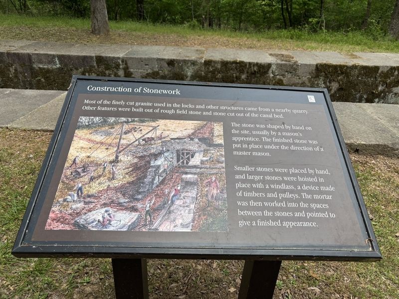
Photographed by Benjamin Rubin, April 25, 2026
1. Construction of Stonework Marker
Most of the finely cut granite used in the locks and other structures came from a nearby quarry. Other features were built out of rough field stone and stone cut out of the canal bed.
The stone was shaped by hand on the site, usually by a mason's apprentice. The finished stone was put in place under the direction of a master mason.
Smaller stones were placed by hand, and larger stones were hoisted in place with a windlass, a device made of timbers and pulleys. The mortar was then worked into the spaces between the stones and pointed to give a finished appearance.
Erected by South Carolina State Park Service.
Topics. This historical marker is listed in these topic lists: Industry & Commerce • Waterways & Vessels.
Location. 34° 46.324′ N, 80° 52.68′ W. Marker is in Catawba, South Carolina, in York County. It can be reached from Canal Road (County Route 330) 0.4 miles east of Lansford Road, on the left when traveling east. Touch for map. Marker is in this post office area: Lancaster SC 29720, United States of America. Touch for directions.

Regionally,
this page online
Other nearby markers. At least 8 other markers are within 2 miles of this marker, measured as the crow flies: Great Indian Warrior Trading Path (within shouting distance of this marker); Mill Complex (approx. 0.3 miles away); The Canal Bed (approx. half a mile away); Culvert (approx. 0.6 miles away); Footbridge (approx. 0.9 miles away); A Nest with a Bird's-Eye View (approx. 1.2 miles away); Landsford Canal State Park Trails (approx. 1.3 miles away); The Guardlock (approx. 1.3 miles away). Touch for a list and map of all markers in Catawba.
Credits. This page was last revised on April 28, 2026. It was originally submitted on April 25, 2026, by Benjamin Rubin of Columbia, South Carolina. This page has been viewed 18 times since then. Photo 1. submitted on April 25, 2026, by Benjamin Rubin of Columbia, South Carolina. • Bernard Fisher was the editor who published this page.
Editor’s want-list for this marker. Wide shot of marker and its surroundings. • Can you help?
