Near Fort Oglethorpe in Catoosa County, Georgia — The American South (South Atlantic)
Smith's Mississippi Battery.
Maney's Brigade, Cheatham's Division, Polk's Corps.
Photographed by Edward Troxel
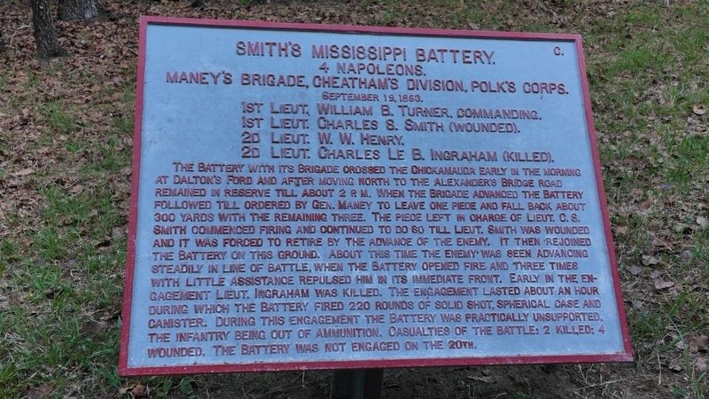
1. Smith's Mississippi Battery Marker
4 Napoleons.
Maney's Brigade, Cheatham's Division, Polk's Corps.
September 19, 1863.
1st Lieut. William B. Turner, Commanding.
Ist Lieut. Charles S. Smith (Wounded).
2d Lieut. W. W. Henry.
2d Lieut. Charles Le B. Ingraham (Killed).
this page online
Topics. This historical marker is listed in this topic list: War, US Civil. A significant historical date for this entry is September 19, 1863.
Location. 34° 55.079′ N, 85° 14.426′ W. Marker is near Fort Oglethorpe, Georgia, in Catoosa County. It can be reached from Alexanders Bridge Road south of Brotherton Road, on the right when traveling south. This marker is located off of a hiking path that connects Alexanders Bridge Road and Brotherton Road. Park on the south side of Alexanders Bridge Road near Huggin's Tennessee Battery (CSA, MT-1361). Follow the path southeast to the shell monument for Brig. Gen. Preston Smith (CSA). A path will lead south to this tablet. Touch for map. Marker is at or near this postal address: 3370 Lafayette Rd, Fort Oglethorpe GA 30742, United States of America. Touch for directions.

Regionally, this marker is in the Mountains. It is also in the American South and specifically in the Deep South. Globally,
Photographed by Edward Troxel, April 16, 2026
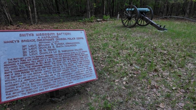
2. Smith's Mississippi Battery Marker
Other nearby markers. At least 8 other markers are within walking distance of this marker: Stanford's Mississippi Battery. (about 300 feet away, measured in a direct line); Jackson's Brigade (approx. ¼ mile away); Smith's Brigade (approx. 0.3 miles away); Preston Smith Memorial Shell Monument (approx. 0.3 miles away); 77th Pennsylvania Infantry (approx. 0.3 miles away); 29th Indiana Infantry (approx. 0.3 miles away); Joe L. Campbell Memorial (approx. 0.3 miles away); Dodge's Brigade (approx. 0.3 miles away). Touch for a list and map of all markers in Fort Oglethorpe.
Also see . . . Chickamauga & Chattanooga National Military Park. National Park Service (Submitted on April 28, 2026.)
Credits. This page was last revised on April 28, 2026. It was originally submitted on April 27, 2026, by Edward Troxel of Creal Springs, Illinois. This page has been viewed 17 times since then. Photos: 1, 2. submitted on April 27, 2026, by Edward Troxel of Creal Springs, Illinois. • Bernard Fisher was the editor who published this page.
