Boerne in Kendall County, Texas — The American South (West South Central)
From Trailway, Railway, Roadway to Greenway
Old No. 9
Photographed by James Hulse, April 26, 2026
1. From Trailway, Railway, Roadway to Greenway Marker
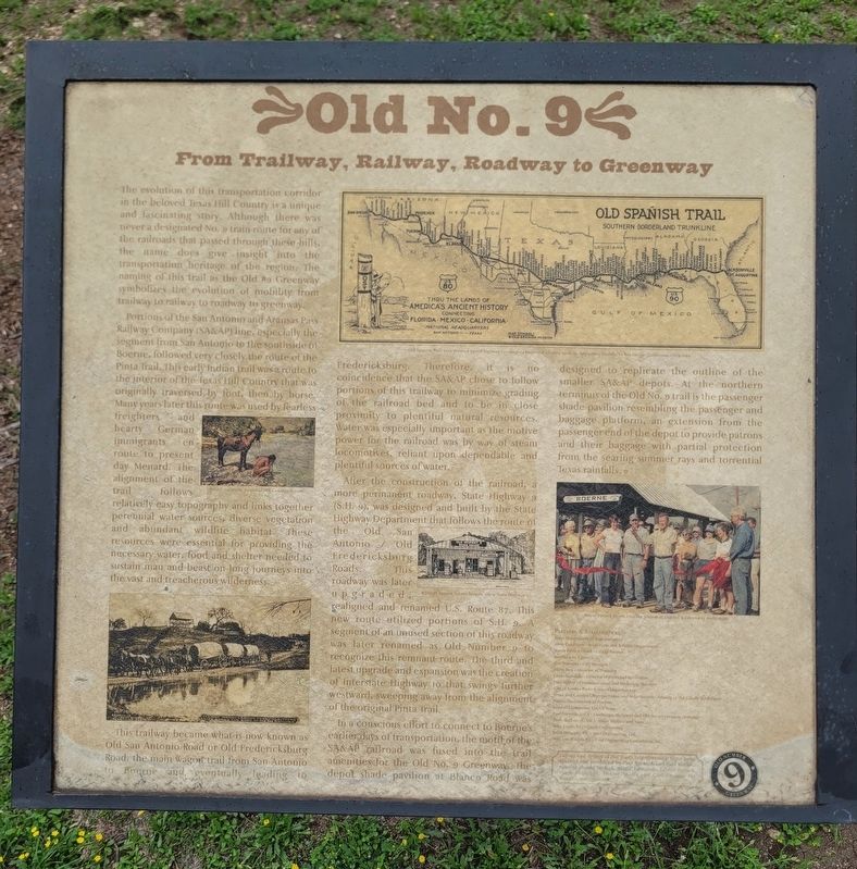
The evolution of this transportation corridor in the beloved Texas Hill Country is a unique and fascinating story. Although there was never a designated No. 9 train route for any of the railroads that passed through these hills, the name does give insight into the transportation heritage of the region. The naming of this trail as the Old No. 9 Greenway symbolizes the evolution of mobility from trailway to railway to roadway to greenway.
Portions of the San Antonio and Aransas Pass Railway Company (SA&AP) line, especially the segment from San Antonio to the south side of Boerne, followed very closely the route of the Pinta Trail. This early Indian trail was a route to the interior of the Texas Hill Country that was originally traversed by foot, then by horse. Many years later this route was used by fearless freighters and hearty German immigrants en route to present-day Menard. The alignment of the trail follows relatively easy topography and links together perennial water sources, diverse vegetation, and abundant wildlife habitat. These resources were essential for providing the necessary water, food, and shelter needed
this page online
This trailway became what is now known as Old San Antonio Road or Old Fredericksburg Road, the main wagon trail from San Antonio to Boerne and eventually leading to Fredericksburg. Therefore, it is no coincidence that the SA&AP chose to follow portions of this trailway to minimize grading of the railroad bed and to be in close proximity to plentiful natural resources. Water was especially important, as the motive power for the railroad was by way of steam locomotives, reliant upon dependable and plentiful sources of water.
After the construction of the railroad, a more permanent roadway, State Highway (S.H. 9), was designed and built by the State Highway Department, following the route of the Old San Antonio and Old Fredericksburg Roads. This roadway was later upgraded, realigned, and renamed U.S. Route 87. This new route utilized portions of S.H. 9. A segment of an unused section of this roadway was later renamed Old Number 9 to recognize this remnant route. The third and latest upgrade and expansion was the creation of Interstate Highway 10 that
Photographed by James Hulse, April 26, 2026
2. From Trailway, Railway, Roadway to Greenway Marker
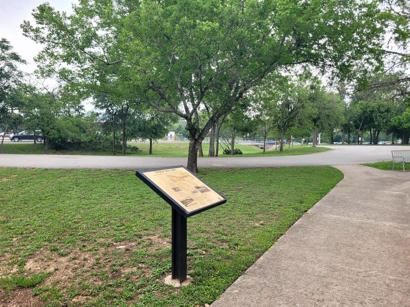
The marker is located at the trailhead for the Old No. 9 trail.
In a conscious effort to connect to the region’s earlier ways of transportation, the motif of the SA&AP railroad was fused into the trail amenities for the Old No. 9 Greenway. The depot shade pavilion at Blanco Road was designed to replicate the outline of the smaller SA&AP depots. At the northern terminus of the Old No. 9 trail is the passenger shade pavilion, resembling the passenger and baggage platform, an extension from the passenger end of the depot to provide patrons and their baggage with partial protection from the searing summer rays and torrential Texas rainfalls.
Captions:
Native American pauses at Hill Country stream.
Old Spanish Trail auto route, a paved highway connecting historical centers from St. Augustine, Florida, to San Diego, California, circa 1929.
Waring's former Texaco Station along State Highway 9.
Mayor Patrick Heath cuts the ribbon at Old No. 9 Greenway dedication.
Partners & Stakeholders:
Texas Department of Transportation • Andy Goldblum - Texas Parks and Wildlife Department • Mayor Patrick Heath, City of Boerne • Boerne City Council • Kon Bowman, City Manager • Suris Turk, Director of Planning • Linda Donarski - Director of Parks and Recreation • Paul Kirtley - Communication and Marketing Manager • City of Boerne - Parks & Street Departments • Brent and Carolyn Chipman Evans, and Mike Morton - Friends of the Cibolo Wilderness • Native Plant Society of Boerne • Kendall Elementary KLEAN Team • Paul Barwick, ASLA - Landscape Architect and Old No. 9 Greenway Designer • Dixie Watkins III, ASLA - Dixie Watkins and Assoc. • Mike Coyle, P.E. - Coyle Engineering • Keith Strimple, P.E. - M&S Engineering, Ltd. • Matt Van Wiklen, P.E. - Civil Engineering Consultants, Inc.
Layout and design of the Trail’s Interpretive Signs were created and produced by Paul Barwick and Paul Kirtley. Special thanks to Col. Bettie Edmonds, Lester Haines, Hugh Hemphill, Tommy Shultz, and Carl Coduey for historic materials.
Erected by Old
Photographed by James Hulse, April 26, 2026
3. From Trailway, Railway, Roadway to Greenway Marker
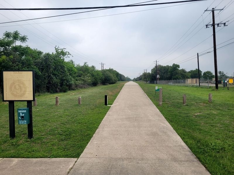
The view of the Old No. 9 Greenway looking towards the north.
Topics. This historical marker is listed in these topic lists: Railroads & Streetcars • Roads & Vehicles. A significant historical year for this entry is 1929.
Location. 29° 47.337′ N, 98° 42.946′ W. Marker is in Boerne, Texas, in Kendall County. It is on S Esser Road north of State Highway 46, on the left when traveling north. Touch for map. Marker is at or near this postal address: 153 Winding Windmill, Boerne TX 78006, United States of America. Touch for directions.

Regionally, this marker is in the Hill Country and in the San Antonio Metropolitan Area. Globally, it is in North America, a Gulf of Mexico state, the Western Hemisphere, the Western World, and the Anglosphere. Historically, it finds itself in what was once New Spain, the Republic of Texas, and one of the Confederate States of America.
Other nearby markers. At least 8 other markers are within walking distance of this marker: Old No. 9 Trail (about 500 feet away, measured in a direct line); Sheep Dip Crossing (about 500 feet away); Cibolo Nature Center in City Park (about 600 feet away); Herff Ranch (about 600 feet away); City Park (approx.
Photographed by James Hulse, April 26, 2026
4. From Trailway, Railway, Roadway to Greenway Marker
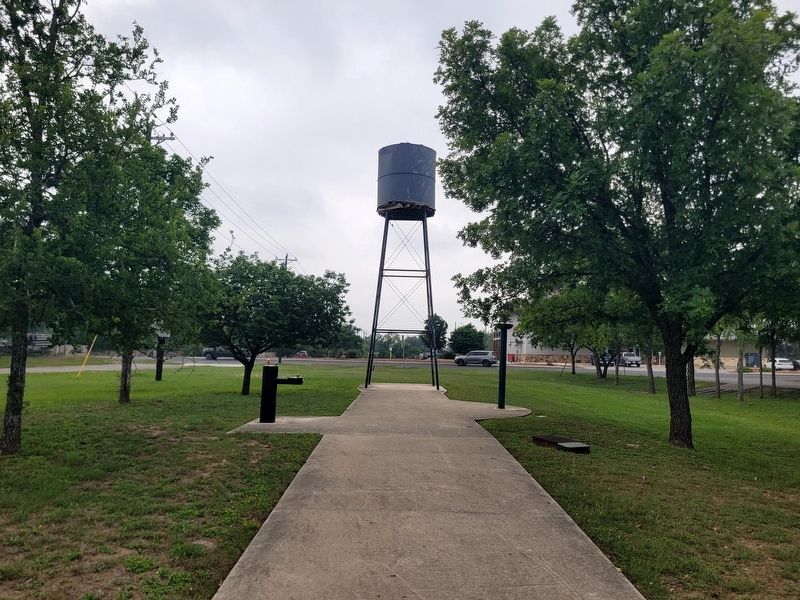
The water tower is located at the end of the greenway trail.
Credits. This page was last revised on April 29, 2026. It was originally submitted on April 28, 2026, by James Hulse of Medina, Texas. This page has been viewed 22 times since then. Photos: 1, 2, 3, 4. submitted on April 29, 2026, by James Hulse of Medina, Texas.
