Monterey in Monterey County, California — The American West (Pacific Coastal)
Monterey's Commercial Fishing Fleet
Photographed by Andrew Ruppenstein, March 22, 2010
1. Monterey's Commercial Fishing Fleet Marker
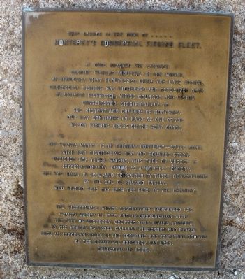
Monterey's Commerical Fishing Fleet.
It once boasted the largest sardine fishing industry in the world, an industry that flourished until the late 1940's. Commercial fishing was pioneered and developed here by the Sicilian fishermen, whose courage and vision contributed significantly to the history and culture of Monterey. Our Bay continues to rank as one of the major fishing areas on the West Coast.
The "Santa Maria" is an original Monterey-style boat, with her distinctive bow and rounded stern. Designed for these waters, this type of vessel is internationally known as a "double-ender". She was built in 1918 and skippered by three generations of the Sal Di Franco Family, who fished this Bay from the turn of the century.
The Fisherman's Wharf Association purchased the "Santa Maria" in 1975 and, in conjunction with the City of Monterey, created this living tribute to the memory of those gallant fishermen who played such an important role in the economic and spiritual growth of the beautiful Monterey Bay Area. Dedicated 1970.
Erected 1970.
Topics. This historical marker is listed
this page online
Location. 36° 36.067′ N, 121° 53.541′ W. Marker is in Monterey, California, in Monterey County. It is at the intersection of Del Monte Avenue and Washington Street, on the right when traveling west on Del Monte Avenue. Marker is located on the Monterey Peninsula Recreation Trail. Touch for map. Marker is in this post office area: Monterey CA 93940, United States of America. Touch for directions.

Regionally, this marker is on the Central Coast and specifically on the Coast Ranges. It is also on the American Pacific Coast. Globally, it is in North America, on the Ring of Fire, on the Pacific Rim, in the Western Hemisphere, in the Western World, and in the Anglosphere. Historically, it finds itself in what was once New Spain and also Mexico’s Alta California.
Other nearby markers. At least 8 other markers are within walking distance of this marker: Local Railway Led the Way to America's Salad Bowl. (about 300 feet away, measured in a direct line); Monterey's Historic Railway -- from Passengers to Industry (about
Photographed by Andrew Ruppenstein, March 22, 2010
2. Francesca Marker
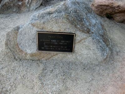
Also mounted on a low rock next to the ship, the Francesca Marker reads: "Francesca - A classic wood 1937 Monterey Style salmon troller. Donated August 1993 by the Ronald L. Aliotti Family."
More about this marker. The marker is located at the entrance to the municipal marina, where Del Monte Avenue splits off onto Lighthouse Avenue.
Photographed by Andrew Ruppenstein, March 22, 2010
3. The Francesca and the Monterey's Commericial Fishing Fleet Marker
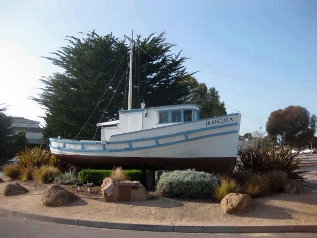
Here the Monterey's Commercial Fishing Fleet marker is visible, mounted on a low rock directly in front of the Francesca. Although the marker speaks of the ship Santa Maria, there is a small marker on the same rock just to the right of the main marker, reading "SANTA MARIA - retired August 1993", presumably indicating that the Santa Maria was removed in favor of the Francesca.
Credits. This page was last revised on April 28, 2021. It was originally submitted on April 17, 2010, by Andrew Ruppenstein of Lamorinda, California. This page has been viewed 2,886 times since then and 42 times this year. Photos: 1, 2, 3. submitted on April 17, 2010, by Andrew Ruppenstein of Lamorinda, California. • Syd Whittle was the editor who published this page.
