
Midtown - Downtown in Columbia in Richland County, South Carolina — The American South (South Atlantic)
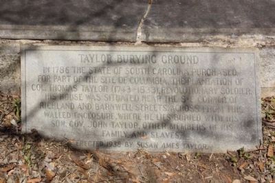
Taylor Burying Ground
Photographed by Mike Stroud, 2010
1. Taylor Burying Ground Marker
Thomas Taylor (1743-1833), was an officer in Sumter's brigade throughout the war. He took part in the battles of Hanging Rock, Black Storks, and Fort Granby. He was born in Amelia County, Va. ; died in Columbia, S. C.
Erected 1938 by Susan Ames Taylor.
Topics. This historical marker is listed in these topic lists: Cemeteries & Burial Sites • War, US Revolutionary. A significant historical year for this entry is 1786.
Location. 34° 0.825′ N, 81° 1.713′ W. Marker is in Columbia, South Carolina, in Richland County. It is in Midtown - Downtown. It is on Richland Street near Barnwell Street, on the right when traveling west. Touch for map. Marker is in this post office area: Columbia SC 29201, United States of America. Touch for directions.

Regionally, this marker is in the Midlands. It is also in the American South and specifically in the Deep South. Globally, it is in North America, the Western Hemisphere, the Western World, and the Anglosphere. Historically,
this page online
Other nearby markers. At least 8 other markers are within walking distance of this marker: Thomas Taylor / Taylor Cemetery (within shouting distance of this marker); 1900 Block of Henderson Street / William J. Sumter (about 600 feet away, measured in a direct line); Colonel Thomas Taylor (about 600 feet away); A Nurturing Nature (about 700 feet away); Seibels House (about 700 feet away); By Any Other Name Would Smell as Sweet (about 800 feet away); A Horticultural Heritage (about 800 feet away); Rooted in the Past, Enhancing the Future (about 800 feet away). Touch for a list and map of all markers in Columbia.
Regarding Taylor Burying Ground. Today, a commercial building sits on the southeast corner of Richland and Barnwell Streets, as mentioned.
Also see . . . John Taylor (May 4, 1770 – April 16, 1832) was the 51st Governor of South Carolina, Wikipedia . His term in office was primarily known for rallying the state to oppose
Photographed by Mike Stroud, February 28, 2010
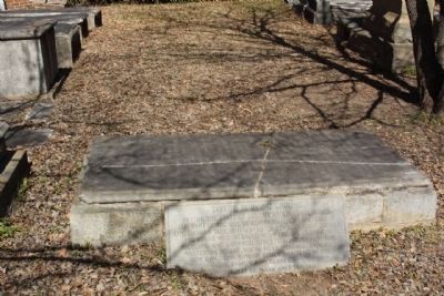
2. Taylor Burying Ground Marker
Photographed by Mike Stroud, February 28, 2010
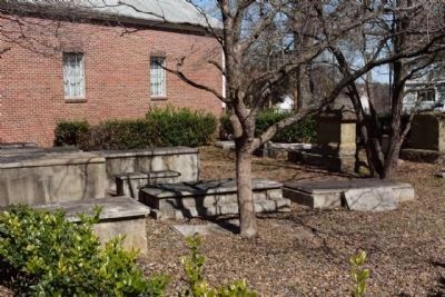
3. Taylor Burying Ground and Marker (at right)
Located on the east grounds of the Taylor Evangelical Methodist Church, in Columbia
Credits. This page was last revised on February 16, 2023. It was originally submitted on April 18, 2010, by Mike Stroud of Bluffton, South Carolina. This page has been viewed 1,940 times since then and 78 times this year. Photos: 1, 2, 3. submitted on April 18, 2010, by Mike Stroud of Bluffton, South Carolina.
