Near Wytheville in Wythe County, Virginia — The American South (Mid-Atlantic)
Battle of Wytheville
The First Skirmish
Photographed by Don Morfe, July 31, 2013
1. Battle of Wytheville Marker
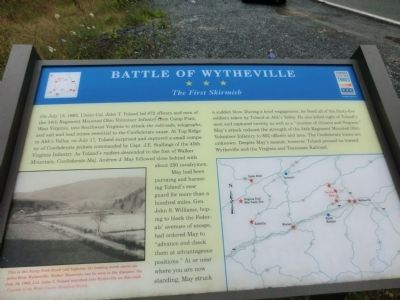
On July 13, 1863, Union Col. John T. Toland led 872 officers and men of the 34th Regiment Mounted Ohio Volunteer Infantry from Camp Piatt, West Virginia, into Southwest Virginia to attack the railroads, telegraphs, and salt and lead mines essential to the Confederate cause. At Tug Ridge in Abb’s Valley, on July 17, Toland surprised and captured a small company of Confederate pickets commanded by Capt. J.E. Stallings of the 45th Virginia Infantry. As Toland’s raiders descended to the foot of Walker Mountain, Confederate Maj. Andrew J. May followed close behind with about 250 cavalry men.
May had been pursuing and harassing Toland’s rear guard for more than a hundred miles. Gen. John S. Williams, hoping to block the Federals’ avenues of escape, had ordered May to “advance and check them at advantageous positions.” At or near where you are now standing May struck a sudden blow. During a brief engagement, he freed all of the thirty-five soldiers taken by Toland at Abb’s Valley. He also killed eight of Toland’s men and captured twenty, as well as a “number of citizens and Negroes.” May’s attack reduced the strength of the
this page online
(caption)
This is the Stony Fork Road (old highway 52) looking north about six miles from Wytheville. Walker Mountain can be seen in the distance. On July 18, 1863, Col. John T. Toland marched into Wytheville on this road. — Courtesy of the Wythe County Historical Society
Erected by Virginia Civil War Trails. (Marker Number 2.)
Topics and series. This historical marker is listed in this topic list: War, US Civil. In addition, it is included in the Virginia Civil War Trails series list. A significant historical month for this entry is July 1949.
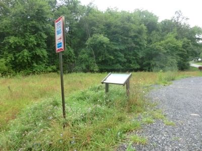
Location. This marker has been replaced by another marker nearby. It was located near 37° 0.612′ N, 81° 11.412′ W. Marker was near Wytheville, Virginia, in Wythe County. It was at the intersection of Stony Fork Road (U.S. 52) and Krenning Road (Virginia Route 717), on the right when traveling south on Stony Fork Road. Touch for map. Marker was at or near this postal address:
Photographed by Don Morfe, July 31, 2013
2. Battle of Wytheville Marker

Regionally, this marker was in Southwest Virginia and in the Blue Ridge Highlands. It was also in the American South, specifically in the Upper South, in Appalachia, and specifically in Southern Appalachia. Globally, it was in North America, the Western Hemisphere, the Western World, and the Anglosphere. Historically, it found itself in what was once the territory of the Mississippian Culture, one of the original Thirteen Colonies, one of the Confederate States of America, and the Antebellum South.
Other nearby markers. At least 8 other markers are within 6 miles of this location, measured as the crow flies: A different marker also named Battle of Wytheville (here, next to this marker); Homesteader's Legacy (approx. 2.6 miles away); One of the “Big Four” (approx. 2.8 miles away); a different marker also named Battle of Wytheville (approx. 3.1 miles away); Toland’s Raid (approx. 3.2 miles away); Wythe County / Bland County (approx. 3.2 miles away); a different marker also named Battle of Wytheville (approx. 3.2 miles away); George Daniel Flohr (approx. 5.9 miles away). Touch for a list and map of all markers in Wytheville.
Other markers no longer nearby. One of the "Big Four" (was approx. 2.8 miles away but has been replaced with another marker now near it); a different marker also named Battle of Wytheville (was approx. 3.1 miles away but has been replaced with another marker now near it); a different marker also named Battle of Wytheville (was approx. 3.2 miles away but has been replaced with another marker now near it).
Credits. This page was last revised on July 6, 2026. It was originally submitted on August 5, 2013, by Don Morfe of Baltimore, Maryland. This page has been viewed 1,412 times since then and 64 times this year. Last updated on April 30, 2026, by Jacob Gutman of Philadelphia, Pennsylvania. Photos: 1, 2. submitted on August 5, 2013, by Don Morfe of Baltimore, Maryland. • Devry Becker Jones was the editor who published this page.
