
Trade in Johnson County, Tennessee — The American South (East South Central)
Daniel Boone's Trail
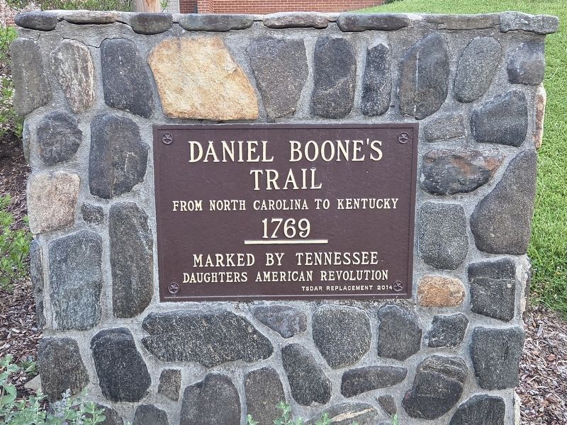
Photographed by Mark Parker, April 28, 2026
1. Daniel Boone's Trail Marker
From North Carolina to Kentucky
1769
Erected 2014 by Tennessee Society Daughters of the American Revolution.
Topics and series. This historical marker is listed in these topic lists: Colonial Era • Exploration • Settlements & Settlers. In addition, it is included in the Daughters of the American Revolution (DAR) series list. A significant historical year for this entry is 1769.
Location. 36° 20.847′ N, 81° 44.471′ W. Marker is in Trade, Tennessee, in Johnson County. It can be reached from Modock Road 0.1 miles east of U.S. 421, on the right when traveling east. Location of the marker is to the right of the front steps to Trade Elementary School. Touch for map. Marker is at or near this postal address: 228 Modock Rd, Trade TN 37691, United States of America. Touch for directions.

Regionally, this marker is in East Tennessee. It is also in the American South, specifically in the Upper South, in Appalachia, and specifically in Southern Appalachia. Globally, it is in North America, the Western Hemisphere, the Western World, and the Anglosphere. Historically, it finds itself
this page online
Other nearby markers. At least 8 other markers are within 9 miles of this marker, measured as the crow flies: Indigenous People (here, next to this marker); The Trading Ground (approx. 0.2 miles away); Camp Mast (approx. 6.3 miles away in North Carolina); Cove Creek High School (approx. 6.3 miles away in North Carolina); Military Veterans of Western Watauga County (approx. 6.3 miles away in North Carolina); Maymead Stock Farm (approx. 7 miles away); John Smith Miller House (approx. 7.1 miles away in North Carolina); Elkland Depot (approx. 8.4 miles away in North Carolina). Touch for a list and map of all markers in Trade.

Photographed by Mark Parker, April 28, 2026
2. Daniel Boone's Trail Marker at the steps to Trade Elementary School

Photographed by Mark Parker, April 28, 2026
3. Full view of Trade Elementary School. Marker is to the right of the steps
Credits. This page was last revised on May 6, 2026. It was originally submitted on April 30, 2026, by Mark Parker of Hickory, North Carolina. This page has been viewed 15 times since then. Photos: 1, 2, 3. submitted on April 30, 2026, by Mark Parker of Hickory, North Carolina. • James Hulse was the editor who published this page.
