
Near Little Gold in Unorganized Yukon, Yukon — The Northern Territories (North America)
Top of the World Highway
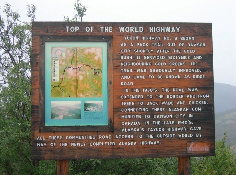
Photographed by Jimmy Emerson, July 2012
1. Top of the World Highway Marker
In the 1930s, the road was extended to the border and from there to Jack Wade and Chicken, connecting these Alaskan communities to Dawson City in Canada. In the late 1940s Alaska's Taylor Highway gave all these communities road access to the outside world by way of the newly completed Alaska Highway.
Inset: Above- Road construction about 1935. At that time Yukon's Highway 9 was called Ridge Road since it followed mountaintop ridges rather than river valleys.
Left - the remote and austere landscape the road traversed between Dawson City and the Alaska border gave rise to the moniker "Top of the World Highway" in the 1970s. Today, the entire route to Tetlin Junction in Alaska is often referred to as the Top of the World Route.
Topics. This historical marker is listed in this topic list: Roads & Vehicles. A significant historical year for this entry is 1930.
Location. 64° 5.136′ N, 140° 59.984′ W. Marker is near
this page online

Regionally, this marker is in the Canadian North. Globally, it is in North America, on the Ring of Fire, in the Arctic, in the Western Hemisphere, and in the Western World. Historically, it finds itself in what was once a British colony.
Credits. This page was last revised on May 28, 2026. It was originally submitted on April 30, 2026, by Jimmy Emerson of Dalton, Georgia. This page has been viewed 15 times since then. Photo 1. submitted on April 30, 2026, by Jimmy Emerson of Dalton, Georgia. • Andrew Ruppenstein was the editor who published this page.
