Scituate in Plymouth County, Massachusetts — The American Northeast (New England)
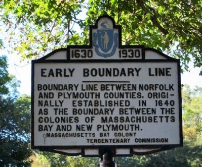
Early Boundary Line
1630 - 1930
Photographed by Russell C. Bixby, September 9, 2011
1. Early Boundary Line Marker
Erected 1930 by Massachusetts Bay Colony-Tercentenary Commission.
Topics and series. This historical marker is listed in these topic lists: Colonial Era • Political Subdivisions. In addition, it is included in the Massachusetts Bay Colony—Tercentenary Commission Markers series list. A significant historical year for this entry is 1640.
Location. 42° 13.365′ N, 70° 47.351′ W. Marker is in Scituate, Massachusetts, in Plymouth County. It is on Country Way 0.1 miles south of Mordecal Lincoln Road, on the left when traveling north. Touch for map. Marker is in this post office area: Scituate MA 02066, United States of America. Touch for directions.

Regionally, this marker is on the South Shore. It is also in the American Northeast, in New England, and on the Eastern Seaboard. Globally, it is in the North Atlantic Region, North America, the Western Hemisphere, the Western World, and the Anglosphere. Historically, it finds itself in what was once
this page online
Other nearby markers. At least 8 other markers are within 4 miles of this marker, measured as the crow flies: Mordecai Lincoln Mill and Homestead (about 300 feet away, measured in a direct line); Mordecai Lincoln Homestead (about 600 feet away); Gannett’s Corner (approx. 0.3 miles away); Minot's Ledge Lighthouse (approx. 1.1 miles away); Antoine and Wilson Memorial (approx. 1.1 miles away); Lawson Tower (approx. 2.3 miles away); Cudworth House (approx. 2.4 miles away); Williams-Barker House (approx. 3½ miles away). Touch for a list and map of all markers in Scituate.
Regarding Early Boundary Line. This marker is near the easternmost end of the border laid out by early colonists between Massachusetts Bay and Plymouth Colony in the 17th Century. A stone marker column at Boundary Pond in Wompatuck State Park and remnants of a stone wall laid by early settlers also remain within Wompatuck State Park. The line runs virtually straight through to the intersection of Routes 228 and 53 on the Hingham/Norwell border. Angles, slightly in the middle of nearby Accord Pond, and then runs virtually straight
Photographed by Russell C. Bixby, September 9, 2011
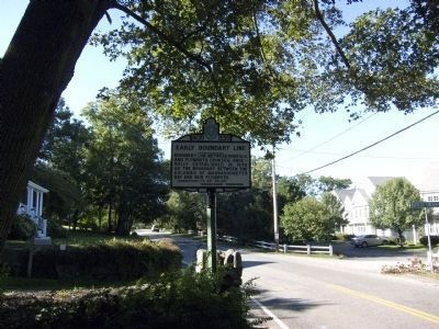
2. South Main Street at Mordecal Lincoln Road
Related marker. Click here for another marker that is related to this marker. To better understand the relationship, study each marker in the order shown.
Also see . . .
1. Historical Markers Erected by Massachusetts Bay Colony Tercentenary Commission (1930). Original 1930 publication by the Commonwealth of Massachusetts of Tercentenary Commission Markers, commemorating the three hundredth anniversary of the Massachusetts Bay Colony. (Submitted on September 10, 2011, by Russell Chaffee Bixby of Bernardston, Massachusetts.)
2. Friends of Wompatuck Map - Boundary Pond and Old Colony Line. To visit a section of the Old Colony Line in Wompatuck State Park, access this map link from a phone and select the "points of interest" option from the menu. A point of interest marker with a description near trail marker S10 will appear on your screen. A visit requires a hike. Without a significant hike, a visitor can park at Boundary Pond and walk back towards
Photographed by G.W.Bartlett, March 27, 2026
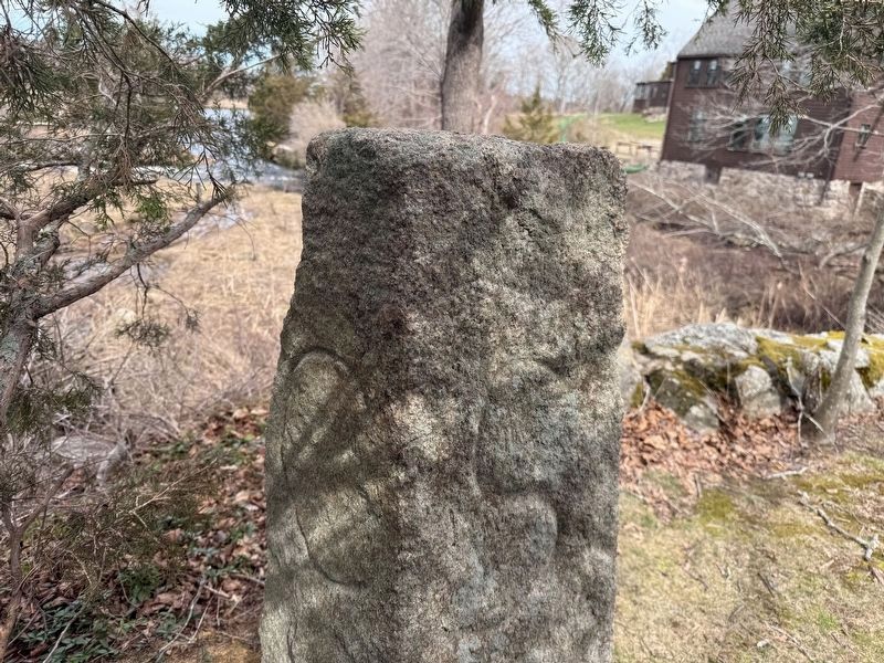
3. Ancient Cohasset Scituate Border Marker
A pre-revolutionary pillar used to mark the Cohasset Scituate border is also across the street on Mordecai Lincoln Road on the other side of the bridge over the Bound Brook.
"Old Colony Line - The Patten Line, now known as The Old Colony Line, is a stone wall that runs from Hunters Pond in Scituate to the Rhode Island border in a perfectly straight line. It was built in 1640 to separate the pilgrim colony from the puritan colony. In Wompatuck, the wall was fragmented when the area was developed into The Hingham Naval Ammunition Depot Annex. Today, the wall separates Hingham and Cohasset from Nowell and Scituate."(Submitted on May 1, 2026, by G.W.Bartlett of Hingham, Massachusetts.)
Credits. This page was last revised on May 4, 2026. It was originally submitted on September 10, 2011, by Russell Chaffee Bixby of Bernardston, Massachusetts. This page has been viewed 1,875 times since then and 543 times this year. Last updated on May 1, 2026, by G.W.Bartlett of Hingham, Massachusetts. Photos: 1, 2. submitted on September 10, 2011, by Russell Chaffee Bixby of Bernardston, Massachusetts. 3. submitted on March 27, 2026, by G.W.Bartlett of Hingham, Massachusetts. • Devry Becker Jones was the editor who published this page.
