Staunton, Virginia — The American South (Mid-Atlantic)
Appalachian Virginia, 1850s
Antebellum United States
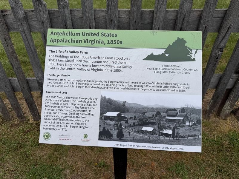
The Life of a Valley Farm
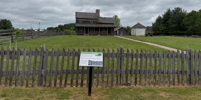
The buildings of the 1850s stood on a single farmstead until the museum acquired them in 1986. Here they show how a lower middle-class family lived in the central Valley of Virginia in the 1850s.
The Barger Family
Like many other German-speaking immigrants, the Barger family had moved to western Virginia from Pennsylvania in the 1790s. In 1832, Barger Barger III purchased two adjoining tracts of land totaling 187 acres near Little Patterson Creek for $350. Anna and John Barger, their daughter, and two sons lived there until the property was foreclosed in 1869.
Success and Loss.
The 1860 Census shows the farm producing 237 bushels of wheat, 350 bushels of corn, 220 bushels of oats, 100 pounds of flax, and 1000 pounds of tobacco. The family owned 6 horses, 7 milk cows, 2 other cattle, 30 sheep, and 71 hogs. Distilling and milling activities also occurred on the farm. Financial difficulties, likely due to the impact of the Civil War on Virginia's economy, led to John Barger filing for bankruptcy in 1870.
[Caption:]
Farm location: Near Eagle Rock in Botetourt County, VA, along Little Patterson Creek.
Erected by Frontier
this page online
Topics. This historical marker is listed in these topic lists: Agriculture • Settlements & Settlers. A significant historical year for this entry is 1986.
Location. 38° 7.632′ N, 79° 2.665′ W. Marker is in Staunton, Virginia. It can be reached from Frontier Drive north of Barterbrook Road, on the right when traveling north. Touch for map. Marker is at or near this postal address: 1274 Richmond Rd, Staunton VA 24401, United States of America. Touch for directions.

Regionally, this marker is in the Shenandoah Valley. It is also in the American South and specifically in the Upper South. Globally, it is in North America, the Western Hemisphere, the Western World, and the Anglosphere. Historically, it finds itself in what was once the territory of the Mississippian Culture, one of the original Thirteen Colonies, one of the Confederate States of America, and the Antebellum South.
Other nearby markers. At least 8 other markers are within walking distance of this marker: Valley of Virginia, 1850s (here, next to this marker); Schoolhouse, 1840s
Credits. This page was last revised on May 1, 2026. It was originally submitted on May 1, 2026, by Devry Becker Jones of Washington, District of Columbia. This page has been viewed 18 times since then. Photos: 1, 2. submitted on May 1, 2026, by Devry Becker Jones of Washington, District of Columbia.
