Staunton, Virginia — The American South (Mid-Atlantic)
Appalachian Virginia, 1850s
Antebellum United States
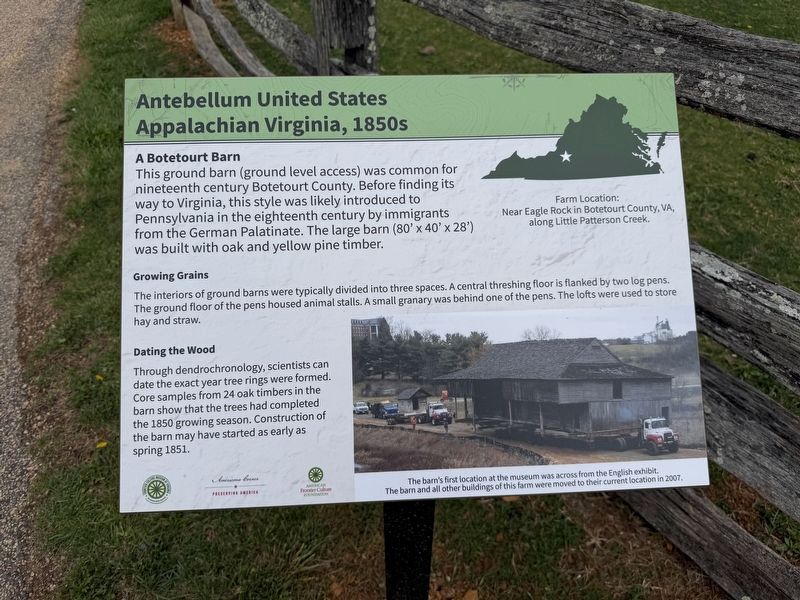
A Botetourt Barn
This ground barn (ground level access) was common for nineteenth century Botetourt County. Before finding its way to Virginia, this style was likely introduced to Pennsylvania in the eighteenth century by immigrants from the German Palatinate. The large barn (80' x 40' x 28') was built with oak and yellow pine timber.
Growing Grains
The interiors of ground barns were typically divided into three spaces. A central threshing floor is flanked by two log pens. The ground floor of the pens housed animal stalls. A small granary was behind one of the pens. The lofts were used to store hay and straw.
Dating the Wood
Through dendrochronology, scientists can date the exact year tree rings were formed. Core samples from 24 oak timbers in the barn show that the trees had completed the 1850 growing season. Construction of the barn may have started as early as spring 1851.
[Captions:]
Farm Location: Near Eagle Rock in Botetourt County, VA, along Little Patterson Creek.
The barn's first location at the museum was across from the English exhibit. The barn and all other buildings of this farm were moved to their current location in 2007.
Erected by Frontier
this page online
Topics. This historical marker is listed in these topic lists: Architecture • Immigration. A significant historical year for this entry is 1850.
Location. 38° 7.643′ N, 79° 2.655′ W. Marker is in Staunton, Virginia. It can be reached from Frontier Drive north of Barterbrook Road, on the right when traveling north. Touch for map. Marker is at or near this postal address: 1274 Richmond Rd, Staunton VA 24401, United States of America. Touch for directions.

Regionally, this marker is in Virginia’s Shenandoah Valley. It is also in the American South and specifically in the Upper South. Globally, it is in North America, the Western Hemisphere, the Western World, and the Anglosphere. Historically, it finds itself in what was once the territory of the Mississippian Culture, one of the original Thirteen Colonies, one of the Confederate States of America, and the Antebellum South.
Other nearby markers. At least 8 other markers are within walking distance of this marker: A different marker also named Appalachian Virginia, 1850s (within

Credits. This page was last revised on May 4, 2026. It was originally submitted on May 2, 2026, by Devry Becker Jones of Washington, District of Columbia. This page has been viewed 17 times since then. Photos: 1, 2. submitted on May 2, 2026, by Devry Becker Jones of Washington, District of Columbia.
