Kirkwood in St. Louis County, Missouri — The American Midwest (Upper Plains)
The Meramec Highlands Quarry at Dee Koestering Park

Photographed by Jason Voigt, May 1, 2026
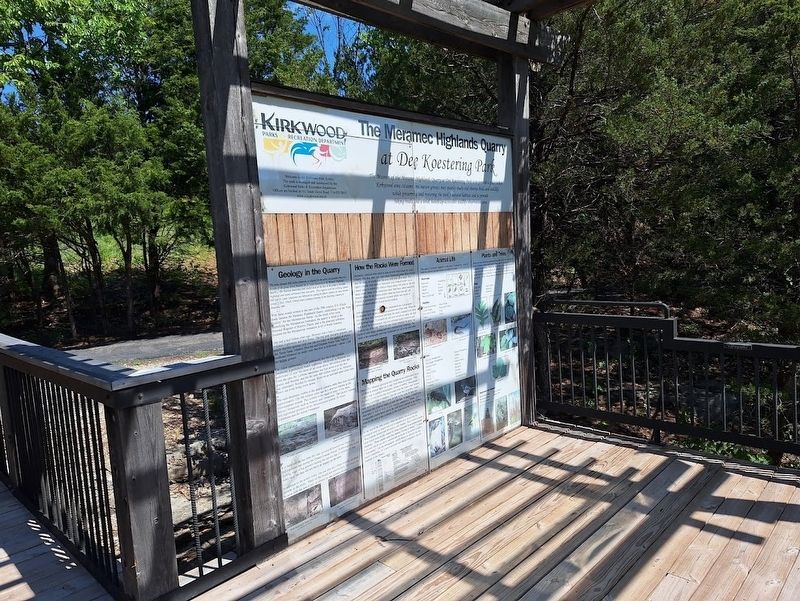
1. The Meramec Highlands Quarry at Dee Koestering Park Marker
left panel
(left panel:)
History of the Quarry
Meramec Highlands Quarry in Dee Koestering Park served as a cornerstone of the Meramec Highlands Resort development, established circa 1890. The quarry may have started as a "local diggings" prior to its development as a commercial joint venture of the Sunset Hill Electric, Light and Power Company and the Meramec Highlands Company. By 1891, the quarry was in full operation, and became wholly owned by the Meramec Highlands Company by 1895.
The quarry provided a unique building stone ("Meramec Blue Stone") for the Meramec Highland Inn, the Meramec Station railway depot, the local school and store, as well as foundations and decorative stone for resort buildings and cottages. It likely provided some crushed stone for roads and roadbed stone for the nearby St. Louis and San Francisco Railway.
While in full operation during the construction of the Highlands, the quarry featured mechanical channelers, steam drills, gangsaws, and a crushing mill plant. Stone quarried from the wall as large blocks was carried 1,000 feet to the mill via pulley driven cable. A quarter mile railway spur
this page online
As a wholly owned subsidiary of the Meramec Highlands Company, quarry fortunes rose and fell with that venture. When visited in 1902 by the Missouri Bureau of Geology and Mines, the quarry was deemed "one of the best equipped" but also had been abandoned for "a number of years." Some sources claim that the quarry was re-opened in 1903 to provide stone for St. Louis World's Fair buildings and other structures in Forest Park; however, no buildings are believed in existence today in Forest Park that were built with stone from the quarry. The site was abandoned as a quarry operation in 1905.
Today, several hundred tons of quarried stone remain scattered in the quarry, including a number of large stones, which are stacked at the site. Stone slabs show drill holes (1 1/2 inches to 2 inches in diameter) and one massive
Photographed by Jason Voigt, May 1, 2026
2. The Meramec Highlands Quarry at Dee Koestering Park Marker
right panel
History of the Highlands
The Meramec Highlands was the dream of a St. Louis businessman, Marcus Bernheimer. Bernheimer's vision was to create a summer resort along the Meramec River. In 1891, it appears the construction of the Highlands Inn and the train station neared completion. By 1893, Bernheimer had acquired nearly 350 acres of what would become a 438-acre complex.
By 1895, advertising for the project promoted the Meramec Highlands Railroad Station, the 125-room Highland Inn, a park area, sidewalks, pressurized water mains, 15 cottages, the Sunset Hill Pagoda dance hall, mineral spring bath-houses, steam laundry, livery stable, dormitories and two five-room cottages on Sunset Hill. Other amenities included an electric light plant, a general merchandise store, the steam yacht "Columbia," a conservatory and hot house, a dairy, 50 rowboats and a stone boat house, a large ice house, company stables and at least 15 housing units for area workers and laborers. Although the
Photographed by Jason Voigt, May 1, 2026
3. The Meramec Highlands Quarry at Dee Koestering Park Marker
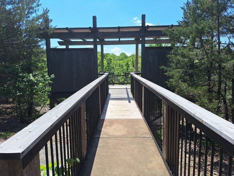
both panels are on an overlook platform
Since its closure as an active quarry, the quarry itself has remained a popular recreational site, both before and after the Highlands era. Many Kirkwoodians relate stories of picnics and other adventures in the quarry area in years past. The City of Kirkwood purchased the site from Dee and Ernie Koestering in 2001, with a portion of the cost paid for by the Land and Water Conservation Fund. The park was opened to the public, and dedicated to the people of Kirkwood, in 2003. A special thanks is extended to the Kirkwood Rotary Club for designing and building this scenic overlook and interpretive display area.
(right panel:)
Geology in the Quarry
"The name Spergen Hill (Salem) limestone is adopted for the oolitic and granular limestone division of the group shown beneath the St. Louis limestone at the Meramec Highlands Quarry…The Warsaw limestones (and shales) occur at the base of the group at Meramec Highlands and extend northward from that point. This, together with the overlying Spergen Hill and St. Louis Limestones are embraced in a group for which I propose the name Meramec Group." --E.O. Ulrich, United States Geological Survey, in the Quarrying Industry in Missouri, 1904
With these words written at the turn of the 20th century, E.O. Ulrich made famous the Meramec Highlands Quarry, establishing it as the "type locality" for the Meramecian Series. As the result of his work identifying the Meramecian formation, the quarry is listed in the National Register of Historic Places, and is the principal reference location for the Meramecian formation in all of North America.
One and a half billion years ago, Missouri was a land of volcanoes, volcanic explosions and lava flows. The red, pink and gray granites, and purple rhyolite igneous rock you can see today on the surface at places like Taum Sauk, Johnson Shut-Ins and Elephant Rocks State Parks in Southeast Missouri lie under your feet here in Kirkwood -- about 1,500 feet below ground.
The oldest sedimentary rock underneath this site is the LaMotte Sandstone, a prehistoric beach sandstone, which tells us Missouri was underwater or near the shore of an ocean about 500 million years ago. From the time the LaMotte sandstone was laid down over the first granite and rhyolite, and for the next 400 million years or so, Missouri was alternately flooded by oceans, dried out as land and spent some time above sea level being worn down.
The rock structures visible in the quarry contains rocks that were formed approximately 320-360 million years ago in a structure known as the Mississippian system. This system is the equal of some of the more famous formations such as Jurassic and Cretaceous. The Quarry exposes two significant portions of the Mississippian system: St. Louis Limestone and the Salem Formation.
It is believed the last time the seas covered Kirkwood was about 300 million years ago during the Pennsylvanian Period. Kirkwood was at the leading edge of big glaciers during the last Ice Age (2 million - 20,000 years ago) but they did not have an impact on the area.
In addition to the actual rocks, you can also see a large number of fossil records in the rocks. Many of the fossils are microscopic, but some can be seen with the naked eye, as shown by the pictures below.
How the Rocks Were Formed
Sediments collected when shallow seas covered what is now St. Louis County. The thin, dark, silty rock (shaly limestone) most likely formed near the shore, in muddy tidal flat areas with little to no sand. The lighter colored, more massive limestones were formed further out in cleaner areas of oceanically shallow (likely about 100 meter or 300 feet deep) water. Some of the limestones show faint lines called crossbeds, formed where the sea bottom shifted when the stone was still soft. Fossils of prehistoric sea creatures occurred where new layers of sediment catastrophically buried the old seafloor.
Sediment layers, once (unreadable) compressed into rock as great thicknesses built up and water was squeezed out of the rock. When the sea over these rock formations retreated, the newly exposed rock dried, and layering began. Eventually the sea level would rise again, the land rock would be re-submerged, and new sediment layers would be laid down on top of the old. When the seas finally retreated for good, top layers of rock began eroding and were removed over millennia. The result is the topography and rock formations you see in the park today.
Mapping the Quarry Rocks
Since 1853, Missouri geologists have looked at our sedimentary rocks, and tried to arrange them into a map, from oldest to youngest. This vertical map is called a stratigraphic column or profile. Stratigraphy is the study of rock layers (the word comes from the Latin word "stratus," meaning a covering or blanket). Just like your face in profile, Quarry rock layers can jut our like a nose, or sink in like eyes, be hard and prominent like eyebrow ridges, or soft, like lips. A quarry or bluff is an ideal place to look at rocks in their original, undisturbed layers. The stratigraphic profile below shows the rock layers exposed in the Quarry from the top area at this overlook, to the creek bed at the bottom of the hill.
At the turn of the 20th century, when the Quarry was in its heyday, geologists were no longer satisfied to separate rock layers like the Mississippian System into 40 million year chunks. They wanted smaller units which were locally related by being deposited in an uninterrupted sequence. These smaller units they labeled "Group or Series." A single rock unit which can show variation but no break in deposition is call a "Formation." Use the stratigraphic profile below to identify the two major formations, St. Louis Limestone and Salem Limestone, that are exposed in the Quarry.
Animal Life
The quarry's ecosystem supports a wide range of animal life. Look for both the animals and their tracks throughout the park
Mammals:
Opossum · Squirrel · Skunk · Raccoon · Deer (white-tail) · Groundhog · Fox · Coyote · Rabbit · Bat
Reptiles:
Copperhead Snake · Garter Snake · Blue-tailed Skink · Toad · Salamander · Black Snake · Rink-neck Snake · Frog · Turtle
Birds:
Pileated Woodpecker · Red-headed Woodpecker · Red-tail Hawk · Junco · House Finch · Dove · Robin · Migratory Geese · Cardinal · Owl · Downy Woodpecker · Turkey · Crow · Yellow Finch · Blue Jay · Bluebird · Grackle · Sparrow · Hummingbird
Plants and Trees
Plants and trees within the park can be associated with two biomes: the Ozark Highland climax oak-hickory forest and the Mississippi Floodplain forest biome. While the oak-hickory forest is predominant, the area also has limestone glades, dry hilltops, dry and wet sink-holes, wooded ponds, shaded hillsides, ravines, creek beds, forest thickets and open glades. While walking through the quarry, look for the following:
Trees:
White Oak · Redbud · Hickory · Sycamore · Sugar Maple · Dogwood · Hackberry
Vegetation and Grasses:
Woodland Cedar · Bluestem Grass · Sideoats Grama · Native Grasses · Indian Grass
Erected by Kirkwood Parks & Recreation Department.
Topics. This historical marker is listed in these topic lists: Animals • Industry & Commerce • Parks & Recreational Areas. A significant historical year for this entry is 1890.
Location. 38° 33.977′ N, 90° 26.359′ W. Marker is in Kirkwood, Missouri, in St. Louis County. It can be reached from Marshall Road. Marker(s) are accessible at a lookout, which is located off a walking path. (see below). Touch for map. Marker is at or near this postal address: 1703 Marshall Rd, Saint Louis MO 63122, United States of America. Touch for directions.

Regionally, this marker is in Greater St. Louis. It is also in the American Midwest, in the Lewis & Clark Corridor, in the Corn Belt, and in the Great River Road Region. Globally, it is in North America, the Western Hemisphere, the Western World, and the Anglosphere. Historically, it finds itself in what was once the Viceroyalty of New France, the territory of the Mississippian Culture, the Louisiana Purchase, and the Antebellum South.
Other nearby markers. At least 8 other markers are within 2 miles of this marker, measured as the crow flies: Veteran's Memorial (approx. 0.3 miles away); Historic Quinette Cemetery (approx. 0.3 miles away); Quinette Cemetery (approx. 0.3 miles away); Greentree Park and Meramec Greenway (approx. half a mile away); Meramec River Greenway - Unger Park (approx. one mile away); Missouri Pacific #750 (approx. 1.2 miles away); "Charles H." - Lake Street Elevated #9 (approx. 1.2 miles away); Illinois Central #30 (approx. 1.2 miles away). Touch for a list and map of all markers in Kirkwood.
Regarding The Meramec Highlands Quarry at Dee Koestering Park. To access the marker:
Park at the lot off Marshall Road. Walk on the trail for 0.8 miles, following the signs to the overlook. Please note that this is a very steep trail and is not recommended for some people. No dogs, bicycles, scooters or anything motorized is allowed on the trail.
Credits. This page was last revised on May 3, 2026. It was originally submitted on May 2, 2026, by Jason Voigt of Glen Carbon, Illinois. This page has been viewed 48 times since then. Photos: 1. submitted on May 2, 2026, by Jason Voigt of Glen Carbon, Illinois. 2, 3. submitted on May 3, 2026, by Jason Voigt of Glen Carbon, Illinois.
