
Arkansas City in Desha County, Arkansas — The American South (West South Central)
Arkansas City River Port
1873-1927
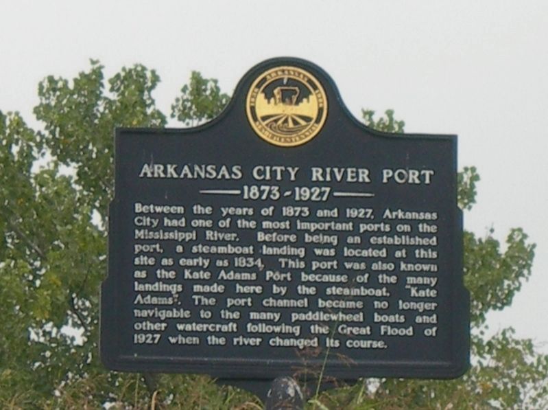
Photographed by Jimmy Emerson, 2008
1. Arkansas City River Port Marker
Erected 1986 by Arkansas Sesquicentennial Commission.
Topics. This historical marker is listed in this topic list: Waterways & Vessels. A significant historical year for this entry is 1893.
Location. 33° 36.295′ N, 91° 12.238′ W. Marker is in Arkansas City, Arkansas, in Desha County. It is at the intersection of Desoto Avenue and Sprague Street, on the right when traveling east on Desoto Avenue. Touch for map. Marker is at or near this postal address: 101 Sprague Street, Arkansas City AR 71630, United States of America. Touch for directions.

Regionally, this marker is in the Arkansas Delta, in the Mississippi Alluvial Plain,
this page online
Other nearby markers. At least 8 other markers are within 9 miles of this marker, measured as the crow flies: Arkansas City Commercial Historic District (within shouting distance of this marker); Desha County (about 800 feet away, measured in a direct line); The X. O. Pindall Law Office (about 800 feet away); Flood of 1927 (approx. 0.2 miles away); a different marker also named Desha County (approx. 0.3 miles away); John H. Johnson Cultural & Educational Museum (approx. 0.4 miles away); Mississippi River Blues: The 1927 Flood (approx. 7.4 miles away in Mississippi); William Fisher Johnson (approx. 8.4 miles away in
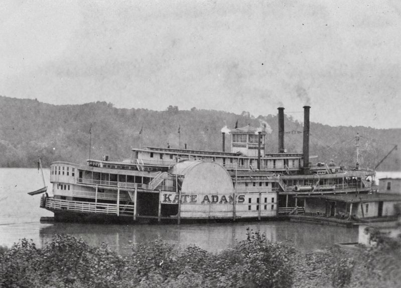
courtesy University of Wisconsin-LaCrosse Historic Steamboat Photographs Collection, circa 1896
2. Kate Adams (Packet, 1888-1898)
UW-Lacrosse Library notes: “ Original price $48,000, home port or owner's residence circa 1889 was Memphis, Tennessee; ran Memphis, Tennessee-Arkansas City, Arkansas trade; sold September 1898 and renamed Dewey”
Another marker is no longer nearby. The Great Flood of 1927 (was approx. 7.6 miles away in Mississippi but has been confirmed missing).
More about this marker. Located on the levee near the post office
Also see . . . Arkansas City (Desha County) (Encyclopedia of Arkansas). Excerpt:
Arkansas City continued to grow during the first years of the twentieth century. The three oldest structures from this time period were listed on the National Register of Historic Places as the Arkansas City Commercial District. Because of the town’s proximity to the river, it was vulnerable to flooding. The river flooded the town several times, and the Flood of 1927 devastated the town. More than 2,000 people had to be rescued. The floodwaters were up to the second floor of some homes, and the citizens of the area camped in tents on top of the levee. When the flood waters receded, the river channel, which was just across the levee, had moved about a mile to the east. This brought an end to the port at Arkansas City and made the railroads useless. The town never(Submitted on May 3, 2026.)fully recovered from this tragedy.Photographed by Jimmy Emerson, May 13, 20263. Arkansas City River Port Marker is on the river levee

Credits. This page was last revised on May 14, 2026. It was originally submitted on May 2, 2026, by Jimmy Emerson of Dalton, Georgia. This page has been viewed 22 times since then. Photos: 1. submitted on May 2, 2026, by Jimmy Emerson of Dalton, Georgia. 2. submitted on May 3, 2026. 3. submitted on May 13, 2026, by Jimmy Emerson of Dalton, Georgia. • Andrew Ruppenstein was the editor who published this page.
