Ashland Township in Saunders County, Nebraska — The American Midwest (Upper Plains)
The Mormon Pioneer Trail
A Fork In The Road
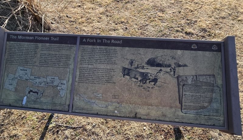
Photographed by Susan Van Den Bosch, February 18, 2026
1. The Mormon Pioneer Trail Marker
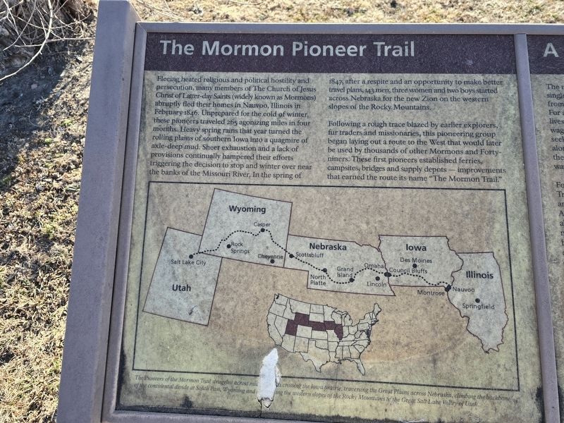
The Mormon Pioneer Trail
Fleeing heated religious and political hostility and persecution, many members of The Church of Jesus Christ of Latter-day Saints (widely known as Mormons) abruptly fled their homes in Nauvoo, Illinois in February 1846. Unprepared for the cold of winter there pioneers traveled 265 agonizing miles in four months. Heavy spring rains that year turned the rolling plains of southern Iowa into a quagmire of axle-deep mud. Sheer exhaustion and a lack of provisions continually hampered their efforts triggering the decision to stop and winter over near the banks of the Missouri River. In the spring of 1847, after a respite and an opportunity to make better travel plans, 143 men, three women and two boys started across Nebraska or the new Zion on the western slopes of the Rocky Mountain.
Following a rough trace blazed by earlier explorer, fur trader and missionaries, this pioneering group began laying out a route to the West that would later be used by thousands of other Mormons and Forty-niners. These pioneers established ferries, campsites, bridges and supply depots – improvements that earned the route
this page online
A Fork in the Road
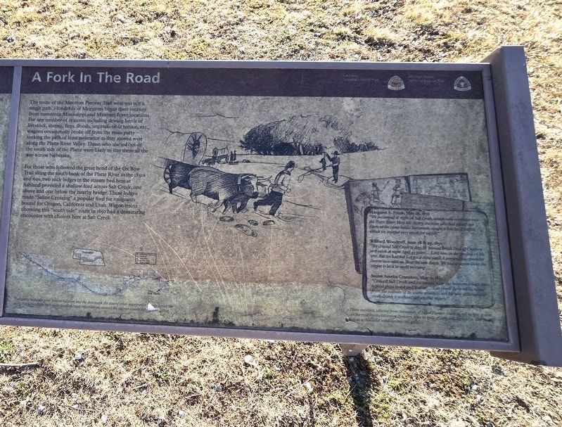
The route of the Mormon Pioneer Trail west as not a single path. Hundreds of Mormons began their journey from numerous Mississippi and Missouri River locations. For any number of reasons; including driving herds of livestock, storms, fires, floods, unpredictable terrain, etc., wagons occasionally broke off from the main party – seeking the path of least resistance as they moved west along the Platte River Valley. Those who started out on the south side of the Platte were likely to stay there all the way across Nebraska.
For those who followed the great bend of the Ox Box Trail along the south bank of the Platte River in the 1850s and 60s, two rock ledges in the stream bed here at Ashland provided a shallow ford across Salt Creek, one above and one below the nearby bridge. The ledges made “Saline Crossing” a popular ford for emigrants bound for Oregon, California and Utah. Wagon Trains choosing this “south side” route in 1850 had a devastating encounter with cholera here at Salt Creek.
Margare A. Frink, May 16, 1850
“We encamped at night on Salt Creek, which runs northeast intothe Platte River. Here Mr. Avery, the man who had joined our party at the camp below Savannah, caught a fine lot of catfish, which we enjoyed very much for supper.”Photographed by Susan Van Den Bosch, February 18, 20262. The Mormon Pioneer Trail
Wilford Woodruff, June 28 & 29, 1850
“We crossed Salt Creek today. Br Samuel Smith Died of Cholera at 8 o'clock at night Aged 43 years…Laid him on the ground in his tent. But we had but just got it done until A tremendous thunder Storm over took us. Blew the tent down. We had to cover over the corpse & let it lie until morning…”
Susan Almelia Cranston, May 11, 1851 “Crossed Salt Creek and encamped near the bottom where there is good grass wood and water… Salte creek derived is name from the saltness of the water which is not for use although our stock drank it without perceptible injury.”
These excerpts taken from thousands of pioneer journals
Topics. This historical marker is listed in these topic lists: Religion & Religious Structures • Roads & Vehicles. A significant historical year for this entry is 1846.
Location. 41° 2.327′ N, 96° 21.964′ W. Marker is in Ashland, Nebraska, in Saunders County. It is in Ashland Township. It is on Silver Street, on the right
Photographed by Susan Van Den Bosch, February 18, 2026
3. A Fork In The Road Marker

Regionally, this marker is in Eastern Nebraska and in Greater Lincoln. It is also in the American Midwest, in the Corn Belt, and on the prairies. Globally, it is in North America, the Western Hemisphere, the Western World, and the Anglosphere. Historically, it finds itself in what was once the Louisiana Purchase.
Other nearby markers. At least 8 other markers are within 7 miles of this marker, measured as the crow flies: In Honor Of John McBride Belnap (about 800 feet away, measured in a direct line); The Ox-Bow Trail (approx. half a mile away); Prehistoric Burial Site (approx. 2.8 miles away); Platte River (approx. 3.6 miles away); The Armour and Company Icehouse (approx. 5½ miles away); Native Americans in the Lower Platte Valley (approx. 5.7 miles away); Melia (approx. 5.7 miles away); Welcome to the Canyon Ponds (approx. 6.3 miles away). Touch for a list and map of all markers in Ashland.
Photographed by Susan Van Den Bosch, February 18, 2026
4. The Mormon Pioneer Trail Marker
Credits. This page was last revised on May 10, 2026. It was originally submitted on May 3, 2026, by Susan Van Den Bosch of Almond, Wisconsin. This page has been viewed 27 times since then. Photos: 1, 2, 3, 4. submitted on May 3, 2026, by Susan Van Den Bosch of Almond, Wisconsin. • J. Makali Bruton was the editor who published this page.
