Archdale in Dorchester County, South Carolina — The American South (South Atlantic)
Archdale Hall
Photographed by Mike Stroud, 2010
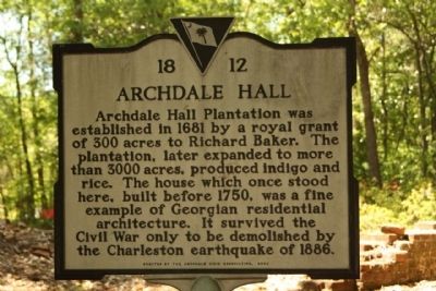
1. Archdale Hall Marker
Archdale Hall Plantation was established in 1681 by a royal grant of 300 acres to Richard Baker. The plantation, later expanded to more than 3000 acres, produced indigo and rice. The house which once stood here, built before 1750, was a fine example of Georgian residential architecture. It survived the Civil War only to be demolished by the Charleston earthquake of 1886.
Erected 2002 by South Carolina Department of Archives and History; sponsored by the Archdale Civic Association. (Marker Number 18-11.)
Topics. This historical marker is listed in these topic lists: Colonial Era • Notable Buildings • Settlements & Settlers. A significant historical year for this entry is 1681.
Location. 32° 53.991′ N, 80° 6.131′ W. Marker is in Archdale, South Carolina, in Dorchester County. It is on Mansfield Blvd.. Located just south of Willow Oak Circle / Scottswood Drive. Touch for map. Marker is in this post office area: North Charleston SC 29418, United States of America. Touch for directions.

Regionally, this marker is in the Lowcountry. It is also in the American South, specifically in the Deep South, and on
this page online
Other nearby markers. At least 8 other markers are within 2 miles of this marker, measured as the crow flies: Windsor Hill Plantation (approx. 1.8 miles away); a different marker also named Windsor Hill Plantation (approx. 1.8 miles away); Camellias: Up on a Pedestal (approx. 1.8 miles away); Azaleas (approx. 1.9 miles away); William Henry Drayton (approx. 1.9 miles away); The Earthquake of 1886 (approx. 1.9 miles away); The Ashley River (approx. 2 miles away); The Magnolia Houses (approx. 2 miles away).
More about this marker. Although the marker has 18-12 on it, its correct number is actually 18-11 according to the South Carolina Department of Archives and History (http://www.scaet.org/markers/display.cfm?id=96).
Also see . . . South Carolina Plantations. Archdale
Photographed by Mike Stroud, April 11, 2010
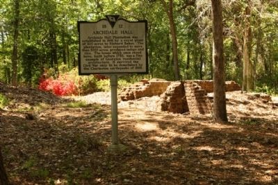
2. Archdale Hall ruins and Marker
Photographed by Mike Stroud, April 11, 2010
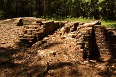
3. Archdale Hall ruins
Photographed by Mike Stroud, April 11, 2010
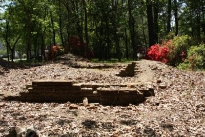
4. Archdale Hall ruins
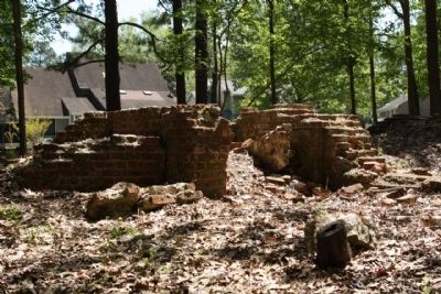
Photographed by Mike Stroud, April 11, 2010
5. Archdale Hall ruins
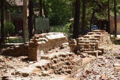
Photographed by Mike Stroud, April 11, 2010
6. Archdale Hall Marker and ruins as seen amid today's community
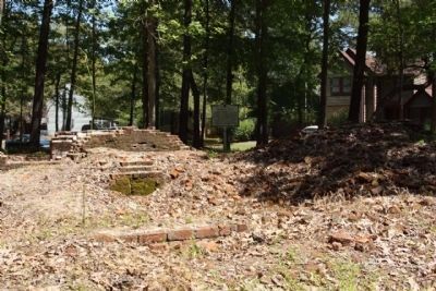
Photographed by Mike Stroud, April 11, 2010
7. Archdale Hall Marker and ruins
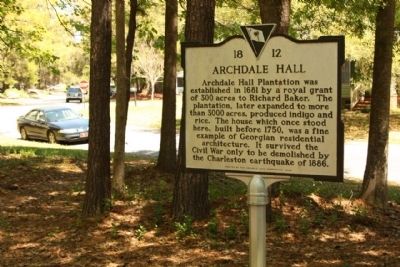
Photographed by Mike Stroud, April 11, 2010
8. Archdale Hall Marker,
Background shows intersection Mansfield Blvd. and
Willow Oak Circle / Scottswood Drive
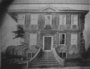
The Archdale Civic Association, South Carolina Plantations, circa 1886
9. Archdale Hall
Credits. This page was last revised on May 28, 2026. It was originally submitted on April 12, 2010, by Mike Stroud of Bluffton, South Carolina. This page has been viewed 2,619 times since then and 143 times this year. Last updated on April 19, 2010, by Michael Sean Nix of Spartanburg, South Carolina. Photos: 1, 2, 3, 4, 5, 6, 7, 8, 9. submitted on April 12, 2010, by Mike Stroud of Bluffton, South Carolina. • Kevin W. was the editor who published this page.
