Stoney Creek in Hamilton, Ontario — Central Canada (North America)
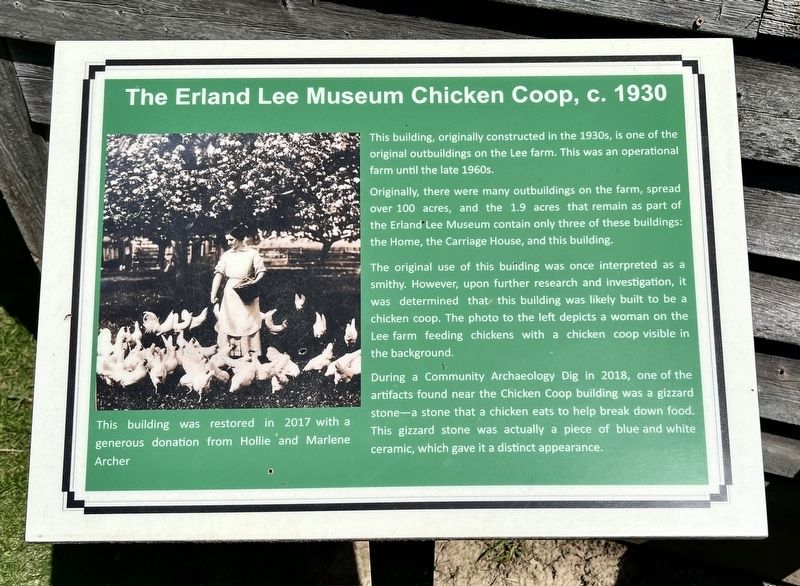
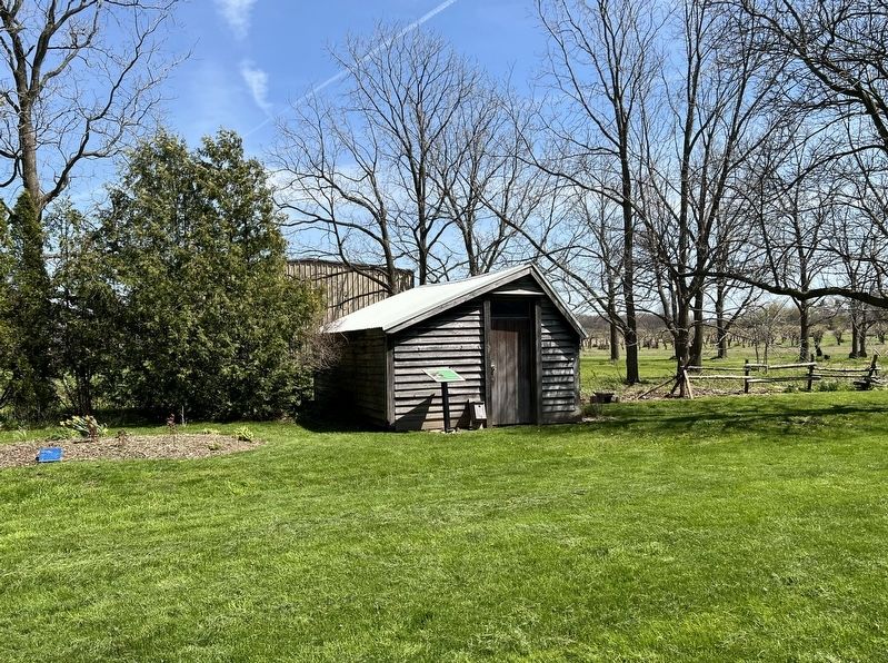
The Erland Lee Museum Chicken Coop, c. 1930
Photographed by Tim Boyd, May 4, 2026
1. The Erland Lee Museum Chicken Coop, c. 1930 Marker
Originally, there were many outbuildings on the farm, spread over 100 acres, and the 1.9 acres that remain as part of the Erland Lee Museum contain only three of these buildings: the Home, the Carriage House, and this building.
The original use of this building was once interpreted as a smithy. However, upon further research and investigation, it was determined that this building was likely built to be a chicken coop. The photo to the left depicts a woman on the Lee farm feeding chickens with a chicken coop visible in the background.
During a Community Archaeology Dig in 2018, one of the artifacts found near the Chicken Coop building was a gizzard stone-a stone that a chicken eats to help break down food. This gizzard stone was actually a piece of blue and white ceramic, which gave it a distinct appearance.
The Erland Lee Museum Chicken Coop, c. 1930
This building was restored in 2017 with a generous donation from Hollie and Marlene Archer
Topics.
this page online
Location. 43° 12.393′ N, 79° 43.317′ W. Marker is in Hamilton, Ontario. It is in Stoney Creek. It can be reached from Ridge Road. The marker is on the grounds of the Erland Lee Home National Hisptric Site, behind the main house. Touch for map. Marker is at or near this postal address: 552 Ridge Road, Hamilton ON L8J 2Y6, Canada. Touch for directions.

Regionally, this marker is on the Golden Horseshoe, in the Hamilton-Halton-Brant Area, and specifically in the Toronto Metropolitan Area. It is also in Central Canada. Globally, it is in North America, on the Great Lakes, in the Western Hemisphere, in the Western World, and in the Anglosphere. Historically, it finds itself in what was once a British colony, the Viceroyalty of New France, the Haudenosaunee (Iroquois) Confederacy, and Rupert’s Land.
Other nearby markers. At least 8 other markers are within 5 kilometers of this marker, measured as the crow flies: The Erland Lee Home and the First Women’s Institute (within shouting distance of this marker);
Photographed by Tim Boyd, May 4, 2026
2. The Erland Lee Museum Chicken Coop, c. 1930 Marker
Credits. This page was last revised on May 9, 2026. It was originally submitted on May 6, 2026, by Tim Boyd of Hamilton, Ontario. This page has been viewed 15 times since then. Photos: 1. submitted on May 6, 2026, by Tim Boyd of Hamilton, Ontario. 2. submitted on May 7, 2026, by Tim Boyd of Hamilton, Ontario. • Andrew Ruppenstein was the editor who published this page.
