Fort Monroe in Hampton, Virginia — The American South (Mid-Atlantic)
Engineer Wharf
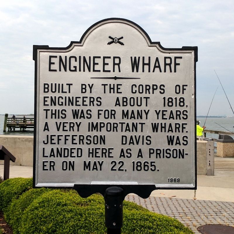
Photographed by Bernard Fisher, May 28, 2017
1. Engineer Wharf Marker
Erected 1969.
Topics. This historical marker is listed in these topic lists: Forts and Castles • War, US Civil. A significant historical date for this entry is May 22, 1865.
Location. Marker is missing. It was located near 37° 0.069′ N, 76° 18.435′ W. Marker was in Hampton, Virginia. It was in Fort Monroe. It was on Fenwick Road east of Engineer Lane, on the right when traveling east. Touch for map. Marker was at or near this postal address: 53 Fenwick Rd, Fort Monroe VA 23651, United States of America. Touch for directions.

Regionally, this marker was on Virginia’s Peninsula and in Coastal Virginia. It was also in the American South, specifically in the Upper South, in the Tidewater, and on the Eastern Seaboard. Globally, it was in the North Atlantic Region, North America, the Western Hemisphere, the Western World, and the Anglosphere. Historically, it found itself in what was once the territory of the Mississippian Culture, one of the original Thirteen
this page online
Other nearby markers. At least 8 other markers are within walking distance of this location: The Movement of a Legacy (here, next to this marker); The Cultural Connections (a few steps from this marker); Fort Monroe History (a few steps from this marker); The Sculpture (a few steps from this marker); a different marker also named First Africans in Virginia (about 300 feet away); Old Point Comfort Light (about 300 feet away); Jefferson Davis Memorial Arch (about 400 feet away); Notable Locations in the Hampton Roads (about 400 feet away). Touch for a list and map of all markers in Hampton.
Other markers no longer nearby. Fort Monroe Seawall History (was here, next to this marker but has been confirmed missing); a different marker also named Fort Monroe Seawall History (was a few steps from this marker but has been confirmed missing); First Africans in Virginia (was about 300 feet away, measured in a direct line but has been replaced with another marker now near it).
Also see . . .
1. Fort Monroe National Monument. National Park Service
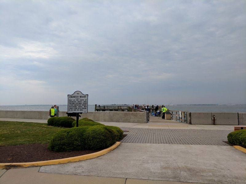
Photographed by Bernard Fisher, May 28, 2017
2. Engineer Wharf Marker
2. Fort Monroe (Stone Fort) National Register of Historic Places Registration Form. (Submitted on August 19, 2019.)

National Park Service, Thomas Stone National Historic Site, August 15, 2018
3. Engineer Wharf Marker
Viewing south from Fenwick Road.
Credits. This page was last revised on May 8, 2026. It was originally submitted on May 29, 2017, by Bernard Fisher of Richmond, Virginia. This page has been viewed 722 times since then and 58 times this year. Last updated on May 7, 2026, by Evan Dwyer of Richmond, Virginia. Photos: 1, 2. submitted on May 29, 2017, by Bernard Fisher of Richmond, Virginia. 3. submitted on August 19, 2019. • Devry Becker Jones was the editor who published this page.
