Fort Monroe in Hampton, Virginia — The American South (Mid-Atlantic)
Fort Monroe Seawall History
Seawall Construction Details
Photographed by Bernard Fisher, May 28, 2017
1. Fort Monroe Seawall History Marker
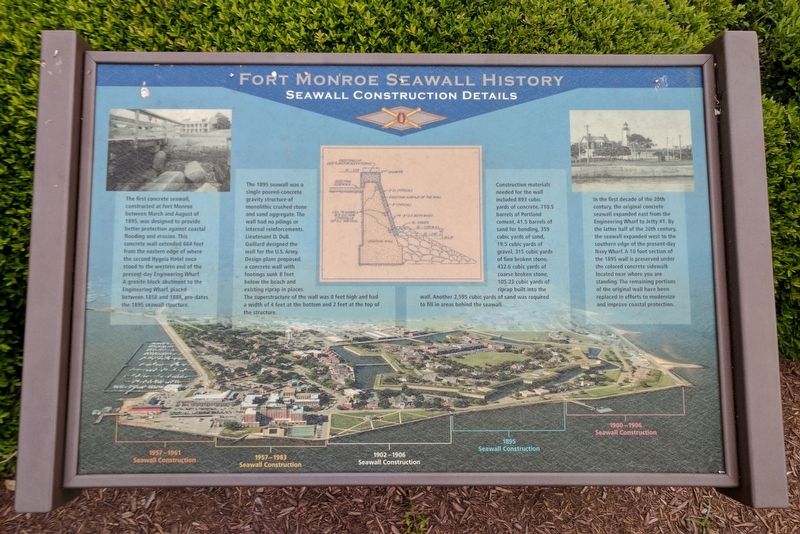
The first concrete seawall, constructed at Fort Monroe between March and August of 1895, was designed to provide better protection against coastal flooding and erosion. This concrete wall extended 664 feet from the eastern edge of where the second Hygeia Hotel once stood to the western end of the present-day Engineering Wharf. A granite block abutment to the Engineering Wharf, placed between 1858 and 1888, pre-dates the 1895 seawall structure.
The 1895 seawall was a single poured-concrete gravity structure of monolithic crushed stone and sand aggregate. The wall had no pilings or internal reinforcements. Lieutenant D. DuB. Gaillard designed the wall for the U.S. Army. Design plans proposed a concrete wall with footings sunk 8 feet below the beach and existing riprap in places. The superstructure of the wall was 8 feet high and had a width of 4 feet at the bottom and 2 feet at the top of the structure.
Construction materials needed for the wall included 893 cubic yards of concrete, 710.5 barrels of Portland cement, 41.5 barrels of sand for bonding, 359 cubic yards of sand, 19.5 cubic yards of gravel,
this page online
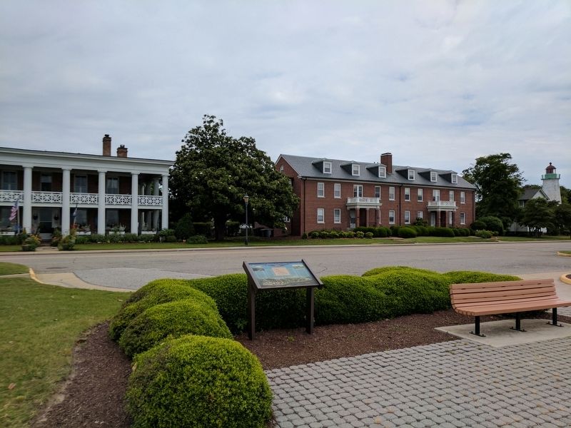
In the first decade of the 20th century, the original concrete seawall expanded east from the Engineering Wharf to Jetty #1. By the latter half of the 20th century, the seawall expanded west to the southern edge of the present-day Navy Wharf. A 10 foot section of the 1895 wall is preserved under the colored concrete sidewalk located near where you are standing. The remaining portions of the original wall have been replaced in efforts to modernize and improve coastal protection.
Topics. This historical marker is listed in these topic lists: Forts and Castles • Man-Made Features. A significant historical year for this entry is 1895.
Location. Marker is missing. It was located near 37° 0.068′ N, 76° 18.443′ W. Marker was in Hampton, Virginia. It was in Fort Monroe. It was on Fenwick Road east of Engineer Lane, on the right when traveling east. Touch for map. Marker was at or near this postal address: 53 Fenwick Rd, Fort Monroe VA 23651, United States of
Photographed by Bernard Fisher, May 28, 2017
2. Fort Monroe Seawall History Marker

Regionally, this marker was on Virginia’s Peninsula and in Coastal Virginia. It was also in the American South, specifically in the Upper South, in the Tidewater, and on the Eastern Seaboard. Globally, it was in the North Atlantic Region, North America, the Western Hemisphere, the Western World, and the Anglosphere. Historically, it found itself in what was once the territory of the Mississippian Culture, one of the original Thirteen Colonies, one of the Confederate States of America, and the Antebellum South.
Other nearby markers. At least 8 other markers are within walking distance of this location: Fort Monroe History (here, next to this marker); The Movement of a Legacy (a few steps from this marker); The Cultural Connections (within shouting distance of this marker); The Sculpture (within shouting distance of this marker); a different marker also named First Africans in Virginia (within shouting distance of this marker); Old Point Comfort Light (about 300 feet away, measured in a direct line); Notable Locations in the Hampton Roads (about 400 feet away); Retreat / Courtesies (about 400 feet away). Touch for a list and map of all markers in Hampton.
Other markers no longer nearby. Engineer Wharf (was a few steps from this marker but has been confirmed missing); a different marker also named Fort Monroe Seawall History (was a few steps from this marker but has been confirmed missing); First Africans in Virginia (was within shouting distance of this marker but has been replaced with another marker now near it).
Also see . . .
1. Fort Monroe National Monument. National Park Service (Submitted on May 29, 2017.)
2. Fort Monroe (Stone Fort) National Register of Historic Places Registration Form. (Submitted on August 19, 2019.)
Credits. This page was last revised on May 8, 2026. It was originally submitted on May 29, 2017, by Bernard Fisher of Richmond, Virginia. This page has been viewed 562 times since then and 56 times this year. Last updated on May 7, 2026, by Evan Dwyer of Richmond, Virginia. Photos: 1, 2. submitted on May 29, 2017, by Bernard Fisher of Richmond, Virginia. • Devry Becker Jones was the editor who published this page.
